Toggle navigation
LMEC Home
Exhibitions
Georeferencing
Tools for Teachers
Collections
My Favorites
Sign Up / Log In
Search
Search the map portal
Map Collection
Map Collection
Map Sets
Search
Search
Search for
Search In
All Fields
Creator
Title
Subject
Place
Search All Digital Collections
Advanced Search
513 Results
My Search
Start Over
More Like
commonwealth:q524nf16p
Remove constraint More Like: commonwealth:q524nf16p
Filter your Search
Place
North and Central America
452
United States
326
New York
41
District of Columbia
30
Washington
29
Florida
19
Canada
17
Alabama
15
more
Place
»
Topic
Manuscript maps--Early works to 1800
92
Washington (D.C.)--Maps
31
Manuscript maps
21
Gulf Coast (U.S.)--Maps, Manuscript--Early works to 1800
12
Fortification--New York (State)--New York--Maps--Early works to 1800
11
New York (N.Y.)--Buildings, structures, etc--Maps, Manuscript--Early works to 1800
9
New York (N.Y.)--Maps, Manuscript--Early works to 1800
8
Saratoga Campaign, N.Y., 1777--Maps, Manuscript--Early works to 1800
8
more
Topic
»
Date
Date range begin
–
Date range end
Current results range from
1700
to
1926
View distribution
Creator
Hills, John, (Surveyor)
18
Montrésor, John, 1736-1799
16
Bingham, William, 1752-1804
12
Adlum, John, 1759-1836
10
Washington, George, 1732-1799
9
Faden, William, 1749-1836
7
Morgan, Benjamin, (Draftsman)
7
Wangenheim, Friedrich Adam Julius von
7
more
Creator
»
Format
Maps/Atlases
511
Manuscripts
475
Objects/Artifacts
2
Georeferenced
Yes
13
No
500
Collection
American Revolutionary War-Era Maps
484
Library of Congress Collection
480
Maritime Charts and Atlases
30
Norman B. Leventhal Map & Education Center Collection
29
Urban Maps
19
William L. Clements Library Collection
2
MacLean Collection Map Library
1
New York Public Library Collection
1
Available to use
Creative Commons license
481
No known restrictions
29
Search Constraints
Sort by relevance
relevance
title
date (asc)
date (desc)
Number of results to display per page
20 per page
10
per page
20
per page
50
per page
100
per page
View results as:
grid view
map view
Search Results
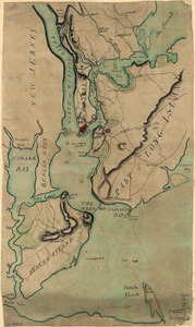
281.
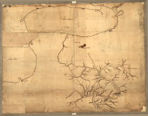
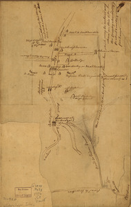
Plan of Governor's, Kennedy's, and Brown's Islan[ds] and Red Hook together with part of the Bay and soundings : shewing the...
282.
A plan of Mr. Clifton's neck land platted by a scale of 50 poles to the inch : recto
283.
A plan of Mr. Clifton's neck land platted by a scale of 50 poles to the inch : verso
284.
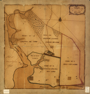
A plan of my farm on Little Huntg. Creek & Potomk. R
285.
Plan of New York and Staten Islands with part of Long Island
286.
Plan of New York and Staten Islands with part of Long Island, survey'd in the years 1781, & 82
287.
Plan of part of the River Delaware from Chester to Philadelphia : in which is mark'd the position of His Majs. ships on the...
288.
A plan of part of the rivers Tombecbe, Alabama, Tensa, Perdido, & Scambia in the province of West Florida : with a sketch of...
289.
Plan of part of western front
290.
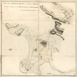
A plan of Paulus Hook with the road to Bergen and parts adjacent in the province of New Jersey
291.
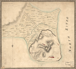
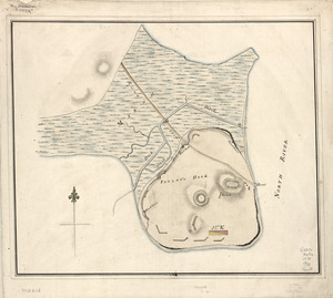
Plan of Paulus's Hook and fortifications
292.
Plan of Paulus's Hook and fortifications
293.
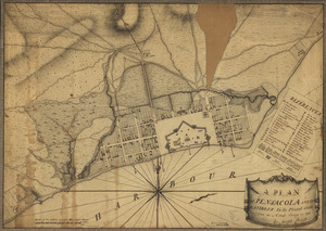
A plan of Pensacola and its environs in its present state : from an actual survey in 1778
294.
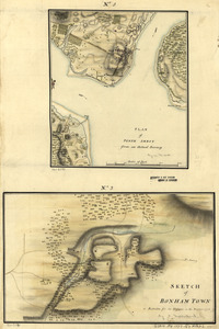
Plan of Perth Amboy from an actual survey. Sketch of Bonham Town
295.
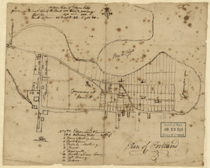
Plan of Portland
296.
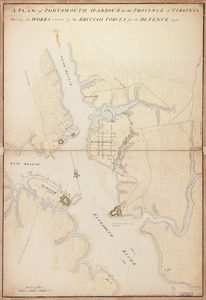
A plan of Portsmouth Harbour in the province of Virginia : shewing the works erected by the British forces for its defence, 1781
297.
Plan of Princeton, Dec. 31, 1776
298.
Plan of Quebec, the capital of Canada in North America, with the bason and part of the adjacent contry [sic] shewing the...
299.
Plan of Quebec, the capital of Canada in North America, with the bason and part of the adjacent contry [sic] shewing the...
300.
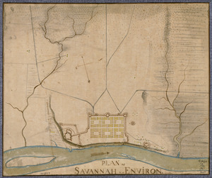
Plan of Savannah & its environs in 1782
‹ Prev
Next ›
1
2
…
11
12
13
14
15
16
17
18
19
…
25
26
![Plan of Governor's, Kennedy's, and Brown's Islan[ds] and Red Hook together with part of the Bay and soundings](https://bpldcassets.blob.core.windows.net/derivatives/images/commonwealth:q524nj614/image_thumbnail_300.jpg)
![Plan of Quebec, the capital of Canada in North America, with the bason and part of the adjacent contry [sic] shewing the principal encampments and works of the British Army commanded by Maior General Wolfe and those of the French Army commanded by Lieut. General, the Marquis of Mont Calm during the siege of that place in 1759 [overlay down]](https://bpldcassets.blob.core.windows.net/derivatives/images/commonwealth:q524nd83b/image_thumbnail_300.jpg)
![Plan of Quebec, the capital of Canada in North America, with the bason and part of the adjacent contry [sic] shewing the principal encampments and works of the British Army commanded by Maior General Wolfe and those of the French Army commanded by Lieut. General, the Marquis of Mont Calm during the siege of that place in 1759 [overlay up]](https://bpldcassets.blob.core.windows.net/derivatives/images/commonwealth:q524nd81s/image_thumbnail_300.jpg)