Toggle navigation
LMEC Home
Exhibitions
Georeferencing
Tools for Teachers
Collections
My Favorites
Sign Up / Log In
Search
Search the map portal
Map Collection
Map Collection
Map Sets
Search
Search
Search for
Search In
All Fields
Creator
Title
Subject
Place
Search All Digital Collections
Advanced Search
513 Results
My Search
Start Over
More Like
commonwealth:q524nf16p
Remove constraint More Like: commonwealth:q524nf16p
Filter your Search
Place
North and Central America
452
United States
326
New York
41
District of Columbia
30
Washington
29
Florida
19
Canada
17
Alabama
15
more
Place
»
Topic
Manuscript maps--Early works to 1800
92
Washington (D.C.)--Maps
31
Manuscript maps
21
Gulf Coast (U.S.)--Maps, Manuscript--Early works to 1800
12
Fortification--New York (State)--New York--Maps--Early works to 1800
11
New York (N.Y.)--Buildings, structures, etc--Maps, Manuscript--Early works to 1800
9
New York (N.Y.)--Maps, Manuscript--Early works to 1800
8
Saratoga Campaign, N.Y., 1777--Maps, Manuscript--Early works to 1800
8
more
Topic
»
Date
Date range begin
–
Date range end
Current results range from
1700
to
1926
View distribution
Creator
Hills, John, (Surveyor)
18
Montrésor, John, 1736-1799
16
Bingham, William, 1752-1804
12
Adlum, John, 1759-1836
10
Washington, George, 1732-1799
9
Faden, William, 1749-1836
7
Morgan, Benjamin, (Draftsman)
7
Wangenheim, Friedrich Adam Julius von
7
more
Creator
»
Format
Maps/Atlases
511
Manuscripts
475
Objects/Artifacts
2
Georeferenced
Yes
13
No
500
Collection
American Revolutionary War-Era Maps
484
Library of Congress Collection
480
Maritime Charts and Atlases
30
Norman B. Leventhal Map & Education Center Collection
29
Urban Maps
19
William L. Clements Library Collection
2
MacLean Collection Map Library
1
New York Public Library Collection
1
Available to use
Creative Commons license
481
No known restrictions
29
Search Constraints
Sort by relevance
relevance
title
date (asc)
date (desc)
Number of results to display per page
20 per page
10
per page
20
per page
50
per page
100
per page
View results as:
grid view
map view
Search Results
241.
Plan de l'affaire de Westfield & du camp de Raway
242.
Plan de l'attaque et de la prise de l'isle de la Grenade le 3 juillet 1779
243.
Plan de New-York et des îles environnantes
244.
Plan de New-York et les environs
245.
Plan de notre camp à New Brunswick le 12e. juin : notre marche le 14 à Middlebush, la situation du camp le 15e juin, et cette...
246.
Plan de Portsmouth en Virginie
247.
Plan de Rhode Island et les differentes operations de la flotte-françoises et des troupes americaines : commandées par le...
248.
Plan de Rhode Islande, les differentes operations de la flotte françoise et des trouppes Américaines commandeés par le major...
249.
Plan de Rhodes-Island, et position de l'armée françoise a Newport
250.
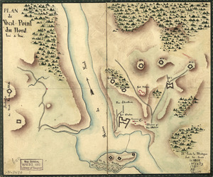
Plan de West-Point du nord, levé a vue
251.
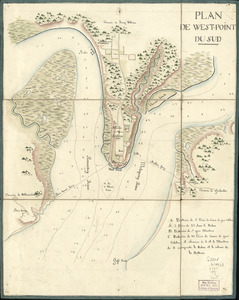
Plan de West-Point du Sud
252.
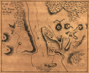
Plan de West-Pointe du nord levé a vue
253.
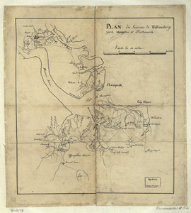
Plan des environs de Williamsburg, York, Hampton, et Portsmouth
254.
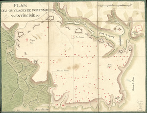
Plan des ouvrages de Portsmouth en Virginie
255.
Plan des ouvrages de Portsmouth en Virginie
256.
Plan des ouvrages faits à York-town en Virginie
257.
Plan du camp retranchè à Wilmington pour y couvrir notre hospital apres la Battaille de Brandywine
258.
Plan du canton de Plimouth et partie des Baradéres
259.
Plan du Cap Breton, dit Louisbovrg avec ces environs pries
260.
Plan du Môle St. Nicolas
‹ Prev
Next ›
1
2
…
9
10
11
12
13
14
15
16
17
…
25
26