Toggle navigation
LMEC Home
Exhibitions
Georeferencing
Tools for Teachers
Collections
My Favorites
Sign Up / Log In
Search
Search the map portal
Map Collection
Map Collection
Map Sets
Search
Search
Search for
Search In
All Fields
Creator
Title
Subject
Place
Search All Digital Collections
Advanced Search
498 Results
My Search
Start Over
More Like
commonwealth:q524n7707
Remove constraint More Like: commonwealth:q524n7707
Filter your Search
Place
North and Central America
434
United States
311
New York
40
Boston Harbor
20
Florida
19
Canada
17
Alabama
15
Chatham (county)
15
more
Place
»
Topic
Manuscript maps--Early works to 1800
95
Manuscript maps
21
Nautical charts--Massachusetts--Boston Harbor--Early works to 1800
16
Gulf Coast (U.S.)--Maps, Manuscript--Early works to 1800
12
Boston Harbor (Mass.)--Maps--Early works to 1800
11
Fortification--New York (State)--New York--Maps--Early works to 1800
11
Nautical charts--Massachusetts--Boston Bay--Early works to 1800
9
New York (N.Y.)--Buildings, structures, etc--Maps, Manuscript--Early works to 1800
9
more
Topic
»
Date
Date range begin
–
Date range end
Current results range from
1688
to
1899
View distribution
Creator
Hills, John, (Surveyor)
18
Montrésor, John, 1736-1799
16
Bingham, William, 1752-1804
12
Adlum, John, 1759-1836
10
Washington, George, 1732-1799
9
Faden, William, 1749-1836
7
Morgan, Benjamin, (Draftsman)
7
Wangenheim, Friedrich Adam Julius von
7
more
Creator
»
Format
Maps/Atlases
496
Manuscripts
479
Objects/Artifacts
2
Georeferenced
Yes
8
No
490
Collection
American Revolutionary War-Era Maps
494
Library of Congress Collection
483
Maritime Charts and Atlases
44
Urban Maps
15
Norman B. Leventhal Map & Education Center Collection
14
Boston and New England Maps
13
Mapping Boston Collection
7
Richard H. Brown Revolutionary War Map Collection at Mount Vernon
1
Available to use
Creative Commons license
491
No known restrictions
7
Search Constraints
Sort by date (desc)
relevance
title
date (asc)
date (desc)
Number of results to display per page
20 per page
10
per page
20
per page
50
per page
100
per page
View results as:
grid view
map view
Search Results
461.
Plan du terrain sur le cap appartenant à la paroise de cette uille 1756
462.
Plano del desembocadero del Río Misipipi en el seno Mexicano con parte del territorio de la Movila, el qual incluien los...
463.
Plano del puerto del Guárico, cuyo conocimto. y entrada es del modo siguiente
464.
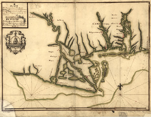
Plano. I descripcion de la costa, desde el Cavo Cañaveral, hasta cerca de la boca de la Vir[g]inia : contando, costa de...
465.
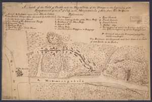
Copy of a sketch of the Monongahela, with the field of battle
466.
Fort Edward to Crown Point
467.
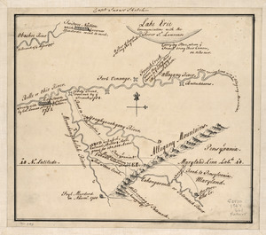
Map of the country about the Mississippi
468.
Mr. Armstrong's rough draft of the country to the west of Susquehanna
469.
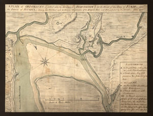
A plan of Chignecto (called also by the French Beau-Bassin) at the head of the Bay of Fundi upon the Istmus of Accadia shewing...
470.
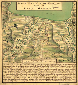
Plan of Fort William Henry and camp at Lake George
471.
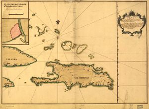
Plano de la Ysla de Santo Domingo, parte de las Cuba, Jamaica y otras contiguas a ellas, del seno mexicano
472.
Qubbec, ville de l'Amerique septentrionale dans la Nouvelle France avec titre d'Eveché située sur le fleuve de St. Laurens a...
473.
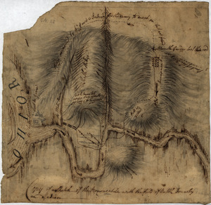
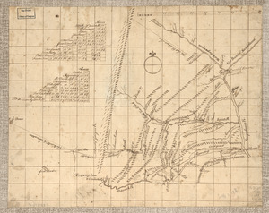
S[i]r: This is minuts of the fort at Crown Point and of the redouts built round it; which I took on the mountain to the west of...
474.
A sketch of the field of battle with the disposition of the troops in the beginning of the engagement of the 9th of July on the...
475.
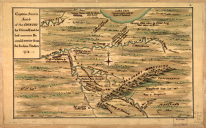
Captain Snow's scetch of the country by himself, and the best accounts he could receive from the Indian traders
476.
Captain Snow's sketch
477.
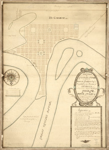
An exact-plan of George-Town : so named by Patrick Graham, Esqr., President of the Province of Georgia, in honr. to His Royal...
478.
Draft of the lands disputed by Philipse Patent against Beekmans & Rambaults
479.
A general plan of Annapolis Royal
480.
A Map of the western parts of the province of Pennsylvania, Virginia, &c
‹ Prev
Next ›
1
2
…
20
21
22
23
24
25
![Plano. I descripcion de la costa, desde el Cavo Cañaveral, hasta cerca de la boca de la Vir[g]inia](https://bpldcassets.blob.core.windows.net/derivatives/images/commonwealth:q524nf34m/image_thumbnail_300.jpg)

![S[i]r: This is minuts of the fort at Crown Point and of the redouts built round it; which I took on the mountain to the west of Crown Point abt. a miles distance](https://bpldcassets.blob.core.windows.net/derivatives/images/commonwealth:q524nd85w/image_thumbnail_300.jpg)