Toggle navigation
LMEC Home
Exhibitions
Georeferencing
Tools for Teachers
Collections
My Favorites
Sign Up / Log In
Search
Search the map portal
Map Collection
Map Collection
Map Sets
Search
Search
Search for
Search In
All Fields
Creator
Title
Subject
Place
Search All Digital Collections
Advanced Search
8834 Results
My Search
Start Over
More Like
commonwealth:q524n4572
Remove constraint More Like: commonwealth:q524n4572
Filter your Search
Place
North and Central America
6,009
United States
4,859
Massachusetts
2,079
Europe
1,396
Suffolk (county)
1,046
Boston
1,019
Canada
454
Asia
441
more
Place
»
Topic
Boston (Mass.)--Maps
586
United States--Maps
282
North America--Maps--Early works to 1800
240
Real property--Massachusetts--Boston--Maps
175
Massachusetts--Maps
162
Landowners--Massachusetts--Boston--Maps
133
New England--Maps
102
Europe--Maps
79
more
Topic
»
Date
Date range begin
–
Date range end
Current results range from
1482
to
2023
View distribution
Creator
United States. Hydrographic Office
595
O.H. Bailey & Co
148
Des Barres, Joseph F. W. (Joseph Frederick Wallet), 1722-1824
123
United States. Post Office Dept
120
Ptolemy, 2nd cent
100
Walling, Henry Francis, 1825-1888
94
Jefferys, Thomas, -1771
91
Sayer, Robert, 1725-1794
87
more
Creator
»
Format
Maps/Atlases
8,774
Manuscripts
217
Prints
56
Books
36
Objects/Artifacts
10
Drawings/Illustrations
8
Posters
5
Georeferenced
Yes
872
No
7,962
Collection
Norman B. Leventhal Map & Education Center Collection
8,704
Boston and New England Maps
2,234
Urban Maps
2,023
Maritime Charts and Atlases
1,083
American Revolutionary War-Era Maps
739
Boston Redevelopment Authority Collection
87
MacLean Collection Map Library
59
New York Public Library Collection
32
more
Collection
»
Available to use
No known restrictions
8,556
Creative Commons license
111
Search Constraints
Sort by relevance
relevance
title
date (asc)
date (desc)
Number of results to display per page
20 per page
10
per page
20
per page
50
per page
100
per page
View results as:
grid view
map view
Search Results
3001.
Indian Territory showing railroad systems - June 30, 1902
3002.
Indian Territory showing townsites approved to June 30-1902
3003.
Indian Territory, with part of the adjoining state of Kansas, &c
3004.
Indians of the U.S.A.
3005.
Indicazione del piu rimarcabile in Napoli e contorni
3006.
Indie interioris civitates decima Asia tabula continet India int. Gangem
3007.
Indie Occidentali
3008.
Indo-Chine, carte de la mission Pavie
3009.
Industrial map of New England
3010.
Infrastructure around Tobin Bridge/US route 1 in Charlestown
3011.
Inner-London
3012.
Innocence abroad
3013.
Innsbruck und dessen nächste umgebung
3014.
Die inseln des Südl. Indischen Oceans, meist nach Englischen aufnahmen zusammengestellt
3015.
Insubres in Segusianis : partie du dioecese et archevche de Lyon : partie septentrionale de Bresse, Bugey, et Valromey,...
3016.
Insubres in Segusianis : partie du dioecese, et Archevesché de Lyon : partie méridionale de la Bresse du Bugey, et Valromey,...
3017.
Insula Borneo et occidentalis pars Celebris, cum adjacentibus insulis
3018.
Insula Candia : ejusque fortificatio
3019.
Insula Gaditana, vulgo Isla de Cadiz
3020.
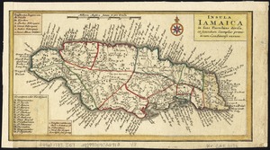
Insula Iamaica : in suas parochias divisa et secundum exemplar primitivum Londinense excusa
‹ Prev
Next ›
1
2
…
147
148
149
150
151
152
153
154
155
…
441
442