Toggle navigation
LMEC Home
Exhibitions
Georeferencing
Tools for Teachers
Collections
My Favorites
Sign Up / Log In
Search
Search the map portal
Map Collection
Map Collection
Map Sets
Search
Search
Search for
Search In
All Fields
Creator
Title
Subject
Place
Search All Digital Collections
Advanced Search
8744 Results
My Search
Start Over
More Like
commonwealth:q524n365j
Remove constraint More Like: commonwealth:q524n365j
Filter your Search
Place
North and Central America
5,967
United States
4,889
Massachusetts
2,079
Europe
1,396
Suffolk (county)
1,047
Boston
1,020
Canada
463
Asia
438
more
Place
»
Topic
Boston (Mass.)--Maps
587
United States--Maps
330
Real property--Massachusetts--Boston--Maps
175
Massachusetts--Maps
162
Landowners--Massachusetts--Boston--Maps
133
North America--Maps--Early works to 1800
103
New England--Maps
102
Europe--Maps
79
more
Topic
»
Date
Date range begin
–
Date range end
Current results range from
1482
to
2023
View distribution
Creator
United States. Hydrographic Office
595
O.H. Bailey & Co
148
Des Barres, Joseph F. W. (Joseph Frederick Wallet), 1722-1824
123
United States. Post Office Dept
120
Ptolemy, 2nd cent
100
Walling, Henry Francis, 1825-1888
94
Geological Survey (U.S.)
87
Jefferys, Thomas, -1771
85
more
Creator
»
Format
Maps/Atlases
8,684
Manuscripts
215
Prints
56
Books
36
Objects/Artifacts
10
Drawings/Illustrations
8
Posters
5
Georeferenced
Yes
871
No
7,873
Collection
Norman B. Leventhal Map & Education Center Collection
8,700
Boston and New England Maps
2,234
Urban Maps
2,024
Maritime Charts and Atlases
1,083
American Revolutionary War-Era Maps
657
Boston Redevelopment Authority Collection
88
American Antiquarian Society Collection
20
William L. Clements Library Collection
13
more
Collection
»
Available to use
No known restrictions
8,557
Creative Commons license
50
Search Constraints
Sort by relevance
relevance
title
date (asc)
date (desc)
Number of results to display per page
20 per page
10
per page
20
per page
50
per page
100
per page
View results as:
grid view
map view
Search Results
1081.
Birthplace of Washington
1082.
Biscaia, Alava, et Guipuscoa Cantabriae veteris partes
1083.
Blackinton, Mass
1084.
Black's general map of the seat of war
1085.
Black's special war map
1086.
Blackwood's map of the seat of war
1087.
Blairstown, New Jersey
1088.
Block diagram showing terrain of the Balkan Peninsula
1089.
Block diagram showing terrain of the Trentino region
1090.
Block diagram showing terrain of the Trieste-Isonzo region
1091.
Block Island, Rhode Island
1092.
Block map, vicinity of Faneuil Hall, Boston : embracing Custom House, Post Office Square, Fort Hill Square, and Chamber of...
1093.
A block of 6 brick houses the property of Isaac Stebbins Esquire
1094.
Bloomingville, [Ohio]
1095.
Bloys
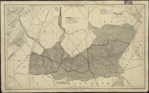
1096.
Blue Hills Reservation
1097.
Blue Hills Reservation
1098.
Bocche del Fiume Negro et Isole di Cape Verde : possedute dà Portoghesi, scoperte da Antonio di Nola Genouese nell' anno 1440,...
1099.
The Boone-Lincoln community where Daniel Boone was born, Berks County, Pennsylvania
1100.
Boothbay Harbor, Lincoln County, Maine : 1885
‹ Prev
Next ›
1
2
…
51
52
53
54
55
56
57
58
59
…
437
438