Toggle navigation
LMEC Home
Exhibitions
Georeferencing
Tools for Teachers
Collections
My Favorites
Sign Up / Log In
Search
Search the map portal
Map Collection
Map Collection
Map Sets
Search
Search
Search for
Search In
All Fields
Creator
Title
Subject
Place
Search All Digital Collections
Advanced Search
326 Results
My Search
Start Over
More Like
commonwealth:q524mv071
Remove constraint More Like: commonwealth:q524mv071
Filter your Search
Place
North and Central America
256
United States
178
New York
53
Canada
33
Suffolk (county)
31
Boston
29
North America
28
New England
18
more
Place
»
Topic
New York (State)--Maps--Early works to 1800
26
North America--Maps--Early works to 1800
19
Boston (Mass.)--History--Revolution, 1775-1783--Maps--Early works to 1800
16
New England--Maps--Early works to 1800
15
New Jersey--Maps--Early works to 1800
12
Northeastern States--Maps--Early works to 1800
11
Québec (Province)--Maps--Early works to 1800
10
Vues d'optique
10
more
Topic
»
Date
Date range begin
–
Date range end
Current results range from
1636
to
1799
View distribution
Creator
Faden, William, 1749-1836
36
Jefferys, Thomas, -1771
31
Le Rouge, Georges-Louis
23
Des Barres, Joseph F. W. (Joseph Frederick Wallet), 1722-1824
21
Sayer, Robert, 1725-1794
21
Korn, Christoph Heinrich, 1726-1783
11
Raspe, Gabriel Nicolaus, 1712-1785
11
Simcoe, John Graves, 1752-1806
10
more
Creator
»
Format
Maps/Atlases
283
Prints
32
Manuscripts
23
Drawings/Illustrations
9
Books
2
Georeferenced
Yes
15
No
311
Collection
American Revolutionary War-Era Maps
316
Richard H. Brown Revolutionary War Map Collection at Mount Vernon
293
Norman B. Leventhal Map Center Collection
20
New York Public Library Collection
9
Boston and New England Maps
5
Maritime Charts and Atlases
3
Mapping Boston Collection
2
Sidney R. Knafel Map Collection at Phillips Academy
2
more
Collection
»
Available to use
Creative Commons license
306
No known restrictions
18
Search Constraints
Sort by relevance
relevance
title
date (asc)
date (desc)
Number of results to display per page
10 per page
10
per page
20
per page
50
per page
100
per page
View results as:
grid view
map view
Search Results
1.
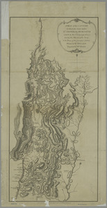
A map of the inhabited part of Canada from the French surveys : with the frontiers of New York and New England from the large...
2.
A chorographical map of the northern department of North-America
3.
Lauff des flusses St. Laurentzi von Quebec bis an den See Ontario : 2. bladt
4.
Carte de la Nouvelle York, y-compris les terres cédées du N. Hamp-Shire, sous le nom d'etat de Vermont
5.
A map of the provinces of New-York and New Jersey, with a part of Pennsylvania and the Province of Quebec
6.
Karte von dem Ostlichen-Stucke von Neu Franckreich oder Canada in America : besonders aber Acadia und Neu Schottland
7.
A chorographical map of the Province of New-York in North America, divided into counties, manors, patents and townships :...
8.
A map of the country in which the army under Lt. General Burgoyne acted in the campaign of 1777 : shewing the marches of the...
9.
A map of the country in which the army under Lt. General Burgoyne acted in the campaign of 1777 : shewing the marches of the...
10.
Plan of Part of Black River & Part of Otter Creek with the Distances by Computation
‹ Prev
Next ›
1
2
3
4
5
…
32
33