Toggle navigation
LMEC Home
Exhibitions
Georeferencing
Tools for Teachers
Collections
My Favorites
Sign Up / Log In
Search
Search the map portal
Map Collection
Map Collection
Map Sets
Search
Search
Search for
Search In
All Fields
Creator
Title
Subject
Place
Search All Digital Collections
Advanced Search
419 Results
My Search
Start Over
More Like
commonwealth:p8418t63d
Remove constraint More Like: commonwealth:p8418t63d
Filter your Search
Place
North and Central America
412
United States
368
New York
91
Virginia
70
New Jersey
52
York (county)
33
Yorktown
33
South Carolina
31
more
Place
»
Topic
United States--History--Revolution, 1775-1783--Maps
330
Virginia--Maps--Early works to 1800
38
Newport (R.I.)--Maps
24
Yorktown (Va.)--History--Siege, 1781--Maps--Early works to 1800
19
Maryland--Maps--Early works to 1800
18
Charleston (S.C.)--Maps
16
Hudson River (N.Y. and N.J.)--Maps
15
New Jersey--Maps
14
more
Topic
»
Date
Date range begin
–
Date range end
Current results range from
1590
to
1881
View distribution
Creator
Clinton, Henry, Sir, 1738?-1795
17
Hills, John, active 1777-1819
13
André, John, 1751-1780
11
Faden, William, 1749-1836
11
Montrésor, John, 1736-1799
10
Fage, Edward
9
Castries, Charles Eugène Gabriel de La Croix, marquis de, 1727-1801
8
D'Ethy, captain
8
more
Creator
»
Format
Maps/Atlases
413
Manuscripts
20
Drawings/Illustrations
5
Prints
1
Georeferenced
Yes
6
No
413
Collection
American Revolutionary War-Era Maps
396
William L. Clements Library Collection
305
Norman B. Leventhal Map & Education Center Collection
35
New-York Historical Society Collection
24
Richard H. Brown Revolutionary War Map Collection at Mount Vernon
15
MacLean Collection Map Library
9
Maps from AAS
7
Maritime Charts and Atlases
6
more
Collection
»
Available to use
No known restrictions
58
Creative Commons license
35
Search Constraints
Sort by relevance
relevance
title
date (asc)
date (desc)
Number of results to display per page
20 per page
10
per page
20
per page
50
per page
100
per page
View results as:
grid view
map view
Search Results
141.
Hudson River from Peekskill to Slaughters Landing
142.
Hudson River from Stony Point to West Point
143.
Hudson River from West Point to Dobbs Ferry
144.
Hudson's River from Stony Pt. to Fort Montgomery
145.
Isle de Newyork : reconnaissance des ouvrages du nord de lisle de Newyork faite en presence des Généraux, Wasington et...
146.
Kings Bridge
147.
Lent's Creek and Baillies Creek
148.
Lines of Charleston
149.
Long Island
150.
Map of American camp in New Jersey and surrounding countryside
151.
Map of New York I. with the adjacent rocks and other remarkable parts of Hell-Gate
152.
A map of that part of Pensylvania now the principle seat of war in America wherein may be seen the situation of Philadelphia,...
153.
A map of the country adjacent to Kingsbridge, surveyed by order of his excellency General Sir Henry Clinton K.B., commander in...
154.
A map of the environs of Boston
155.
A map of the environs of Brooklyn : surveyed by order of his excellency General Sir Henry Clinton K.B., commander in chief of...
156.
A map of the pass at Jamaica, Long Island : surveyed by order of his excellency General Sir Henry Clinton K:B: commander in...
157.
Map of the powers at war with Great Britain, 1783
158.
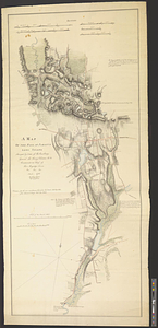
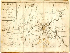
Map of the seat of the late war at Boston in the state of Massachusetts
159.
A Map of the seat of the late war at Boston in the state of Massachusetts
160.
Map of the vicinity of Yorktown, Virginia, 1881
‹ Prev
Next ›
1
2
…
4
5
6
7
8
9
10
11
12
…
20
21