Toggle navigation
LMEC Home
Exhibitions
Georeferencing
Tools for Teachers
Collections
My Favorites
Sign Up / Log In
Search
Search the map portal
Map Collection
Map Collection
Map Sets
Search
Search
Search for
Search In
All Fields
Creator
Title
Subject
Place
Search All Digital Collections
Advanced Search
216 Results
My Search
Start Over
More Like
commonwealth:mw22z4376
Remove constraint More Like: commonwealth:mw22z4376
Filter your Search
Place
North and Central America
199
United States
137
Canada
117
New England
94
New France
29
Middle Atlantic
20
Saint Lawrence River
18
Northeastern United States
17
more
Place
»
Topic
New England--Maps--Early works to 1800
97
Canada--Maps--Early works to 1800
79
United States--Maps--Early works to 1800
27
New France--Maps
24
Seven Years' War, 1756-1763--Campaigns--Canada--Maps
21
Middle Atlantic States--Maps--Early works to 1800
20
Northeastern States--Maps--Early works to 1800
17
North America--Maps--Early works to 1800
15
more
Topic
»
Date
Date range begin
–
Date range end
Current results range from
1617
to
1999
View distribution
Creator
Bellin, Jacques Nicolas, 1703-1772
17
Jefferys, Thomas, d. 1771
8
Jefferys, Thomas, -1771
7
Mackellar, Patrick, 1717-1778
7
Holland, Samuel, 1728-1801
6
Bowles, Carington, 1724-1793
5
Kitchin, Thomas, 1719-1784
5
Anville, Jean Baptiste Bourguignon d', 1697-1782
4
more
Creator
»
Format
Maps/Atlases
216
Manuscripts
3
Georeferenced
Yes
8
No
208
Collection
American Revolutionary War-Era Maps
162
Norman B. Leventhal Map & Education Center Collection
83
Library and Archives Canada Collection
52
MacLean Collection Map Library
43
Boston and New England Maps
30
Mapping Boston Collection
23
Sidney R. Knafel Map Collection at Phillips Academy
16
Maritime Charts and Atlases
10
more
Collection
»
Available to use
No known restrictions
62
Creative Commons license
41
Search Constraints
Sort by relevance
relevance
title
date (asc)
date (desc)
Number of results to display per page
20 per page
10
per page
20
per page
50
per page
100
per page
View results as:
grid view
map view
Search Results
161.
New France, New Englande, New Scotlande, and New Foundlande
162.
A new map of New England, New York, New Iarsey, Pensilvania, Maryland and Virginia
163.
A new map of Nova Scotia, and Cape Britain : with the adjacent parts of New England and Canada, composed from a great number of...
164.
A new map of Nova Scotia, and Cape Britain : with the adjacent parts of New England and Canada, composed from a great number of...
165.
A new map of the most considerable plantations of the English in America
166.
A new mapp of New England and Annapolis and the countrys adjacent
167.
Noua Anglia, Nouum Belgium, et Virginia
168.
Noui Belgii Nouaeque Angliae nec non partis Virginiae tabula
169.
Nouvelle Angleterre et Nouvel York
170.
Nouvelle Hollande (à présent Nouvelle-York), Nouvelle-Angleterre, et une partie de la Virginie
171.
Nova Anglia Novum Belgium et Virginia
172.
Nova Anglia, Novum Belgium et Virginia
173.
Nova Belgica et Anglia Nova
174.
Nova Belgica et Anglia Nova
175.
Novi Belgii, Novaeque Angliae nec non partis Virginiae tabula
176.
Novi Belgii Novaeqve Angliae nec non partis Virginiae Tabula
177.
Partie de la Novvelle Angleterre contenant les villes, les bourgs, et le commerce des habitans
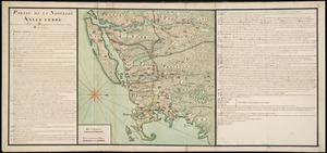
178.
Partie septentrionale des possessions Angloise en Amerique : pour servire d'intelligence à la guerre présente entre les...
179.
Pas caert van Nieu Nederland, Virginia en Nieu Engelant
180.
Pas caerte van Nieu Nederlandt en de Engelsche Virginies van Cabo Cod tot Cabo Canrick
‹ Prev
Next ›
1
2
…
5
6
7
8
9
10
11