Toggle navigation
LMEC Home
Exhibitions
Georeferencing
Tools for Teachers
Collections
My Favorites
Sign Up / Log In
Search
Search the map portal
Map Collection
Map Collection
Map Sets
Search
Search
Search for
Search In
All Fields
Creator
Title
Subject
Place
Search All Digital Collections
Advanced Search
8950 Results
My Search
Start Over
More Like
commonwealth:m900rc53b
Remove constraint More Like: commonwealth:m900rc53b
Filter your Search
Place
North and Central America
6,181
United States
5,097
Massachusetts
2,174
Europe
1,396
Suffolk (county)
1,296
Boston
1,269
Canada
449
Asia
438
more
Place
»
Topic
Boston (Mass.)--Maps
753
United States--Maps
282
Real property--Massachusetts--Boston--Maps
254
City planning--Massachusetts--Boston--Maps
212
Landowners--Massachusetts--Boston--Maps
170
Massachusetts--Maps
166
Urban renewal--Massachusetts--Boston--Maps
118
New England--Maps
104
more
Topic
»
Date
Date range begin
–
Date range end
Current results range from
1482
to
2023
View distribution
Creator
United States. Hydrographic Office
595
Boston Redevelopment Authority
216
O.H. Bailey & Co
148
Des Barres, Joseph F. W. (Joseph Frederick Wallet), 1722-1824
124
United States. Post Office Dept
120
Ptolemy, 2nd cent
100
Walling, Henry Francis, 1825-1888
94
Geological Survey (U.S.)
87
more
Creator
»
Format
Maps/Atlases
8,889
Manuscripts
215
Prints
56
Books
36
Objects/Artifacts
10
Drawings/Illustrations
9
Posters
5
Georeferenced
Yes
885
No
8,065
Collection
Norman B. Leventhal Map & Education Center Collection
8,726
Boston and New England Maps
2,417
Urban Maps
2,200
Maritime Charts and Atlases
1,083
American Revolutionary War-Era Maps
642
Boston Redevelopment Authority Collection
248
Massachusetts Real Estate Atlases
38
Mapping Boston Collection
21
more
Collection
»
Available to use
No known restrictions
8,723
Creative Commons license
71
Search Constraints
Sort by relevance
relevance
title
date (asc)
date (desc)
Number of results to display per page
20 per page
10
per page
20
per page
50
per page
100
per page
View results as:
grid view
map view
Search Results
4401.
Map of part of Cambridge, Mass
4402.
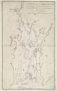
A map of part of Rhode Island shewing the positions of the American and British armies at the Siege of Newport, and the...
4403.
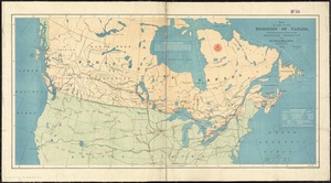
Map of part of the Dominion of Canada, shewing location of some of the principal products, also railway & water routes
4404.
A map of part of the Isthmus of Darien : shewing the communication with Panama, from Portobello & Chagre both by land, and by...
4405.
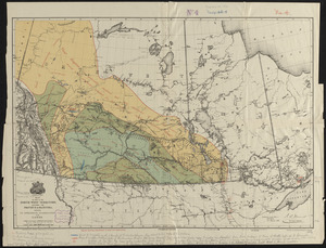
Map of part of the North West Territory, including the province of Manitoba : shewing an approximate classification of the lands
4406.
A map of part of the N:W: Territory of the United States : compiled from actual surveys, and the best information
4407.
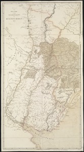
A map of part of the Viceroyalty of Buenos Ayres 1806
4408.
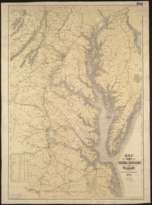
Map of part of Virginia, Maryland and Delaware from the best authorities
4409.
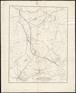
Map of parts of Middlesex & Essex counties, showing the rail road routes between Salem, Lowell, Boston & Methuen
4410.
[Map of parts of Venezuela and Colombia]
4411.
A map of Pennsylvania exhibiting not only the improved parts of that Province, but also its extensive frontiers : laid down...
4412.
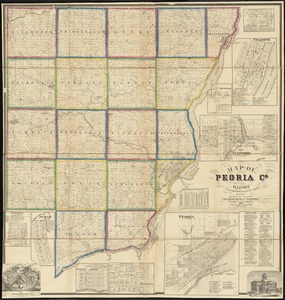
Map of Peoria Co., Illinois
4413.
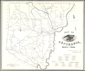
Map of Pepperell, Mass. - 1844
4414.
Map of Perry County, Ohio
4415.
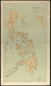
Map of Philippine Islands and adjacent seas : from material of the English and Batavian governments
4416.
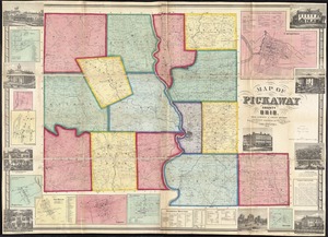
Map of Pickaway County, Ohio
4417.
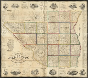
Map of Pike County, Illinois
4418.
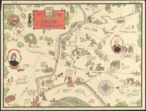
The map of pioneer Hartford : founded 1636, incorporated 1784, showing early landmarks and the locations of historical events
4419.
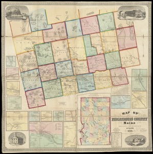
Map of Piscataquis County Maine
4420.
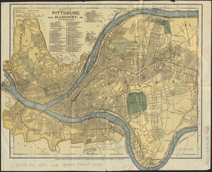
Map of Pittsburg and Allegheny, Pa
‹ Prev
Next ›
1
2
…
217
218
219
220
221
222
223
224
225
…
447
448


![[Map of parts of Venezuela and Colombia]](https://bpldcassets.blob.core.windows.net/derivatives/images/commonwealth:4m90fm18q/image_thumbnail_300.jpg)