Toggle navigation
LMEC Home
Exhibitions
Georeferencing
Tools for Teachers
Collections
My Favorites
Sign Up / Log In
Search
Search the map portal
Map Collection
Map Collection
Map Sets
Search
Search
Search for
Search In
All Fields
Creator
Title
Subject
Place
Search All Digital Collections
Advanced Search
8921 Results
My Search
Start Over
More Like
commonwealth:m900r8893
Remove constraint More Like: commonwealth:m900r8893
Filter your Search
Place
North and Central America
6,152
United States
5,068
Massachusetts
2,138
Europe
1,396
Suffolk (county)
1,267
Boston
1,240
Canada
449
Asia
438
more
Place
»
Topic
Boston (Mass.)--Maps
753
United States--Maps
282
Real property--Massachusetts--Boston--Maps
254
City planning--Massachusetts--Boston--Maps
187
Landowners--Massachusetts--Boston--Maps
170
Massachusetts--Maps
166
New England--Maps
104
North America--Maps--Early works to 1800
103
more
Topic
»
Date
Date range begin
–
Date range end
Current results range from
1482
to
2023
View distribution
Creator
United States. Hydrographic Office
595
Boston Redevelopment Authority
192
O.H. Bailey & Co
148
Des Barres, Joseph F. W. (Joseph Frederick Wallet), 1722-1824
124
United States. Post Office Dept
120
Ptolemy, 2nd cent
100
Walling, Henry Francis, 1825-1888
94
Geological Survey (U.S.)
87
more
Creator
»
Format
Maps/Atlases
8,861
Manuscripts
215
Prints
56
Books
36
Objects/Artifacts
10
Drawings/Illustrations
8
Posters
5
Georeferenced
Yes
885
No
8,036
Collection
Norman B. Leventhal Map & Education Center Collection
8,725
Boston and New England Maps
2,391
Urban Maps
2,175
Maritime Charts and Atlases
1,083
American Revolutionary War-Era Maps
638
Boston Redevelopment Authority Collection
223
Massachusetts Real Estate Atlases
38
Mapping Boston Collection
20
more
Collection
»
Available to use
No known restrictions
8,698
Creative Commons license
70
Search Constraints
Sort by relevance
relevance
title
date (asc)
date (desc)
Number of results to display per page
20 per page
10
per page
20
per page
50
per page
100
per page
View results as:
grid view
map view
Search Results
5041.
A map of those countries in which the apostles travelled : in propagating Christianity
5042.
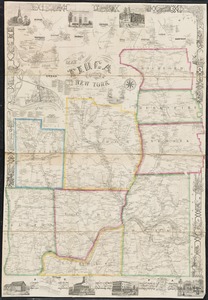
Map of Tioga County, New York : from actual surveys
5043.
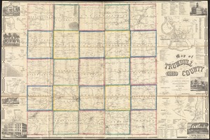
Map of Trumbull County, Ohio
5044.
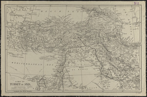
A map of Turkey in Asia
5045.
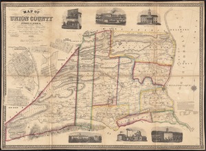
Map of Union County, Pennsylvania : entirely from original surveys
5046.
A map of Upper and Lower Canada : with part of the United States adjoining, comprising the present seat of war
5047.
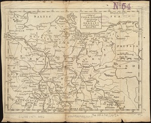
A map of Upper Saxony comprehending that part of Germany which is the present seat of war
5048.
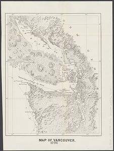
Map of Vancouver : 1798
5049.
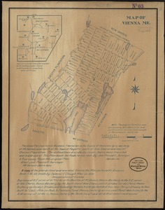
Map of Vienna, Me
5050.
A map of Virginia and Maryland
5051.
Map of Virginia and Maryland, constructed from the latest authorities
5052.
Map of Virginia and West Va., North and part of South Carolina, Maryland and Delaware, showing the situation in these states of...
5053.
Map of Virginia and West Virginia
5054.
Map of Virginia, West Virginia and Ohio : showing Norfolk and Western Railway : main line branches and connections
5055.
[Map of W. Dall's lots in Athens County, Washington County, and Gallia County, Ohio]
5056.
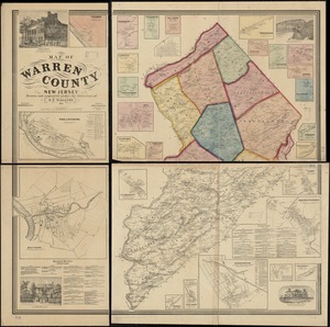
Map of Warren County, New Jersey
5057.
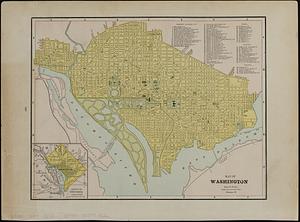
Map of Washington
5058.
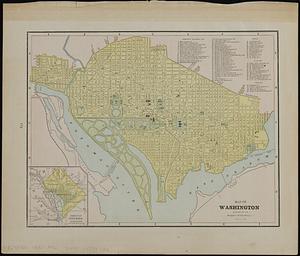
Map of Washington ; map of Cincinnati
5059.
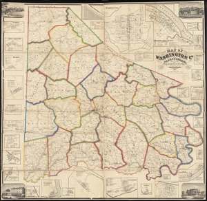
Map of Washington Co., Pennsylvania : from actual surveys
5060.
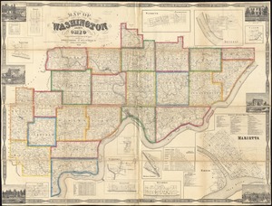
Map of Washington County, Ohio
‹ Prev
Next ›
1
2
…
249
250
251
252
253
254
255
256
257
…
446
447


![[Map of W. Dall's lots in Athens County, Washington County, and Gallia County, Ohio]](https://bpldcassets.blob.core.windows.net/derivatives/images/commonwealth:w9505s00n/image_thumbnail_300.jpg)