Toggle navigation
LMEC Home
Exhibitions
Georeferencing
Tools for Teachers
Collections
My Favorites
Sign Up / Log In
Search
Search the map portal
Map Collection
Map Collection
Map Sets
Search
Search
Search for
Search In
All Fields
Creator
Title
Subject
Place
Search All Digital Collections
Advanced Search
8932 Results
My Search
Start Over
More Like
commonwealth:m900r8027
Remove constraint More Like: commonwealth:m900r8027
Filter your Search
Place
North and Central America
6,163
United States
5,079
Massachusetts
2,138
Europe
1,396
Suffolk (county)
1,278
Boston
1,251
Canada
449
Asia
438
more
Place
»
Topic
Boston (Mass.)--Maps
753
United States--Maps
282
Real property--Massachusetts--Boston--Maps
254
City planning--Massachusetts--Boston--Maps
197
Landowners--Massachusetts--Boston--Maps
170
Massachusetts--Maps
166
Urban renewal--Massachusetts--Boston--Maps
107
New England--Maps
104
more
Topic
»
Date
Date range begin
–
Date range end
Current results range from
1482
to
2023
View distribution
Creator
United States. Hydrographic Office
595
Boston Redevelopment Authority
202
O.H. Bailey & Co
148
Des Barres, Joseph F. W. (Joseph Frederick Wallet), 1722-1824
124
United States. Post Office Dept
120
Ptolemy, 2nd cent
100
Walling, Henry Francis, 1825-1888
94
Geological Survey (U.S.)
87
more
Creator
»
Format
Maps/Atlases
8,872
Manuscripts
215
Prints
56
Books
36
Objects/Artifacts
10
Drawings/Illustrations
8
Posters
5
Georeferenced
Yes
885
No
8,047
Collection
Norman B. Leventhal Map & Education Center Collection
8,725
Boston and New England Maps
2,402
Urban Maps
2,186
Maritime Charts and Atlases
1,083
American Revolutionary War-Era Maps
638
Boston Redevelopment Authority Collection
234
Massachusetts Real Estate Atlases
38
Mapping Boston Collection
20
more
Collection
»
Available to use
No known restrictions
8,709
Creative Commons license
70
Search Constraints
Sort by relevance
relevance
title
date (asc)
date (desc)
Number of results to display per page
20 per page
10
per page
20
per page
50
per page
100
per page
View results as:
grid view
map view
Search Results
1601.
Bird's-eye view of the city of Philadelphia : its streets, avenues, and public buildings--and of the Centennial buildings in...
1602.
Bird's-eye view of the Conemaugh Valley, from Nineveh to the Lake : Johnstown, Pa., from personal sketches and surveys of the...
1603.
Bird's-eye view of the Panama Canal
1604.
Bird's-eye view of the White Mountains, New Hampshire
1605.
Birmingham, Conn : 1876
1606.
Birthplace of Washington
1607.
Biscaia, Alava, et Guipuscoa Cantabriae veteris partes
1608.
Blackinton, Mass
1609.
Black's general map of the seat of war
1610.
Black's special war map
1611.
Blackwood's map of the seat of war
1612.
Blairstown, New Jersey
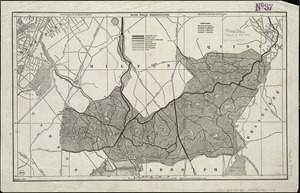
1613.
Block diagram showing terrain of the Balkan Peninsula
1614.
Block diagram showing terrain of the Trentino region
1615.
Block diagram showing terrain of the Trieste-Isonzo region
1616.
Block Island, Rhode Island
1617.
A block of 6 brick houses the property of Isaac Stebbins Esquire
1618.
Bloomingville, [Ohio]
1619.
Bloys
1620.
Blue Hills Reservation
‹ Prev
Next ›
1
2
…
77
78
79
80
81
82
83
84
85
…
446
447