Toggle navigation
LMEC Home
Exhibitions
Georeferencing
Tools for Teachers
Collections
My Favorites
Sign Up / Log In
Search
Search the map portal
Map Collection
Map Collection
Map Sets
Search
Search
Search for
Search In
All Fields
Creator
Title
Subject
Place
Search All Digital Collections
Advanced Search
8720 Results
My Search
Start Over
More Like
commonwealth:kk91fr78h
Remove constraint More Like: commonwealth:kk91fr78h
Filter your Search
Place
North and Central America
5,951
United States
4,864
Massachusetts
2,079
Europe
1,396
Suffolk (county)
1,046
Boston
1,019
Canada
449
Asia
438
more
Place
»
Topic
Boston (Mass.)--Maps
586
United States--Maps
282
Real property--Massachusetts--Boston--Maps
175
Massachusetts--Maps
162
Landowners--Massachusetts--Boston--Maps
133
North America--Maps--Early works to 1800
103
New England--Maps
102
Europe--Maps
79
more
Topic
»
Date
Date range begin
–
Date range end
Current results range from
1482
to
2023
View distribution
Creator
United States. Hydrographic Office
595
O.H. Bailey & Co
148
Des Barres, Joseph F. W. (Joseph Frederick Wallet), 1722-1824
123
United States. Post Office Dept
120
Ptolemy, 2nd cent
100
Walling, Henry Francis, 1825-1888
94
Geological Survey (U.S.)
86
Jefferys, Thomas, -1771
86
more
Creator
»
Format
Maps/Atlases
8,660
Manuscripts
215
Prints
56
Books
36
Objects/Artifacts
10
Drawings/Illustrations
8
Posters
5
Georeferenced
Yes
869
No
7,851
Collection
Norman B. Leventhal Map & Education Center Collection
8,707
Boston and New England Maps
2,233
Urban Maps
2,023
Maritime Charts and Atlases
1,083
American Revolutionary War-Era Maps
629
Boston Redevelopment Authority Collection
87
David Judkins Weaver Papers
13
William L. Clements Library Collection
8
more
Collection
»
Available to use
No known restrictions
8,565
Creative Commons license
47
Search Constraints
Sort by relevance
relevance
title
date (asc)
date (desc)
Number of results to display per page
20 per page
10
per page
20
per page
50
per page
100
per page
View results as:
grid view
map view
Search Results
1621.
Chicago motor coach pictorial map of Chicago
1622.
Chicago Terminal Transfer Railroad Co. map showing property of railroads in the business center of Chicago
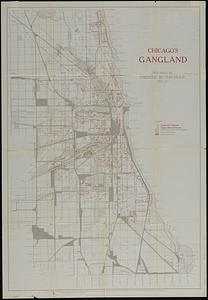
1623.
Chicago's gangland
1624.
Chickamauga and Chattanooga National Military Park and approaches
1625.
Chicopee River
1626.
[Chignecto Bay and vicinity]
1627.
Chikyū bankoku hōzu
1628.
Chili
1629.
Chili
1630.
Chili
1631.
Le Chili
1632.
China : waterways and stage routes
1633.
China
1634.
China
1635.
China : sheet IV south coast from Chauan Bay to Port Matheson including the Pescadore Islands
1636.
China : sheet V eastern coast from Port Matheson to Ragged Point
1637.
China : sheet VIII eastern coast Hieshan Isles to the Yang-Tse-Kiang including the Chusan Islands
1638.
China
1639.
China
1640.
China
‹ Prev
Next ›
1
2
…
78
79
80
81
82
83
84
85
86
…
435
436