Toggle navigation
LMEC Home
Exhibitions
Georeferencing
Tools for Teachers
Collections
My Favorites
Sign Up / Log In
Search
Search the map portal
Map Collection
Map Collection
Map Sets
Search
Search
Search for
Search In
All Fields
Creator
Title
Subject
Place
Search All Digital Collections
Advanced Search
8670 Results
My Search
Start Over
More Like
commonwealth:js956m17p
Remove constraint More Like: commonwealth:js956m17p
Filter your Search
Place
North and Central America
5,909
United States
4,827
Massachusetts
2,070
Europe
1,392
Suffolk (county)
1,062
Boston
1,035
Canada
449
Asia
437
more
Place
»
Topic
Boston (Mass.)--Maps
583
United States--Maps
279
Real property--Massachusetts--Boston--Maps
188
Massachusetts--Maps
162
Landowners--Massachusetts--Boston--Maps
146
North America--Maps--Early works to 1800
103
New England--Maps
101
Europe--Maps
79
more
Topic
»
Date
Date range begin
–
Date range end
Current results range from
1482
to
2023
View distribution
Creator
United States. Hydrographic Office
595
O.H. Bailey & Co
148
Des Barres, Joseph F. W. (Joseph Frederick Wallet), 1722-1824
123
United States. Post Office Dept
120
Ptolemy, 2nd cent
100
Walling, Henry Francis, 1825-1888
94
Geological Survey (U.S.)
87
Jefferys, Thomas, -1771
85
more
Creator
»
Format
Maps/Atlases
8,610
Manuscripts
215
Prints
56
Books
36
Objects/Artifacts
10
Drawings/Illustrations
8
Posters
5
Georeferenced
Yes
869
No
7,801
Collection
Norman B. Leventhal Map & Education Center Collection
8,648
Boston and New England Maps
2,229
Urban Maps
1,999
Maritime Charts and Atlases
1,083
American Revolutionary War-Era Maps
615
Boston Redevelopment Authority Collection
95
Massachusetts Real Estate Atlases
14
Applied Geographics, Inc. Records
1
Available to use
No known restrictions
8,514
Creative Commons license
47
Search Constraints
Sort by relevance
relevance
title
date (asc)
date (desc)
Number of results to display per page
20 per page
10
per page
20
per page
50
per page
100
per page
View results as:
grid view
map view
Search Results
2341.
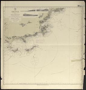
France
2342.
France
2343.
France
2344.
La France à la fin de la 2eme. race (843-987)
2345.
La France à la mort de Louis VII (Le Jeune) (1108-1180)
2346.
La France à la mort de Philippe 1er. (996-1108)
2347.
La France à la mort de Philippe Auguste : (1180-1223)
2348.
France as divided into departments
2349.
La France au commencement de la 3eme. race (987-996)
2350.
France divided into circles and departments
2351.
France divided into circles and departments
2352.
La France divisée en provinces et en généralités : dont le plan est celui de l'ancienne Gaule
2353.
La France divisée par généralités
2354.
France et états limitrophes
2355.
France, from the best authorities
2356.
France kilométrique : carte indiquant les distances kilométriques sur tous les réseaux de chemins de fer
2357.
France, Mediterranean coast : from the Pilote Français 1845 ; republication of Brit. Admty. chart no. 2609, with additions and...
2358.
France, Mediterranean coast : from the Pilote Français 1842 ; republication of Brit. Admty. chart no. 2608, with additions &...
2359.
France, Mediterranean coast : from the Pilote Français 1842 ; republication of Brit. Admty. chart no. 2607, with additions &...
2360.
France, Mediterranean coast : from the Pilote Français 1842 ; republication of Brit. Admty. chart no. 2604, with additions &...
‹ Prev
Next ›
1
2
…
114
115
116
117
118
119
120
121
122
…
433
434