Toggle navigation
LMEC Home
Exhibitions
Georeferencing
Tools for Teachers
Collections
My Favorites
Sign Up / Log In
Search
Search the map portal
Map Collection
Map Collection
Map Sets
Search
Search
Search for
Search In
All Fields
Creator
Title
Subject
Place
Search All Digital Collections
Advanced Search
183 Results
My Search
Start Over
More Like
commonwealth:j38608690
Remove constraint More Like: commonwealth:j38608690
Filter your Search
Place
North and Central America
140
New England
93
United States
42
New York
29
Middle Atlantic
23
Massachusetts
22
Canada
17
Northeastern United States
12
more
Place
»
Topic
New England--Maps--Early works to 1800
91
New York (State)--Maps--Early works to 1800
26
Middle Atlantic States--Maps--Early works to 1800
22
Northeastern States--Maps--Early works to 1800
13
World maps--Early works to 1800
13
North America--Maps--Early works to 1800
11
Massachusetts--Maps--Early works to 1800
10
New Jersey--Maps--Early works to 1800
10
more
Topic
»
Date
Date range begin
–
Date range end
Current results range from
1482
to
1999
View distribution
Creator
Jefferys, Thomas, d. 1771
8
Bellin, Jacques Nicolas, 1703-1772
6
Jefferys, Thomas, -1771
6
Ortelius, Abraham, 1527-1598
5
Sauthier, Claude Joseph
5
Faden, William, 1749-1836
4
Green, John, d. 1757
4
Lodge, John, -1796
4
more
Creator
»
Format
Maps/Atlases
183
Books
1
Manuscripts
1
Georeferenced
Yes
18
No
165
Collection
Sidney R. Knafel Map Collection at Phillips Academy
87
American Revolutionary War-Era Maps
80
Norman B. Leventhal Map Center Collection
71
Boston and New England Maps
30
Mapping Boston Collection
23
Maritime Charts and Atlases
10
Richard H. Brown Revolutionary War Map Collection at Mount Vernon
10
New York Public Library Collection
9
more
Collection
»
Available to use
No known restrictions
49
Creative Commons license
45
Search Constraints
Sort by date (desc)
relevance
title
date (asc)
date (desc)
Number of results to display per page
20 per page
10
per page
20
per page
50
per page
100
per page
View results as:
grid view
map view
Search Results
101.
A correct map of the coast of New England
102.
A map of the coast of New England, from Staten Island to the island of Breton
103.
An actual survey of the sea coast from New York to the I. Cape Brition : with tables of the direct and thwart courses &...
104.
A map of New England, New York, New Jersey and Pensilvania
105.
Recens edita totius Novi Belgii in America Septentrionali siti
106.
Nouvelle Hollande (à présent Nouvelle-York), Nouvelle-Angleterre, et une partie de la Virginie
107.
Partie de la Novvelle Angleterre contenant les villes, les bourgs, et le commerce des habitans
108.
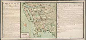
[Map of eastern Massachusetts and vicinity]
109.
New England and New York
110.
A new mapp of New England and Annapolis and the countrys adjacent
111.
Nouvelle Angleterre et Nouvel York
112.
Pas-caert van Nieu Nederland, Virginia, Nieu Engeland als mede Penn-silvania, met de stad Philadelfia van Baston tot Carrik = a...
113.
A new map of New England, New York, New Iarsey, Pensilvania, Maryland and Virginia
114.
Pas-kaart vande zee kusten inde boght van Niew Engeland : tusschen de staaten Hoek en C. de Sable
115.
A map of New-England, being the first that ever was here cut, and done by the best pattern that could be had, which being in...
116.
A map of New-England, being the first that ever was here cut, and done by the best pattern that could be had, which being in...
117.
A map of New-England, being the first that ever was here cut, and done by the best pattern that could be had, which being in...
118.
A map of New England and New York
119.
A chart of the coast of America from New found Land to Cape Cod
120.
A mapp of New England
‹ Prev
Next ›
1
2
3
4
5
6
7
8
9
10


![[Map of eastern Massachusetts and vicinity]](https://bpldcassets.blob.core.windows.net/derivatives/images/commonwealth:9s161d29f/image_thumbnail_300.jpg)


