Toggle navigation
LMEC Home
Exhibitions
Georeferencing
Tools for Teachers
Collections
My Favorites
Sign Up / Log In
Search
Search the map portal
Map Collection
Map Collection
Map Sets
Search
Search
Search for
Search In
All Fields
Creator
Title
Subject
Place
Search All Digital Collections
Advanced Search
9123 Results
My Search
Start Over
More Like
commonwealth:ht250q02z
Remove constraint More Like: commonwealth:ht250q02z
Filter your Search
Place
North and Central America
6,354
United States
5,270
Massachusetts
2,193
Suffolk (county)
1,469
Boston
1,442
Europe
1,396
Canada
449
Asia
438
more
Place
»
Topic
Boston (Mass.)--Maps
752
City planning--Massachusetts--Boston--Maps
418
United States--Maps
282
Urban renewal--Massachusetts--Boston--Maps
252
Real property--Massachusetts--Boston--Maps
225
Massachusetts--Maps
166
Landowners--Massachusetts--Boston--Maps
144
New England--Maps
104
more
Topic
»
Date
Date range begin
–
Date range end
Current results range from
1482
to
2023
View distribution
Creator
United States. Hydrographic Office
595
Boston Redevelopment Authority
398
O.H. Bailey & Co
148
Des Barres, Joseph F. W. (Joseph Frederick Wallet), 1722-1824
124
United States. Post Office Dept
120
Ptolemy, 2nd cent
100
Walling, Henry Francis, 1825-1888
94
Geological Survey (U.S.)
87
more
Creator
»
Format
Maps/Atlases
9,063
Manuscripts
215
Prints
56
Books
36
Objects/Artifacts
10
Drawings/Illustrations
8
Posters
5
Georeferenced
Yes
885
No
8,238
Collection
Norman B. Leventhal Map & Education Center Collection
8,723
Boston and New England Maps
2,619
Urban Maps
2,401
Maritime Charts and Atlases
1,083
American Revolutionary War-Era Maps
638
Boston Redevelopment Authority Collection
453
Mapping Boston Collection
20
Massachusetts Real Estate Atlases
12
more
Collection
»
Available to use
No known restrictions
8,926
Creative Commons license
70
Search Constraints
Sort by relevance
relevance
title
date (asc)
date (desc)
Number of results to display per page
20 per page
10
per page
20
per page
50
per page
100
per page
View results as:
grid view
map view
Search Results
7081.
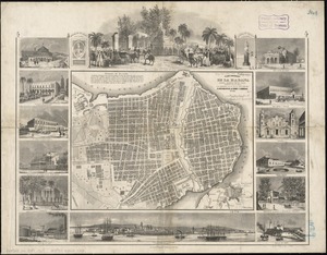
Plano pintoresco de la Habana : con los numeros de las casas
7082.
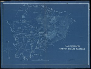
Plano topografico del canton de Los Tuxtlas
7083.
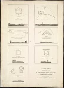
Plans & views of Rebel defences, coast of South Carolina
7084.
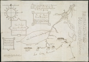
Plans des forts faicts par le Regiment Carignan Salieres sur la Riviere de Richilieu dicte autrement des Iroquois en la...
7085.
Plans des isles, rades, et ports de plusieurs lieux de l'Amérique : tirés de la Carte angloise de Mr. Popple publiée en 1733...
7086.
Plans des isles, rades, et ports de plusieurs lieux de l'Amérique : tirés de la Carte angloise de Mr. Popple publiée en 1733...
7087.
Plans of structures next to the end towers of Longfellow Bridge
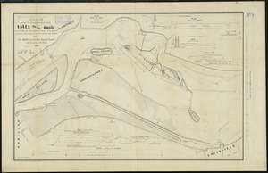
7088.
Plans of the Falls of the Ohio
7089.
Plans on the west coast of Patagonia, South America : from the most recent British surveys
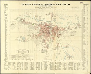
7090.
Planta geral da cidade de São Paulo com indicações diversas
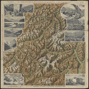
7091.
Plastische karte von Landeck, Tirol : ins ortlergebiet Kaunsertaler u. Oetztaleralpen, Silvretta u. Verwaligruppe...
7092.
Plastischer schul-atlas
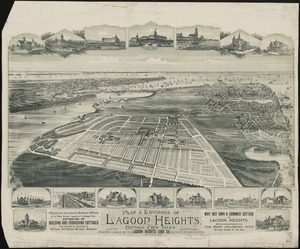
7093.
Plat & environs of Lagoon Heights : showing property owned by the Lagoon Heights Land Co
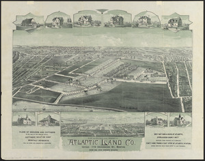
7094.
Plat and environs of the property of Atlantic Land Co.
7095.
Plat map for Mount Wollaston Farm, Braintree, Massachusetts-Bay Colony
7096.
Plat of Benton township, Hocking County, Ohio
7097.
A plat of Good Hope township, Hocking County, Ohio
7098.
A plat of Green township, Hocking County, Ohio
7099.
Plat of lots in Boston (Dorchester Dist.) belonging to B.P. Cunningham
7100.
A plat of Starr township Hocking County Ohio
‹ Prev
Next ›
1
2
…
351
352
353
354
355
356
357
358
359
…
456
457