Toggle navigation
LMEC Home
Exhibitions
Georeferencing
Tools for Teachers
Collections
My Favorites
Sign Up / Log In
Search
Search the map portal
Map Collection
Map Collection
Map Sets
Search
Search
Search for
Search In
All Fields
Creator
Title
Subject
Place
Search All Digital Collections
Advanced Search
8718 Results
My Search
Start Over
More Like
commonwealth:ht2503362
Remove constraint More Like: commonwealth:ht2503362
Filter your Search
Place
North and Central America
5,949
United States
4,864
Massachusetts
2,079
Europe
1,396
Suffolk (county)
1,046
Boston
1,019
Canada
449
Asia
438
more
Place
»
Topic
Boston (Mass.)--Maps
586
United States--Maps
282
Real property--Massachusetts--Boston--Maps
175
Massachusetts--Maps
162
Landowners--Massachusetts--Boston--Maps
133
New England--Maps
104
North America--Maps--Early works to 1800
103
Europe--Maps
79
more
Topic
»
Date
Date range begin
–
Date range end
Current results range from
1482
to
2023
View distribution
Creator
United States. Hydrographic Office
595
O.H. Bailey & Co
148
Des Barres, Joseph F. W. (Joseph Frederick Wallet), 1722-1824
123
United States. Post Office Dept
120
Ptolemy, 2nd cent
100
Walling, Henry Francis, 1825-1888
94
Geological Survey (U.S.)
86
Jefferys, Thomas, -1771
86
more
Creator
»
Format
Maps/Atlases
8,658
Manuscripts
216
Prints
56
Books
36
Objects/Artifacts
10
Drawings/Illustrations
8
Posters
5
Georeferenced
Yes
869
No
7,849
Collection
Norman B. Leventhal Map & Education Center Collection
8,694
Boston and New England Maps
2,233
Urban Maps
2,023
Maritime Charts and Atlases
1,083
American Revolutionary War-Era Maps
640
Boston Redevelopment Authority Collection
87
William L. Clements Library Collection
19
American Antiquarian Society Collection
4
more
Collection
»
Available to use
No known restrictions
8,552
Creative Commons license
47
Search Constraints
Sort by relevance
relevance
title
date (asc)
date (desc)
Number of results to display per page
20 per page
10
per page
20
per page
50
per page
100
per page
View results as:
grid view
map view
Search Results
2541.
A good-natured map of the United States : setting forth the services of the Greyhound Lines and a few principal connecting bus...
2542.
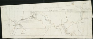
The Gore, part of Falls township, north of Green township
2543.
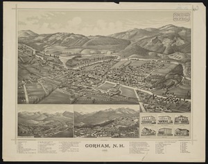
Gorham, N.H : : 1888
2544.
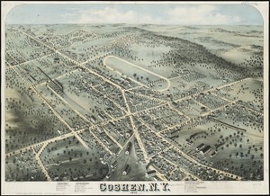
Goshen, N.Y : 1874
2545.
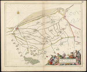
Le gouvernement de Calais, & pays reconquis
2546.
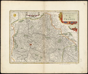
Gouvernement de l'Isle de France
2547.
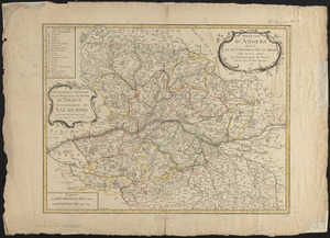
Gouvernement militaire de la province et duché d'Anjou, gouvernement du Saumurois
2548.
Government map of part of the Huron and Ottawa Territory, Ontario
2549.
Graeciae antiquae
2550.
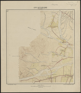
Gral. Alvarado (prov. de Salta)
2551.
The grand bay of Nipe on the north side of Cuba from Spanish draughts ; Plan of Puerto de Baracoa
2552.
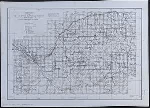
Grand Mesa National Forest, Colorado
2553.
Grand theatre de la guerre en Amerique suivant les plus nouvelles observations des Espagnols, Anglois, François & Hollandois
2554.
Les grandes et petites isles Antilles, et les isles Lucayes avec une partie de la mer du Nord
2555.
Graniteville, Mass : 1886
2556.
Grant County, Wis.
2557.
Grant's campaign war map : supplement : 25 miles around Richmond
2558.
The Graphic map of Bulgaria, eastern Roumelia, the Turkish Empire in Europe, etc., according to the Treaty of Berlin
2559.
The graphic map of European possessions in Africa
2560.
The Graphic parliamentary map showing members returned for county divisions and boroughs : their political party, and the...
‹ Prev
Next ›
1
2
…
124
125
126
127
128
129
130
131
132
…
435
436