Toggle navigation
LMEC Home
Exhibitions
Georeferencing
Tools for Teachers
Collections
My Favorites
Sign Up / Log In
Search
Search the map portal
Map Collection
Map Collection
Map Sets
Search
Search
Search for
Search In
All Fields
Creator
Title
Subject
Place
Search All Digital Collections
Advanced Search
8680 Results
My Search
Start Over
More Like
commonwealth:ht250064m
Remove constraint More Like: commonwealth:ht250064m
Filter your Search
Place
North and Central America
5,924
United States
4,844
Massachusetts
2,099
Europe
1,388
Suffolk (county)
1,072
Boston
1,045
Canada
449
Asia
436
more
Place
»
Topic
Boston (Mass.)--Maps
582
United States--Maps
279
Real property--Massachusetts--Boston--Maps
177
Massachusetts--Maps
161
Landowners--Massachusetts--Boston--Maps
134
North America--Maps--Early works to 1800
103
New England--Maps
101
City planning--Massachusetts--Boston--Maps
92
more
Topic
»
Date
Date range begin
–
Date range end
Current results range from
1482
to
2023
View distribution
Creator
United States. Hydrographic Office
595
O.H. Bailey & Co
148
Des Barres, Joseph F. W. (Joseph Frederick Wallet), 1722-1824
123
United States. Post Office Dept
120
Ptolemy, 2nd cent
100
Boston Redevelopment Authority
95
Walling, Henry Francis, 1825-1888
94
Geological Survey (U.S.)
86
more
Creator
»
Format
Maps/Atlases
8,620
Manuscripts
215
Prints
56
Books
36
Objects/Artifacts
10
Drawings/Illustrations
9
Posters
4
Georeferenced
Yes
870
No
7,810
Collection
Norman B. Leventhal Map & Education Center Collection
8,643
Boston and New England Maps
2,250
Urban Maps
2,014
Maritime Charts and Atlases
1,083
American Revolutionary War-Era Maps
620
Boston Redevelopment Authority Collection
113
Massachusetts Real Estate Atlases
8
William L. Clements Library Collection
3
more
Collection
»
Available to use
No known restrictions
8,525
Creative Commons license
49
Search Constraints
Sort by relevance
relevance
title
date (asc)
date (desc)
Number of results to display per page
20 per page
10
per page
20
per page
50
per page
100
per page
View results as:
grid view
map view
Search Results
7801.
Tabula Frisiae, Groninghae, et Territory Embdensis nec non circum jacentium regionum puta Transisalaniae, Benthemiae,...
7802.
Tabula generalis Sabaudiae
7803.
Tabula geographica qua pars meridionalis sive superior Rheni, Mosae, et Mosellae, ac minores in eosdem influentes Fluvii nec...
7804.
Tabula geographica qua pars septentrionalis sive Inferior Rheni, Mosae, et Mosellae, maximaeque partes Visurgis, Moeni, Amasi,...
7805.
Tabula I Aphri
7806.
Tabula I Asiae
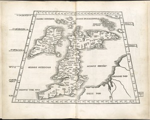
7807.
Tabula I Europae
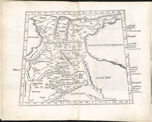
7808.
Tabula II Asiae
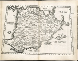
7809.
Tabula II Europae
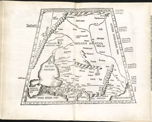
7810.
Tabula III Asiae
7811.
Tabula III Europae
7812.
Tabula IIII Aphricae
7813.
Tabula IIII Asiae
7814.
Tabula IIII Europae
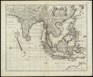
7815.
Tabula Indiae orientalis
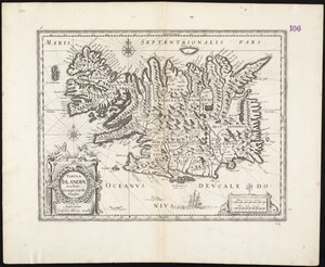
7816.
Tabula Islandiae
7817.
Tabula Italiae antiquae geographica : quam excellentissimus dominus Dex de la Rochefoucauld in oere incidi curavit
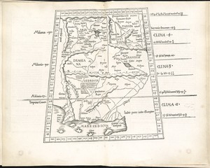
7818.
Tabula IX Asiae
7819.
Tabula IX Europae
7820.
Tabula Magellanica, quâ Tierrae del Fuego, cum celeberrimis fretis a F. Magellano et I. Le Maire detectis novissima et...
‹ Prev
Next ›
1
2
…
387
388
389
390
391
392
393
394
395
…
433
434