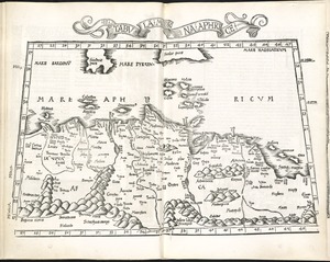
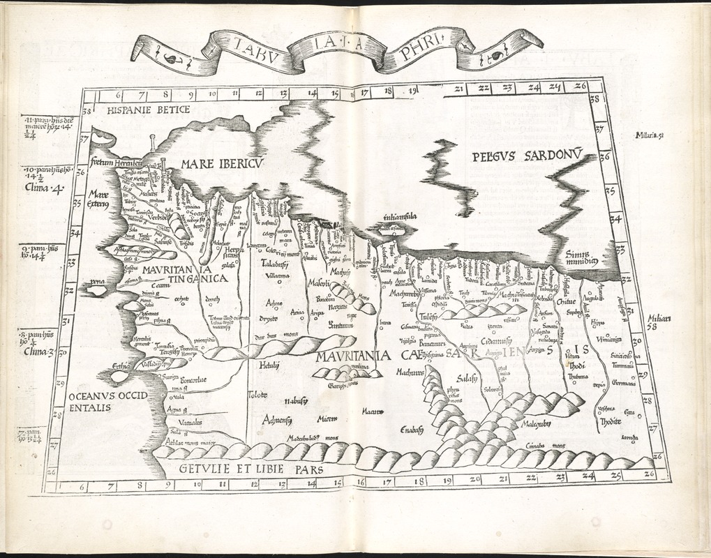
Tabula I Aphri
Item Information
- Title:
- Tabula I Aphri
- Title (alt.):
-
Tabula I Aphricae
Principium Aphricae
- Creator:
- Ptolemy, 2nd cent
- Date:
-
1525
- Format:
-
Maps/Atlases
- Location:
-
Boston Public Library
Norman B. Leventhal Map & Education Center - Collection (local):
-
Norman B. Leventhal Map & Education Center Collection
- Subjects:
-
Algeria--Maps--Early works to 1800
Morocco--Maps--Early works to 1800
Tunisia--Maps--Early works to 1800
- Places:
-
Algeria
Morocco
Tunisia
- Extent:
- 1 map ; 26 x 41 cm.
- Terms of Use:
-
No known copyright restrictions.
No known restrictions on use.
- Publisher:
-
Argentoragi [i.e. Strasbourg] :
Iohannes Grieningerus
- Scale:
-
Scale [ca. 1:5,000,000]
- Language:
-
Latin
- Notes:
-
Map of ancient Mauritania in present day Algeria, Morocco and Tunisia.
Relief shown pictorially.
Includes names of places and natural features.
In margin: climatic and latitudinal notes.
Descriptive text within ornamental borders on verso.
Appears in the author's Geographia, translated by Willibald Pirckheimer, with annotations by Joannes Regiomontanus. Argentoragi [i.e. Strasbourg] : Iohannes Grieningerus, communibus Iohannis Koberger impensis excudebat, anno a Christi Natiuitate 1525 tertio Kal[endas] Apriles.
Text in Latin.
Cataloging, conservation, and digitization made possible in part by The National Endowment for the Humanities: Exploring the human endeavor.
Atlas scanned by Internet Archive http://archive.org/details/claudiiptolemaei00ptol
- Identifier:
-
06_01_007982
- Call #:
-
G1005 .P7 1525
- Barcode:
-
30000003787605