Toggle navigation
LMEC Home
Exhibitions
Georeferencing
Tools for Teachers
Collections
My Favorites
Sign Up / Log In
Search
Search the map portal
Map Collection
Map Collection
Map Sets
Search
Search
Search for
Search In
All Fields
Creator
Title
Subject
Place
Search All Digital Collections
Advanced Search
8563 Results
My Search
Start Over
More Like
commonwealth:ht2500508
Remove constraint More Like: commonwealth:ht2500508
Filter your Search
Place
North and Central America
5,858
United States
4,782
Massachusetts
2,052
Europe
1,359
Suffolk (county)
1,047
Boston
1,020
Canada
448
Asia
422
more
Place
»
Topic
Boston (Mass.)--Maps
577
United States--Maps
273
Real property--Massachusetts--Boston--Maps
176
Massachusetts--Maps
160
Landowners--Massachusetts--Boston--Maps
134
North America--Maps--Early works to 1800
103
New England--Maps
99
Europe--Maps
78
more
Topic
»
Date
Date range begin
–
Date range end
Current results range from
1482
to
2023
View distribution
Creator
United States. Hydrographic Office
594
O.H. Bailey & Co
148
Des Barres, Joseph F. W. (Joseph Frederick Wallet), 1722-1824
123
United States. Post Office Dept
120
Ptolemy, 2nd cent
100
Walling, Henry Francis, 1825-1888
94
Geological Survey (U.S.)
86
Jefferys, Thomas, -1771
85
more
Creator
»
Format
Maps/Atlases
8,504
Manuscripts
215
Prints
56
Books
36
Objects/Artifacts
10
Drawings/Illustrations
8
Posters
4
Georeferenced
Yes
869
No
7,694
Collection
Norman B. Leventhal Map & Education Center Collection
8,550
Boston and New England Maps
2,215
Urban Maps
1,947
Maritime Charts and Atlases
1,081
American Revolutionary War-Era Maps
616
Boston Redevelopment Authority Collection
98
Massachusetts Real Estate Atlases
2
Available to use
No known restrictions
8,420
Creative Commons license
46
Search Constraints
Sort by relevance
relevance
title
date (asc)
date (desc)
Number of results to display per page
20 per page
10
per page
20
per page
50
per page
100
per page
View results as:
grid view
map view
Search Results
1.
Insurance map of Boston : volume 2
2.
Insurance map of Boston : volume 2
3.
Insurance map of Boston vol. 3 (South & East Boston)
4.
Atlas of the city of Boston : Charlestown and East Boston : from actual surveys and official plans
5.
Atlas of the city of Boston : Charlestown and East Boston : from actual surveys and official plans
6.
Atlas of the city of Boston : East Boston : from actual surveys and official plans
7.
Atlas of the city of Boston : East Boston, Mass. : volume nine : from actual surveys and official plans
8.
Atlas of the city of Boston : South & East Boston : volume four
9.
Atlas of the county of Suffolk, Massachusetts : vol. 4th including East Boston, city of Chelsea, Revere and Winthrop : from...
10.
East Boston flood risk
11.
A plan of a survey of Noddles Island
12.
Plan of Boston Land Co's land in Boston & Revere
13.
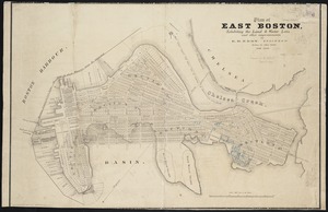
Plan of East Boston
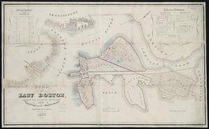
14.
Plan of East Boston : shewing the location of a mill dam and other improvements
15.
Plan of East Boston : exhibiting the land & water lots and other improvements
16.
Plan of East Boston showing the land and water lots sold and unsold : also all buildings and other improvements
17.
Plan of East Boston showing the land and water lots sold and unsold, also all buildings and other improvements
18.
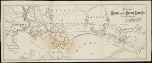
Plan of estate of the Boston Land Co. and surroundings
19.
Plan of Orient Heights, Boston, Mass
20.
Plan of property of the National Dock & Warehouse Co. East Boston
‹ Prev
Next ›
1
2
3
4
5
…
428
429