Toggle navigation
LMEC Home
Exhibitions
Georeferencing
Tools for Teachers
Collections
My Favorites
Sign Up / Log In
Search
Search the map portal
Map Collection
Map Collection
Map Sets
Search
Search
Search for
Search In
All Fields
Creator
Title
Subject
Place
Search All Digital Collections
Advanced Search
8730 Results
My Search
Start Over
More Like
commonwealth:ht24zz47f
Remove constraint More Like: commonwealth:ht24zz47f
Filter your Search
Place
North and Central America
5,961
United States
4,879
Massachusetts
2,114
Europe
1,396
Suffolk (county)
1,081
Boston
1,054
Canada
449
Asia
438
more
Place
»
Topic
Boston (Mass.)--Maps
586
United States--Maps
282
Real property--Massachusetts--Boston--Maps
182
Massachusetts--Maps
162
Landowners--Massachusetts--Boston--Maps
133
North America--Maps--Early works to 1800
103
New England--Maps
102
City planning--Massachusetts--Boston--Maps
101
more
Topic
»
Date
Date range begin
–
Date range end
Current results range from
1482
to
2023
View distribution
Creator
United States. Hydrographic Office
595
O.H. Bailey & Co
148
Des Barres, Joseph F. W. (Joseph Frederick Wallet), 1722-1824
123
United States. Post Office Dept
120
Boston Redevelopment Authority
105
Ptolemy, 2nd cent
100
Walling, Henry Francis, 1825-1888
94
Geological Survey (U.S.)
86
more
Creator
»
Format
Maps/Atlases
8,670
Manuscripts
215
Prints
56
Books
36
Objects/Artifacts
10
Drawings/Illustrations
8
Posters
5
Georeferenced
Yes
869
No
7,861
Collection
Norman B. Leventhal Map & Education Center Collection
8,695
Boston and New England Maps
2,268
Urban Maps
2,058
Maritime Charts and Atlases
1,083
American Revolutionary War-Era Maps
616
Boston Redevelopment Authority Collection
122
Available to use
No known restrictions
8,588
Creative Commons license
47
Search Constraints
Sort by relevance
relevance
title
date (asc)
date (desc)
Number of results to display per page
20 per page
10
per page
20
per page
50
per page
100
per page
View results as:
grid view
map view
Search Results
21.
Washington Street corridor : South Cove to Forest Hills
22.
West Canton Community Park
23.
Fire insurance district atlas : showing the fire insurance districts of the city of Boston : as established by the State...
24.
Insurance map of Boston : volume 2
25.
Insurance map of Boston : volume 2
26.
Insurance map of Boston : volume 1
27.
Insurance map of Boston vol. 3 (South & East Boston)
28.
Insurance map of Charlestown : portions of Roxbury (now annexed to Boston) and Cambridge : 1868 : corrected Nov. 1871
29.
Insurance map of Charlestown : portions of Roxbury (now annexed to Boston) and Cambridge
30.
Insurance maps of Boston volume 4 : comprising portions of Charlestown, East Cambridge, Cambridge Port, Old Cambridge & Somerville
31.
Insurance maps of Boston volume one
32.
Insurance maps of Boston volume two
33.
City of Boston topographic and planimetric survey
34.
Herald Street improvements
35.
Illustrative site plan : a proposal for community review South End/Lower Roxbury development policy
36.
Illustrative site plan : South End urban renewal area, Massachusetts r-56
37.
Illustrative site plan : a proposal for community review South End/Lower Roxbury development policy
38.
Land use New York streets - South Cove 1953
39.
Relationship of TNEMC development plan area to New York streets land assembly and redevelopment project
40.
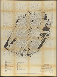
South End project no. Mass. r-56 : existing land use
‹ Prev
Next ›
1
2
3
4
5
6
…
436
437