Toggle navigation
LMEC Home
Exhibitions
Georeferencing
Tools for Teachers
Collections
My Favorites
Sign Up / Log In
Search
Search the map portal
Map Collection
Map Collection
Map Sets
Search
Search
Search for
Search In
All Fields
Creator
Title
Subject
Place
Search All Digital Collections
Advanced Search
462 Results
My Search
Start Over
More Like
commonwealth:gt54s800t
Remove constraint More Like: commonwealth:gt54s800t
Filter your Search
Place
North and Central America
390
United States
217
North America
128
Canada
61
South America
60
Mesoamerica
59
America
50
New York
23
more
Place
»
Topic
America--Maps--Early works to 1800
78
North America--Maps--Early works to 1800
65
Western Hemisphere--Maps--Early works to 1800
49
United States--Maps--Early works to 1800
44
Canada--Maps--Early works to 1800
40
Indians of North America--Maps--Early works to 1800
14
Great Lakes Region (North America)--Maps--Early works to 1800
12
Pennsylvania--Maps--Early works to 1800
11
more
Topic
»
Date
Date range begin
–
Date range end
Current results range from
1520
to
1999
View distribution
Creator
Jefferys, Thomas, -1771
21
Bellin, Jacques Nicolas, 1703-1772
15
Gibson, J. (John), active 1750-1792
14
Robert Sayer and John Bennett (Firm)
14
Sayer, Robert, 1725-1794
14
Carleton, Osgood, 1742-1816
13
Faden, William, 1749-1836
13
Bowles, Carington, 1724-1793
10
more
Creator
»
Format
Maps/Atlases
460
Manuscripts
5
Paintings
3
Ephemera
1
Objects/Artifacts
1
Prints
1
Georeferenced
Yes
2
No
460
Collection
MacLean Collection Map Library
379
American Revolutionary War-Era Maps
346
Norman B. Leventhal Map & Education Center Collection
61
Sidney R. Knafel Map Collection at Phillips Academy
9
Richard H. Brown Revolutionary War Map Collection at Mount Vernon
6
New York Public Library Collection
4
Mapping Boston Collection
3
Newberry Library Collection
2
more
Collection
»
Available to use
No known restrictions
59
Creative Commons license
13
Search Constraints
Sort by relevance
relevance
title
date (asc)
date (desc)
Number of results to display per page
20 per page
10
per page
20
per page
50
per page
100
per page
View results as:
grid view
map view
Search Results
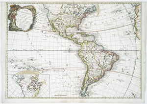
41.
Americae siue noui orbis, noua descriptio
42.
Americae siue noui orbis, noua descriptio
43.
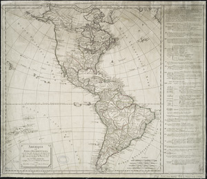
Americae sive Indiae Occidentalis : tabula generalis
44.
Americae tam septentrionalis quam meridionalis in mappa geographica delineatio
45.
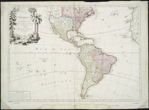
L'Amerique : divisée en ses principaux etats, assujetie aux observations astronomiqes
46.
L'Amerique : suivant le R.P. Charlevoix Jte., Mr. de la Condamine, et plusieurs autres nouvle. observations
47.
L'Amérique
48.
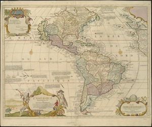
L'Amerique divisée en ses principaux États
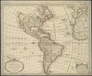
49.
L'Amerique divisée par grand etats
50.
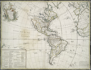
L'Amerique, meridionale, et septentrionale
51.
Amérique ou Indes Occidentales, avec les nouvelles découvertes du Capit'e Cook, depuis le Détroit de Behrings ou du Nord,...
52.
L'Amérique Septentrionale & Meridionale divisée en ses principales parties, ou sont distingués les vns des autres les estats...
53.
L'Amérique suivant le R.P. Charlevoix Jte, Mr. de La Condamine et plusieurs autres nouvle. observations
54.
Carte d'Amerique : divisée en ses principaux etats avec les nouvelles decouvertes faites au Nord et dans la Mer du Sud par les...
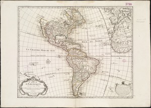
55.
Carte d'Amerique : dressée pour l'usage du roy
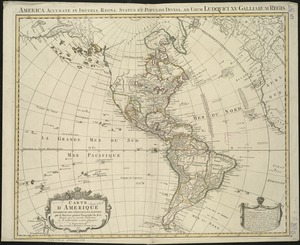
56.
Carte d'Amerique : dressée pour l'usage du Roy
57.
Carte d'Amerique divisées en ses principales parties
58.
Carte du Gouvernement de l'Amerique
59.
A chart of North and South America, including the Atlantic and Pacific Oceans, with the nearest coasts of Europe, Africa and Asia
60.
Chart of the track of the Dolphin, Tamar, Swallow & Endeavour through the South Seas ; & of the track of M. Bougainville round...
‹ Prev
Next ›
1
2
3
4
5
6
7
…
23
24