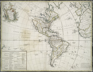
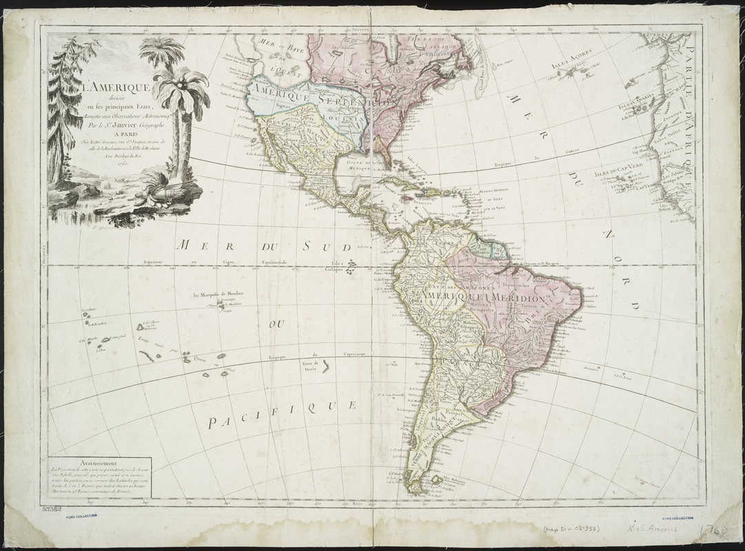
L'Amerique : divisée en ses principaux etats, assujetie aux observations astronomiqes
This map is also available in American Revolutionary Geographies Online (ARGO), a collections portal especially built for material relating to the American Revolutionary War Era. Visit ARGO to learn more about this item and explore the historical geography of North America in the late eighteenth century.
Item Information
- Title:
- L'Amerique : divisée en ses principaux etats, assujetie aux observations astronomiqes
- Creator:
- Janvier, Jean
- Contributor:
- Lattré, Jean
- Contributor:
- Choffard, Pierre-Philippe, 1730-1809
- Name on Item:
-
par le Sr. Janvier, géographe.
- Date:
-
1760
- Format:
-
Maps/Atlases
- Location:
- New York Public Library
- Collection (local):
-
Maps of North and South America
- Subjects:
-
America--Maps--Early works to 1800
- Places:
-
North America (area)
South America
Mesoamerica (area)
- Extent:
- 1 map : hand col. ; 46 x 64 cm.
- Terms of Use:
-
No known copyright restrictions.
This work is licensed for use under a Creative Commons Attribution Non-Commercial Share Alike License (CC BY-NC-SA).

- Publisher:
-
Paris :
Chés Lattré, graveur, rue St. Jacques, au coin de celle de la Parcheminerie, à la ville de Bordeaux
- Scale:
-
Scale [ca. 1:30,000,000]
- Language:
-
French
- Catalog Record:
-
https://digitalcollections.nypl.org/items/510d47db-b218-a3d9-e040-e00a18064a99
- Notes:
-
Relief shown pictorially.
At base of cartouche: P.P. Choffard fecit, 1760.
Prime meridian: Ferro.
"Avec privilege du Roi."
Includes decorative cartouche and "Avertissement."