Toggle navigation
LMEC Home
Exhibitions
Georeferencing
Tools for Teachers
Collections
My Favorites
Sign Up / Log In
Search
Search the map portal
Map Collection
Map Collection
Map Sets
Search
Search
Search for
Search In
All Fields
Creator
Title
Subject
Place
Search All Digital Collections
Advanced Search
462 Results
My Search
Start Over
More Like
commonwealth:gt54s800t
Remove constraint More Like: commonwealth:gt54s800t
Filter your Search
Place
North and Central America
390
United States
217
North America
128
Canada
61
South America
60
Mesoamerica
59
America
50
New York
23
more
Place
»
Topic
America--Maps--Early works to 1800
78
North America--Maps--Early works to 1800
65
Western Hemisphere--Maps--Early works to 1800
49
United States--Maps--Early works to 1800
44
Canada--Maps--Early works to 1800
40
Indians of North America--Maps--Early works to 1800
14
Great Lakes Region (North America)--Maps--Early works to 1800
12
Pennsylvania--Maps--Early works to 1800
11
more
Topic
»
Date
Date range begin
–
Date range end
Current results range from
1520
to
1999
View distribution
Creator
Jefferys, Thomas, -1771
21
Bellin, Jacques Nicolas, 1703-1772
15
Gibson, J. (John), active 1750-1792
14
Robert Sayer and John Bennett (Firm)
14
Sayer, Robert, 1725-1794
14
Carleton, Osgood, 1742-1816
13
Faden, William, 1749-1836
13
Bowles, Carington, 1724-1793
10
more
Creator
»
Format
Maps/Atlases
460
Manuscripts
5
Paintings
3
Ephemera
1
Objects/Artifacts
1
Prints
1
Georeferenced
Yes
2
No
460
Collection
MacLean Collection Map Library
379
American Revolutionary War-Era Maps
346
Norman B. Leventhal Map & Education Center Collection
61
Sidney R. Knafel Map Collection at Phillips Academy
9
Richard H. Brown Revolutionary War Map Collection at Mount Vernon
6
New York Public Library Collection
4
Mapping Boston Collection
3
Newberry Library Collection
2
more
Collection
»
Available to use
No known restrictions
59
Creative Commons license
13
Search Constraints
Sort by relevance
relevance
title
date (asc)
date (desc)
Number of results to display per page
20 per page
10
per page
20
per page
50
per page
100
per page
View results as:
grid view
map view
Search Results
361.
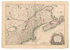
Part of the United States of North America
362.
A particular map to illustrate Gen. Amherst's expedition to Montreal with a plan of the town & draught of the island
363.
Partie de l'Amerique Septentrionale qui comprend la Nouvelle France ou le Canada
364.
Partie de l'Amerique Septentrionale qui comprend le cours de l'Ohio, la N.lle Angleterre, la N.lle York, le New Jersey, la...
365.
Partie des Etats-Unis de l'Amerique Septentrional
366.
Partie méridionale de la Louisiane, avec la Floride, la Caroline et la Virginie
367.
Partie meridionale des possessions angloise en Amerique
368.
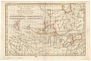
Partie occidentale de la Nouvelle France ou du Canada : pour servir a l'intelligence des affaires et de l"etat present en Amerique
369.
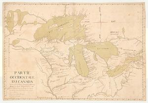
Partie occidentale du Canada, contenant les cinq grands lacs, avec les pays circonvoisins
370.
Partie occidentale du Canada, contenant les cinq grands lacs, avec les pays circonvoisins
371.
Partie occidentale du Canada contenant les cinq grands lacs avec les pays circonvoisins d'après les nouvelles observations
372.
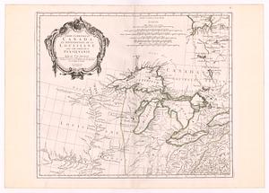
Partie occidentale du Canada contenant les Lacs Ontario, Huron, Errie, & Lac Superieur
373.
Partie occidentale du Canada et septentrionale de la Louisiane avec une partie de la Pensilvanie
374.
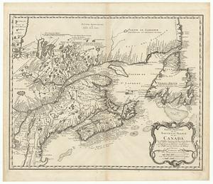
Partie orientale de la Nouvelle France ou du Canada
375.
Partie septentrionale des possessions angloise en Amerique
376.
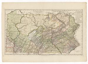
Pennsylvania
377.
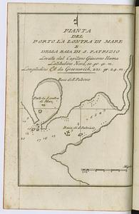
Pianta del Porto la Lontra di mare e della Baia di S. Patrizio levata dal Capitano Giacomo Hanna latitudine nord, 50, gr. 41....
378.
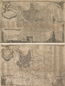
La piccola pianta di Roma
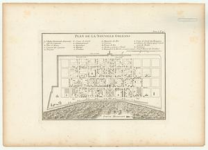
379.
Plan de la Nouvelle Orleans sur les manuscrits du Depot des Cartes de la Marine
380.
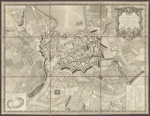
Plan de la ville de Genève : corrigé sur les lieux, en 1777, et 93 par Mr. Meyer ; dedié aux magnifiques et très honorés...
‹ Prev
Next ›
1
2
…
15
16
17
18
19
20
21
22
23
24