Toggle navigation
LMEC Home
Exhibitions
Georeferencing
Tools for Teachers
Collections
My Favorites
Sign Up / Log In
Search
Search the map portal
Map Collection
Map Collection
Map Sets
Search
Search
Search for
Search In
All Fields
Creator
Title
Subject
Place
Search All Digital Collections
Advanced Search
1128 Results
My Search
Start Over
More Like
commonwealth:ft84cd47r
Remove constraint More Like: commonwealth:ft84cd47r
Filter your Search
Place
North and Central America
1,127
United States
1,114
Massachusetts
886
Suffolk (county)
771
Boston
768
Middlesex (county)
53
Downtown Boston
35
Essex (county)
32
more
Place
»
Topic
Boston (Mass.)--Maps
752
Massachusetts--Maps
235
Real property--Massachusetts--Boston--Maps
125
City planning--Massachusetts--Boston--Maps
104
Landowners--Massachusetts--Boston--Maps
100
Urban renewal--Massachusetts--Boston--Maps
63
Buildings--Massachusetts--Boston--Maps
57
Local transit--Massachusetts--Boston--Maps
47
more
Topic
»
Date
Date range begin
–
Date range end
Current results range from
1743
to
2023
View distribution
Creator
Boston Redevelopment Authority
114
Bromley, George Washington
48
Bromley, Walter Scott
47
G.W. Bromley & Co.
42
Geo. H. Walker & Co
36
Geo. H. Walker & Co.
36
MassGIS (Office : Mass.)
24
Boynton, George W., d. 1884
22
more
Creator
»
Format
Maps/Atlases
1,126
Manuscripts
15
Books
8
Ephemera
1
Prints
1
Georeferenced
Yes
152
No
976
Collection
Norman B. Leventhal Map & Education Center Collection
829
Boston and New England Maps
763
Urban Maps
523
Massachusetts Real Estate Atlases
143
Boston Redevelopment Authority Collection
123
American Revolutionary War-Era Maps
47
Applied Geographics, Inc. Records
24
Mapping Boston Collection
22
more
Collection
»
Available to use
No known restrictions
893
Creative Commons license
45
Search Constraints
Sort by relevance
relevance
title
date (asc)
date (desc)
Number of results to display per page
20 per page
10
per page
20
per page
50
per page
100
per page
View results as:
grid view
map view
Search Results
121.
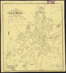
Plan of the central part of the city of Worcester
122.
Plan of Worcester
123.
Pocket map of the city of Worcester, Mass : showing all streets, parks, distances, street car routes, location of public...
124.
Richards standard atlas of the City of Worcester Massachusetts : containing thirty-one double page maps in colors, covering the...
125.
Richards standard atlas of the City of Worcester Massachusetts : containing thirty-one double page maps in colors, covering the...
126.
Worcester, May 28, 1795. : The above plan was surveyed between the months of October, 1794 and the month of April, 1795
127.
Worcester station
128.
The 100th anniversary map of Abraham Lincoln's visit to Massachusetts, September 11-23, 1848
129.
An accurate map of the commonwealth of Massachusetts exclusive of the district of Maine compiled pursuant to an act of the...
130.
An accurate map of the commonwealth of Massachusetts exclusive of the district of Maine compiled pursuant to an act of the...
131.
Automobile map of Massachusetts : central section
132.
Bicycle map of Massachusetts
133.
Bicycle map of north eastern Massachusetts
134.
Bicycle map of south eastern Massachusetts
135.
Bicycle map of western Massachusetts
136.
Boston & Gloucester Steamboat Co. : summer season 1889
137.
Carte géographique, statistique et historique de Massachusetts
138.
Charles River
139.
Chart of Boston Harbor and Massachusetts Bay : with map of the adjacent country
140.
The city of New York as laid out by the Commissioners with the surrounding country
‹ Prev
Next ›
1
2
3
4
5
6
7
8
9
10
11
…
56
57