Toggle navigation
LMEC Home
Exhibitions
Georeferencing
Tools for Teachers
Collections
My Favorites
Sign Up / Log In
Search
Search the map portal
Map Collection
Map Collection
Map Sets
Search
Search
Search for
Search In
All Fields
Creator
Title
Subject
Place
Search All Digital Collections
Advanced Search
140 Results
My Search
Start Over
More Like
commonwealth:dz010t925
Remove constraint More Like: commonwealth:dz010t925
Filter your Search
Place
North and Central America
99
Canada
64
United States
53
Suffolk (county)
33
Boston
32
Nova Scotia
21
Minas Basin
9
Chignecto Bay
8
more
Place
»
Topic
Coasts--Nova Scotia--Maps
62
Boston (Mass.)--Buildings, structures, etc--Maps, Manuscript--Early works to 1800
17
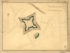
Fortification--Massachusetts--Boston--Maps, Manuscript--Early works to 1800
11
Coasts--Nova Scotia--Pictorial works
10
Atlantic Coast (N.S.)--Maps
8
Boston (Mass.)--History--Siege, 1775-1776--Maps, Manuscript--Early works to 1800
8
Chignecto Bay (N.B. and N.S.)--Maps
8
Fortification--Massachusetts--Boston--Maps--Early works to 1800
8
more
Topic
»
Date
Date range begin
–
Date range end
Current results range from
1758
to
1889
View distribution
Creator
Des Barres, Joseph F. W. (Joseph Frederick Wallet), 1722-1824
94
Montrésor, John, 1736-1799
5
Page, Thomas Hyde, Sir, 1746-1821
4
Browne, William, Captain
2
De Berniere, Henry
2
Holland, Samuel, 1728-1801
2
United States. Hydrographic Office
2
Aitken, Robert, 1735-1802
1
more
Creator
»
Format
Maps/Atlases
139
Manuscripts
35
Prints
1
Georeferenced
Yes
2
No
138
Collection
American Revolutionary War-Era Maps
138
Library of Congress Collection
136
Maritime Charts and Atlases
2
Norman B. Leventhal Map Center Collection
2
Library and Archives Canada Collection
1
William L. Clements Library Collection
1
Available to use
Creative Commons license
136
No known restrictions
2
Search Constraints
Sort by relevance
relevance
title
date (asc)
date (desc)
Number of results to display per page
50 per page
10
per page
20
per page
50
per page
100
per page
View results as:
grid view
map view
Search Results
1.
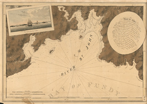
The river St. John
2.
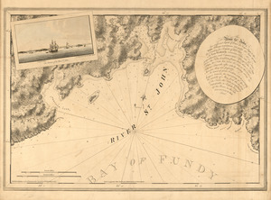
The river St. John
3.
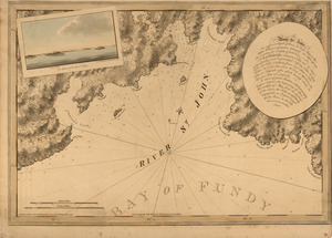
The river St. John
4.
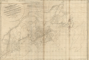
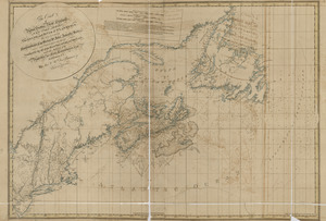
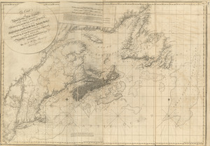
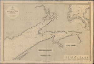
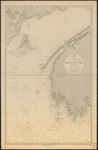
North America, east coast, Bay of Fundy, northern part : from British surveys
5.
North America, east coast, Bay of Fundy, southern part : from British and United States surveys
6.
Plan of the river of St. Johns from Fort Frederick in the Bay of Fundy to the river of Medouesqua with the lake of Temescouata...
7.
A sketch of part of the river St. John on the north side of the Bay of Fundy from Partridge Island in the latitude of 45.22...
8.
Annapolis Royal
9.
Annapolis Royal ; St. Mary's Bay
10.
Annapolis Royal ; St. Mary's Bay
11.
Annapolis Royal ; St. Mary's Bay
12.
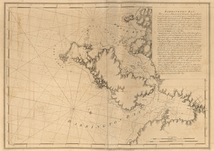
Barrington Bay
13.
Barrington Bay
14.
[Battle of Bunker Hill]
15.
[Boston Harbour, with the surroundings, &c]
16.
Boston, its environs and harbour : with the rebels works raised against that town in 1775
17.
Boston, S. West part : No. 25
18.
[Bunker Hill--rough sketch]
19.
Buzzards Bay and shoals of Nantucket
20.
Canso Harbor
21.
Canso Harbor
22.
Cape Blowmedown ; Cape Split ; Spencers Island and the entrance of Mines Bason ; Isle Haut and Cape Chegnecto
23.
Cape Blowmedown ; Cape Split ; The entrance of Mines Bason ; Isle Haut and Cape Chegnecto
24.
Cape Prospect ... Cape Sambro ... ; The high lands of Haspotagoen ... ; The Ovens at the entrance of Lunenburg Bay ; Cape Sable...
25.
Cape Prospect ... Cape Sambro ... ; The high lands of Haspotagoen ... ; The Ovens at the entrance of Lunenburg Bay ; Cape Sable...
26.
Cape St. Mary n.e. one mile ; South entrance of Grand Passage ; St. Marys Bay
27.
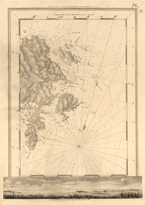
Charlotte Bay
28.
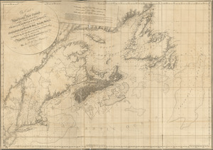
A chart of Nova Scotia
29.
A chart of Nova Scotia
30.
[Chignecto Bay and vicinity]
31.
[Chignecto Bay and vicinity]
32.
[Chignecto Bay and vicinity]
33.
[Chignecto Bay and vicinity]
34.
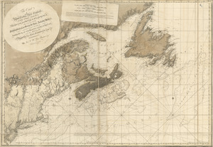
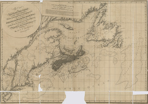
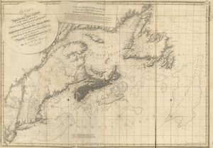
The coast of Nova Scotia, New England, New-York, Jersey, the Gulph and River of St. Lawrence : the islands of Newfoundland,...
35.
The coast of Nova Scotia, New England, New-York, Jersey, the Gulph and River of St. Lawrence : the islands of Newfoundland,...
36.
The coast of Nova Scotia, New England, New-York, Jersey, the Gulph and River of St. Lawrence : the islands of Newfoundland,...
37.
The coast of Nova Scotia, New England, New-York, Jersey, the Gulph and River of St. Lawrence : the islands of Newfoundland,...
38.
The coast of Nova Scotia, New England, New-York, Jersey, the Gulph and River of St. Lawrence : the islands of Newfoundland,...
39.
The coast of Nova Scotia, New England, New-York, Jersey, the Gulph and River of St. Lawrence : the islands of Newfoundland,...
40.
The coast of Nova Scotia, New England, New-York, Jersey, the Gulph and River of St. Lawrence : the islands of Newfoundland,...
41.
A correct view of the late battle at Charlestown : June 17th, 1775
42.
Crow Harbor, on the south shore of Chedabuctou Bay
43.
A draught of the towns of Boston and Charles Town and the circumjacent country : shewing the works thrown up by His Majesty's...
44.
Egmont Harbor
45.
Egmont Harbor
46.
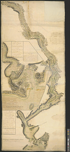
The environs of Fort Cumberland in the Bay of Fundy
47.
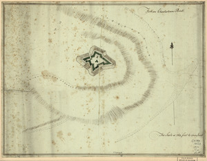
Fort on Charlestown Point
48.
Fort on Dorc̃ester Point
49.
Fort on Fort Hill in Boston
50.
Fort on the first hill in Dorc̃ester : Fort on the second hill in Dorc̃ester
‹ Prev
Next ›
1
2
3


![[Battle of Bunker Hill]](https://bpldcassets.blob.core.windows.net/derivatives/images/commonwealth:z603vj11x/image_thumbnail_300.jpg)
![[Boston Harbour, with the surroundings, &c]](https://bpldcassets.blob.core.windows.net/derivatives/images/commonwealth:t722hs94d/image_thumbnail_300.jpg)


![[Bunker Hill--rough sketch]](https://bpldcassets.blob.core.windows.net/derivatives/images/commonwealth:z603vj151/image_thumbnail_300.jpg)


![[Chignecto Bay and vicinity]](https://bpldcassets.blob.core.windows.net/derivatives/images/commonwealth:z603vj91v/image_thumbnail_300.jpg)
![[Chignecto Bay and vicinity]](https://bpldcassets.blob.core.windows.net/derivatives/images/commonwealth:z603vj878/image_thumbnail_300.jpg)
![[Chignecto Bay and vicinity]](https://bpldcassets.blob.core.windows.net/derivatives/images/commonwealth:z603vj89t/image_thumbnail_300.jpg)
![[Chignecto Bay and vicinity]](https://bpldcassets.blob.core.windows.net/derivatives/images/commonwealth:z603vj85q/image_thumbnail_300.jpg)