Toggle navigation
LMEC Home
Exhibitions
Georeferencing
Tools for Teachers
Collections
My Favorites
Sign Up / Log In
Search
Search the map portal
Map Collection
Map Collection
Map Sets
Search
Search
Search for
Search In
All Fields
Creator
Title
Subject
Place
Search All Digital Collections
Advanced Search
422 Results
My Search
Start Over
More Like
commonwealth:cn69pp161
Remove constraint More Like: commonwealth:cn69pp161
Filter your Search
Place
North and Central America
419
United States
416
Suffolk (county)
409
Boston
408
Massachusetts
107
Roxbury
40
Downtown Boston
38
South End
38
more
Place
»
Topic
City planning--Massachusetts--Boston--Maps
352
Urban renewal--Massachusetts--Boston--Maps
232
Boston (Mass.)--Maps
111
Land use--Massachusetts--Boston--Maps
96
Buildings--Massachusetts--Boston--Maps
73
Real property--Massachusetts--Boston--Maps
43
Central business districts--Massachusetts--Boston--Maps
40
Roxbury (Boston, Mass.)--Maps
40
more
Topic
»
Date
Date range begin
–
Date range end
Current results range from
1835
to
2023
View distribution
Creator
Boston Redevelopment Authority
332
Downtown Waterfront Corporation
10
Victor Gruen Associates
10
Charles A. Maguire and Associates
5
I.M. Pei & Associates
5
Massachusetts. Department of Natural Resources
5
Massachusetts. Metropolitan Area Planning Council
5
Massachusetts. Metropolitan District Commission
5
more
Creator
»
Format
Maps/Atlases
422
Prints
1
Georeferenced
Yes
4
No
418
Collection
Boston and New England Maps
413
Urban Maps
394
Boston Redevelopment Authority Collection
389
Norman B. Leventhal Map & Education Center Collection
34
David Judkins Weaver Papers
4
Applied Geographics, Inc. Records
1
Mapping Boston Collection
1
Mapping Inequality Collection
1
Available to use
No known restrictions
417
Creative Commons license
3
Search Constraints
Sort by relevance
relevance
title
date (asc)
date (desc)
Number of results to display per page
20 per page
10
per page
20
per page
50
per page
100
per page
View results as:
grid view
map view
Search Results
21.
The regional open space system : [Boston, Massachusetts metropolitan area]
22.
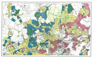
Residential security map of Boston, Mass.
23.
Road map of the Boston district showing the metropolitan park system.
24.
1975 general land use plan
25.
Adams Nervine Asylum
26.
Aerial photo of Charlestown, Massachusetts
27.
Architectural styles, Chinatown historic core, historic edge
28.
Asia, South China Sea, Mui Da Nang to Shenquan Gang including Hainan Dao and Parcel Islands
29.
Back Bay project no. Mass R-47
30.
Back Bay project no. Mass. R-47 : police signal system, fire alarm system and M.T.A. facilities
31.
Back Bay study
32.
Back Bay study landscape plan
33.
Back Bay urban renewal area r-47 : existing land use
34.
Back Bay urban renewal area r-47 : land use plan
35.
Back Bay urban renewal area r-47 : building conditions
36.
Back Bay urban renewal area r-47 : existing land use
37.
Back Bay urban renewal area r-47 : building conditions
38.
Back Bay urban renewal area r-47 : community facilities & circulation plan
39.
Back Bay urban renewal area r-47 : land use plan
40.
Back Bay urban renewal area r-47 : existing circulation
‹ Prev
Next ›
1
2
3
4
5
6
…
21
22