Toggle navigation
LMEC Home
Exhibitions
Georeferencing
Tools for Teachers
Collections
My Favorites
Sign Up / Log In
Search
Search the map portal
Map Collection
Map Collection
Map Sets
Search
Search
Search for
Search In
All Fields
Creator
Title
Subject
Place
Search All Digital Collections
Advanced Search
8725 Results
My Search
Start Over
More Like
commonwealth:cj82m423t
Remove constraint More Like: commonwealth:cj82m423t
Filter your Search
Place
North and Central America
5,957
United States
4,866
Massachusetts
2,077
Europe
1,395
Suffolk (county)
1,044
Boston
1,017
Canada
449
Asia
438
more
Place
»
Topic
Boston (Mass.)--Maps
585
United States--Maps
282
Real property--Massachusetts--Boston--Maps
175
Massachusetts--Maps
162
Landowners--Massachusetts--Boston--Maps
133
North America--Maps--Early works to 1800
103
New England--Maps
102
Europe--Maps
79
more
Topic
»
Date
Date range begin
–
Date range end
Current results range from
1482
to
2023
View distribution
Creator
United States. Hydrographic Office
595
O.H. Bailey & Co
148
Des Barres, Joseph F. W. (Joseph Frederick Wallet), 1722-1824
123
United States. Post Office Dept
120
Ptolemy, 2nd cent
100
Walling, Henry Francis, 1825-1888
94
Geological Survey (U.S.)
86
Jefferys, Thomas, -1771
86
more
Creator
»
Format
Maps/Atlases
8,665
Manuscripts
221
Prints
56
Books
36
Objects/Artifacts
10
Drawings/Illustrations
8
Posters
5
Georeferenced
Yes
869
No
7,856
Collection
Norman B. Leventhal Map & Education Center Collection
8,686
Boston and New England Maps
2,231
Urban Maps
2,017
Maritime Charts and Atlases
1,083
American Revolutionary War-Era Maps
654
Boston Redevelopment Authority Collection
87
MacLean Collection Map Library
15
New York Public Library Collection
9
more
Collection
»
Available to use
No known restrictions
8,544
Creative Commons license
70
Search Constraints
Sort by relevance
relevance
title
date (asc)
date (desc)
Number of results to display per page
20 per page
10
per page
20
per page
50
per page
100
per page
View results as:
grid view
map view
Search Results
3701.
A map of Massachusetts
3702.
Map of Massachusetts
3703.
Map of Massachusetts : to accompany the Massachusetts register & business directory
3704.
Map of Massachusetts
3705.
Map of Massachusetts
3706.
Map of Massachusetts
3707.
Map of Massachusetts
3708.
Map of Massachusetts and Rhode Island
3709.
Map of Massachusetts, Connecticut and Rhode Island constructed from the latest authorities
3710.
Map of Massachusetts, Connecticut and Rhode Island constructed from the latest authorities
3711.
Map of Massachusetts, Connecticut and Rhode Island constructed from the latest authorities
3712.
A map of Massachusetts, Connecticut and Rhodeisland
3713.
A map of Massachusetts, exhibiting the boundary lines of each town and county : compiled from the latest authorities, embracing...
3714.
Map of Massachusetts proper
3715.
Map of Massachusetts, Rhode-Island & Connecticut : compiled from the latest authorities
3716.
Map of Massachusetts, Rhode-Island & Connecticut : compiled from the latest authorities
3717.
Map of Massachusetts showing population according to census of 1910
3718.
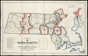
Map of Massachusetts showing population according to United States Census of 1900 and congressional districts
3719.
Map of Massachusetts showing state highways laid out & petitioned for
3720.
Map of Massachusetts showing state highways laid out & petitioned for
‹ Prev
Next ›
1
2
…
182
183
184
185
186
187
188
189
190
…
436
437