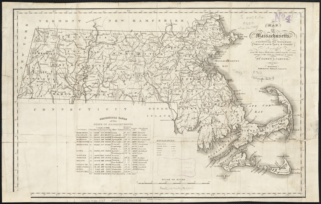
A map of Massachusetts, exhibiting the boundary lines of each town and county : compiled from the latest authorities, embracing the recent surveys of the State for railways and canals
Item Information
- Title:
- A map of Massachusetts, exhibiting the boundary lines of each town and county : compiled from the latest authorities, embracing the recent surveys of the State for railways and canals
- Creator:
- Carter, James G. (James Gordon), 1795-1849
- Name on Item:
-
by James G. Carter.
- Date:
-
[1830]
- Format:
-
Maps/Atlases
- Location:
-
Boston Public Library
Norman B. Leventhal Map & Education Center - Collection (local):
-
Norman B. Leventhal Map & Education Center Collection
- Subjects:
-
Massachusetts--Maps
- Places:
-
Massachusetts
- Extent:
- 1 map ; 27 x 42 cm.
- Terms of Use:
-
No known copyright restrictions.
No known restrictions on use.
- Publisher:
-
Boston :
Hilliard, Gray & Co.
- Scale:
-
Scale [ca. 1:760,300]
- Language:
-
English
- Notes:
-
Relief shown by hachures.
Includes statistical table of the state of Massachusetts.
- Notes (date):
-
This date is inferred.
- Identifier:
-
06_01_002581
- Call #:
-
G3760 1830 .C37
- Barcode:
-
39999058995778


