Toggle navigation
LMEC Home
Exhibitions
Georeferencing
Tools for Teachers
Collections
My Favorites
Sign Up / Log In
Search
Search the map portal
Map Collection
Map Collection
Map Sets
Search
Search
Search for
Search In
All Fields
Creator
Title
Subject
Place
Search All Digital Collections
Advanced Search
8727 Results
My Search
Start Over
More Like
commonwealth:cj82m2356
Remove constraint More Like: commonwealth:cj82m2356
Filter your Search
Place
North and Central America
5,957
United States
4,866
Massachusetts
2,080
Europe
1,396
Suffolk (county)
1,046
Boston
1,019
Canada
458
Asia
438
more
Place
»
Topic
Boston (Mass.)--Maps
586
United States--Maps
282
Real property--Massachusetts--Boston--Maps
175
Massachusetts--Maps
162
Landowners--Massachusetts--Boston--Maps
133
North America--Maps--Early works to 1800
105
New England--Maps
102
Europe--Maps
79
more
Topic
»
Date
Date range begin
–
Date range end
Current results range from
1482
to
2023
View distribution
Creator
United States. Hydrographic Office
595
O.H. Bailey & Co
148
Des Barres, Joseph F. W. (Joseph Frederick Wallet), 1722-1824
123
United States. Post Office Dept
120
Ptolemy, 2nd cent
100
Walling, Henry Francis, 1825-1888
94
Geological Survey (U.S.)
86
Jefferys, Thomas, -1771
86
more
Creator
»
Format
Maps/Atlases
8,667
Manuscripts
216
Prints
56
Books
36
Objects/Artifacts
10
Drawings/Illustrations
8
Posters
5
Georeferenced
Yes
869
No
7,858
Collection
Norman B. Leventhal Map & Education Center Collection
8,701
Boston and New England Maps
2,233
Urban Maps
2,023
Maritime Charts and Atlases
1,086
American Revolutionary War-Era Maps
641
Boston Redevelopment Authority Collection
87
New York Public Library Collection
10
MacLean Collection Map Library
9
more
Collection
»
Available to use
No known restrictions
8,554
Creative Commons license
67
Search Constraints
Sort by relevance
relevance
title
date (asc)
date (desc)
Number of results to display per page
20 per page
10
per page
20
per page
50
per page
100
per page
View results as:
grid view
map view
Search Results
6221.
Plan of Hoosac Tunnel Dock and Elevator Company's docks and land in Charlestown, Mass.
6222.
Plan of house lots & other lands offered for sale by the Boston Water Power Company
6223.
Plan of house lots at Newton Corner near the residence of Dr. Hitchcock, lately belonging to W.S. Tuckerman
6224.
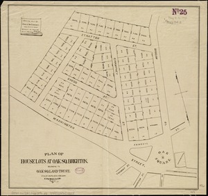
Plan of house lots at Oak Sq. Brighton : belonging to Oak Sq. Land Trust
6225.
[Plan of house lots for sale on Savin Hill Avenue, Dorchester, Mass.]
6226.
Plan of house lots in Boston belonging to Otis H. Weed
6227.
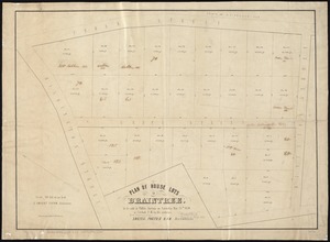
Plan of house lots in Braintree : to be sold at public auction on Saturday May 25th 1850 at 3 o'clock p.m. on the premises
6228.
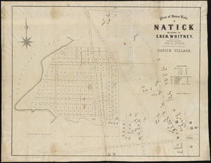
Plan of house lots in Natick belonging to Eben. Whitney : together with a part of Natick Village
6229.
Plan of house lots in the village of Brighton : upon a part of the well known Winship Estate ... to be sold by public auction...
6230.
Plan of house lots in ward 16 : owned by Saml. B. Pierce & Geo. C. Ludington, Boston, near the Dorchester Station, Norfolk...
6231.
Plan of house lots in West Newton, belonging to Chester Judson, to be sold by public auction, on Thursday August 12th at 4...
6232.
Plan of house lots located on Jamaica Plain belonging to the estate of John Dorr, dec'd
6233.
Plan of house lots, Mt. Vernon St., West Roxbury : owned by the Mt. Vernon Land Company, 257 Washington St., Room 3
6234.
[Plan of house lots on Briggs Place, Newton]
6235.
Plan of Humboldt, Humboldt County, Iowa
6236.
Plan of Isle Royale Lode : developments to 1925
6237.
Plan of La Vera Cruz, from Spanish draughts ; Plan of Port Royal Laguna, commonly called Logwood Creeks
6238.
Plan of Lafayette College grounds Easton, Pa
6239.
Plan of Lafayette Mall (Boston Common)
6240.
Plan of Lagoon Heights, Martha's Vineyard, Mass
‹ Prev
Next ›
1
2
…
308
309
310
311
312
313
314
315
316
…
436
437


![[Plan of house lots for sale on Savin Hill Avenue, Dorchester, Mass.]](https://bpldcassets.blob.core.windows.net/derivatives/images/commonwealth:9s161f68b/image_thumbnail_300.jpg)


![[Plan of house lots on Briggs Place, Newton]](https://bpldcassets.blob.core.windows.net/derivatives/images/commonwealth:x059c973z/image_thumbnail_300.jpg)