Toggle navigation
LMEC Home
Exhibitions
Georeferencing
Tools for Teachers
Collections
My Favorites
Sign Up / Log In
Search
Search the map portal
Map Collection
Map Collection
Map Sets
Search
Search
Search for
Search In
All Fields
Creator
Title
Subject
Place
Search All Digital Collections
Advanced Search
8753 Results
My Search
Start Over
More Like
commonwealth:cj82kx76f
Remove constraint More Like: commonwealth:cj82kx76f
Filter your Search
Place
North and Central America
5,981
United States
4,901
Massachusetts
2,079
Europe
1,396
Suffolk (county)
1,046
Boston
1,019
Canada
463
Asia
438
more
Place
»
Topic
Boston (Mass.)--Maps
586
United States--Maps
330
Real property--Massachusetts--Boston--Maps
175
Massachusetts--Maps
162
Landowners--Massachusetts--Boston--Maps
133
North America--Maps--Early works to 1800
103
New England--Maps
102
Europe--Maps
79
more
Topic
»
Date
Date range begin
–
Date range end
Current results range from
1482
to
2023
View distribution
Creator
United States. Hydrographic Office
595
O.H. Bailey & Co
148
Des Barres, Joseph F. W. (Joseph Frederick Wallet), 1722-1824
123
United States. Post Office Dept
120
Ptolemy, 2nd cent
100
Walling, Henry Francis, 1825-1888
94
Geological Survey (U.S.)
87
Jefferys, Thomas, -1771
85
more
Creator
»
Format
Maps/Atlases
8,693
Manuscripts
215
Prints
56
Books
36
Objects/Artifacts
10
Drawings/Illustrations
8
Posters
5
Georeferenced
Yes
871
No
7,882
Collection
Norman B. Leventhal Map & Education Center Collection
8,710
Boston and New England Maps
2,233
Urban Maps
2,023
Maritime Charts and Atlases
1,083
American Revolutionary War-Era Maps
657
Boston Redevelopment Authority Collection
87
Maps from AAS
20
William L. Clements Library Collection
13
more
Collection
»
Available to use
No known restrictions
8,566
Creative Commons license
50
Search Constraints
Sort by relevance
relevance
title
date (asc)
date (desc)
Number of results to display per page
20 per page
10
per page
20
per page
50
per page
100
per page
View results as:
grid view
map view
Search Results
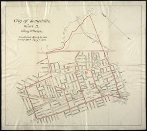
1961.
City of Somerville : ward 3 : voting precincts
1962.
City of Spokane, 1910, Washington : from official records
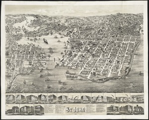
1963.
The city of St. John : New Brunswick
1964.
City of Taunton
1965.
City of Taunton, Mass : 1875
1966.
City of Toronto : compiled from surveys made to the present date
1967.
City of Toronto, reduced by permission from Wadsworth & Unwin's large map
1968.
A city of unequal risks
1969.
City of Utica
1970.
The city of Vineland, New Jersey : 1885
1971.
City of Washington
1972.
City of White Plains, Westchester County, New York
1973.
The city of Worcester, Mass : 1878
1974.
Civitas Londinum ano. dmi. circiter MDLX
1975.
Clappville
1976.
Clare, Mich : 1884
1977.
Clark County, Wis.
1978.
Clason's map of Los Angeles
1979.
Clayton, Delaware : 1885
1980.
Clemens' map of Pennsylvania
‹ Prev
Next ›
1
2
…
95
96
97
98
99
100
101
102
103
…
437
438