Toggle navigation
LMEC Home
Exhibitions
Georeferencing
Tools for Teachers
Collections
My Favorites
Sign Up / Log In
Search
Search the map portal
Map Collection
Map Collection
Map Sets
Search
Search
Search for
Search In
All Fields
Creator
Title
Subject
Place
Search All Digital Collections
Advanced Search
8671 Results
My Search
Start Over
More Like
commonwealth:cj82kv362
Remove constraint More Like: commonwealth:cj82kv362
Filter your Search
Place
North and Central America
5,910
United States
4,822
Massachusetts
2,068
Europe
1,392
Suffolk (county)
1,041
Boston
1,014
Canada
449
Asia
437
more
Place
»
Topic
Boston (Mass.)--Maps
582
United States--Maps
279
Real property--Massachusetts--Boston--Maps
175
Massachusetts--Maps
161
Landowners--Massachusetts--Boston--Maps
133
North America--Maps--Early works to 1800
103
New England--Maps
101
Europe--Maps
79
more
Topic
»
Date
Date range begin
–
Date range end
Current results range from
1482
to
2023
View distribution
Creator
United States. Hydrographic Office
595
O.H. Bailey & Co
148
Des Barres, Joseph F. W. (Joseph Frederick Wallet), 1722-1824
123
United States. Post Office Dept
120
Ptolemy, 2nd cent
100
Walling, Henry Francis, 1825-1888
94
Geological Survey (U.S.)
86
Jefferys, Thomas, -1771
86
more
Creator
»
Format
Maps/Atlases
8,611
Manuscripts
216
Prints
56
Books
36
Objects/Artifacts
10
Drawings/Illustrations
8
Posters
5
Georeferenced
Yes
868
No
7,803
Collection
Norman B. Leventhal Map & Education Center Collection
8,646
Boston and New England Maps
2,221
Urban Maps
1,992
Maritime Charts and Atlases
1,084
American Revolutionary War-Era Maps
639
Boston Redevelopment Authority Collection
87
William L. Clements Library Collection
14
American Antiquarian Society Collection
7
more
Collection
»
Available to use
No known restrictions
8,504
Creative Commons license
49
Search Constraints
Sort by relevance
relevance
title
date (asc)
date (desc)
Number of results to display per page
20 per page
10
per page
20
per page
50
per page
100
per page
View results as:
grid view
map view
Search Results
1.
The seat of war : birds eye view of Virginia, Maryland, Delaware, and the District of Columbia
2.
Delaware and Maryland
3.
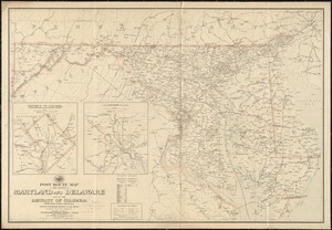
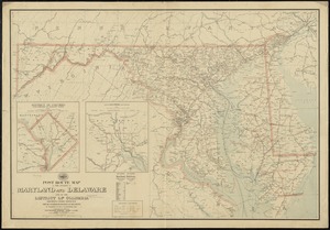
Post route map of the states of Maryland and Delaware and of the District of Columbia showing post offices with the...
4.
Post route map of the states of Pennsylvania, New Jersey, Delaware, and Maryland and of the District of Columbia with adjacent...
5.
Colton's new topographical map of the states of Virginia, Maryland & Delaware, showing also eastern Tennessee & parts of other...
6.
Colton's new topographical map of the states of Virginia, West Virginia, Maryland & Delaware and portions of other adjoining...
7.
Johnson's Virginia, Delaware, Maryland & West Virginia
8.
Map of the State of Virginia
9.
Post route map of the states of Virginia and West Virginia together with Maryland and Delaware with adjacent parts of...
10.
Map of Virginia and Maryland, constructed from the latest authorities
11.
Delaware Bay and Chesapeake Bay
12.
Delaware Bay and Chesapeake Bay
13.
A map of the Delaware and Chesapeak bays with the peninsula between them
14.
Manuscript maps of U.S. states
15.
Post route map of the states of Maryland and Delaware and of the District of Columbia showing post offices with the...
16.
Map of n. eastern Virginia and vicinity of Washington
17.
The tourist's pocket map of the state of Virginia : exhibiting its internal improvements, roads, distances &c
18.
Map of eastern Virginia
19.
Map of eastern Virginia
20.
The new war map of Virginia, Maryland & Pennsylvania
‹ Prev
Next ›
1
2
3
4
5
…
433
434