Toggle navigation
LMEC Home
Exhibitions
Georeferencing
Tools for Teachers
Collections
My Favorites
Sign Up / Log In
Search
Search the map portal
Map Collection
Map Collection
Map Sets
Search
Search
Search for
Search In
All Fields
Creator
Title
Subject
Place
Search All Digital Collections
Advanced Search
8802 Results
My Search
Start Over
More Like
commonwealth:cj82kt994
Remove constraint More Like: commonwealth:cj82kt994
Filter your Search
Place
North and Central America
6,033
United States
4,930
Massachusetts
2,152
Europe
1,396
Suffolk (county)
1,049
Boston
1,022
Canada
456
Asia
438
more
Place
»
Topic
Boston (Mass.)--Maps
592
United States--Maps
282
Massachusetts--Maps
235
Real property--Massachusetts--Boston--Maps
175
Landowners--Massachusetts--Boston--Maps
133
New England--Maps
127
North America--Maps--Early works to 1800
103
Europe--Maps
79
more
Topic
»
Date
Date range begin
–
Date range end
Current results range from
1482
to
2023
View distribution
Creator
United States. Hydrographic Office
595
O.H. Bailey & Co
148
Des Barres, Joseph F. W. (Joseph Frederick Wallet), 1722-1824
123
United States. Post Office Dept
120
Ptolemy, 2nd cent
100
Walling, Henry Francis, 1825-1888
95
Geological Survey (U.S.)
93
Jefferys, Thomas, -1771
86
more
Creator
»
Format
Maps/Atlases
8,741
Manuscripts
217
Prints
56
Books
36
Objects/Artifacts
10
Drawings/Illustrations
8
Posters
5
Ephemera
1
Georeferenced
Yes
882
No
7,920
Collection
Norman B. Leventhal Map & Education Center Collection
8,742
Boston and New England Maps
2,286
Urban Maps
2,024
Maritime Charts and Atlases
1,083
American Revolutionary War-Era Maps
660
Boston Redevelopment Authority Collection
90
David Judkins Weaver Papers
23
Applied Geographics, Inc. Records
20
more
Collection
»
Available to use
No known restrictions
8,600
Creative Commons license
54
Search Constraints
Sort by relevance
relevance
title
date (asc)
date (desc)
Number of results to display per page
20 per page
10
per page
20
per page
50
per page
100
per page
View results as:
grid view
map view
Search Results
3961.
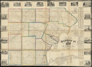
Map of Monroe County, Michigan
3962.
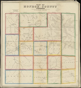
Map of Monroe County, Wisconsin
3963.
Map of Montague Village
3964.
Map of Morris's Purchase or West Geneseo in the state of New York : exhibiting part of the Lakes Erie and Ontario, the...
3965.
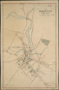
Map of Morristown : Morris County New Jersey
3966.
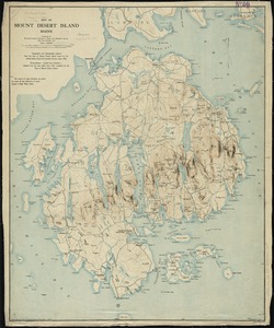
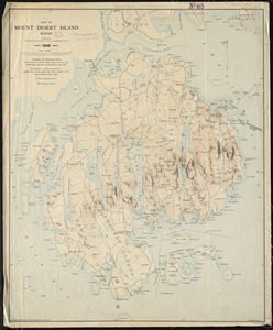
Map of Mount Desert Island, Maine
3967.
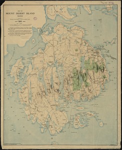
Map of Mount Desert Island, Maine
3968.
Map of Mount Desert Island, Maine
3969.
Map of n. eastern Virginia and vicinity of Washington
3970.
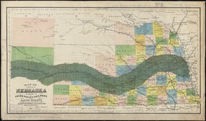
Map of Nebraska showing the Union Pacific Railroad land grant
3971.
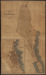
Map of New Bedford
3972.
Map of New Bedford and Fairhaven
3973.
A map of New England and New York
3974.
A map of New England, and Nova Scotia : with part of New York, Canada, and New Britain & the adjacent islands of New Found...
3975.
Map of New England City, Dade County, Ga
3976.
Map of New Hampshire : compiled from the latest authorities
3977.
Map of New Milford, Litchfield Co., Conn
3978.
Map of New York and vicinity
3979.
Map of New York and vicinity
3980.
Map of New York City showing concrete socialism in red, and private enterprises in white, 1895
‹ Prev
Next ›
1
2
…
195
196
197
198
199
200
201
202
203
…
440
441