Map of Monroe County, Michigan
Item Information
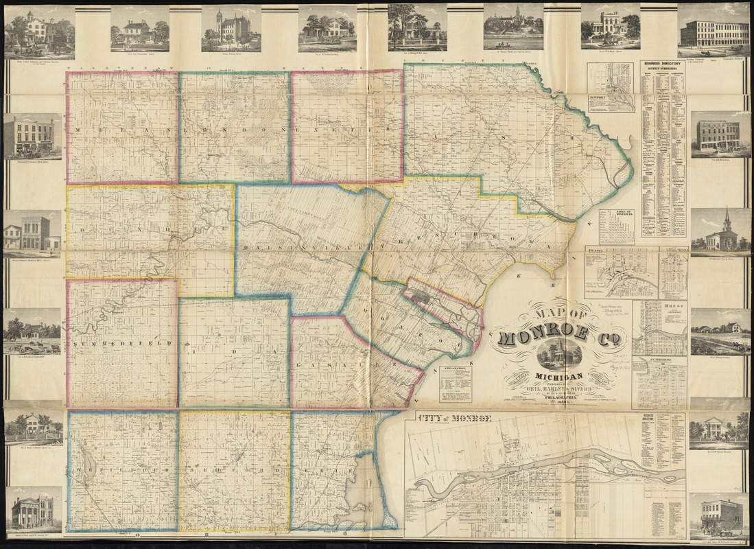
- Title:
- Map of Monroe County, Michigan
- Creator:
- Geil and Jones
- Name on Item:
-
from special surveys & county records by Geil & Jones, Topographical Engineers ; engd. on stone by Worley & Bracher.
- Date:
-
1859
- Format:
-
Maps/Atlases
- Location:
-
Boston Public Library
Norman B. Leventhal Map & Education Center - Collection (local):
-
Norman B. Leventhal Map & Education Center Collection
- Subjects:
-
Landowners--Michigan--Monroe County--Maps
Real property--Michigan--Monroe County--Maps
Monroe County (Mich.)--Maps
Brest (Mich.)--Maps
Dundee (Mich.)--Maps
Monroe (Mich.)--Maps
Oldport (Mich.)--Maps
Petersburg (Mich.)--Maps
Erie (Mich.)--Maps
- Places:
-
MichiganMonroe (county)Dundee
MichiganMonroe (county)Monroe
MichiganMonroe (county)Oldport
MichiganMonroe (county)Petersburg
MichiganMonroe (county)Erie
- Extent:
- 1 map on 2 sheets : hand color ; 112 x 157 cm
- Terms of Use:
-
No known copyright restrictions.
No known restrictions on use.
- Publisher:
-
Philadelphia ; Philada :
Geil, Harley & Siverd, ; R. Pearsall Smith, Map Manufacturer
- Scale:
-
Scale 1:39,600. 1 6/10 in. to 1 mile
- Language:
-
English
- Notes:
-
Entered according to the Act of Congress by Eli F. Siverd in the year 1859 in the Clerks Office of the District Court for the Eastern District of Pennsylvania.
Includes distance table, business directories, and 19 views of public, residential, and commercial buidlings.
Insets: Newport -- Vienna -- Brest -- Dundee -- Petersburg -- City of Monroe.
BPL copy assembled, sectioned into 4 pieces and mounted on cloth.
- Identifier:
-
06_01_011168
- Call #:
-
G4113.M6 1859 .G45
- Barcode:
-
39999065682856
- LCCN:
-
2012593018


