Toggle navigation
LMEC Home
Exhibitions
Georeferencing
Tools for Teachers
Collections
My Favorites
Sign Up / Log In
Search
Search the map portal
Map Collection
Map Collection
Map Sets
Search
Search
Search for
Search In
All Fields
Creator
Title
Subject
Place
Search All Digital Collections
Advanced Search
8755 Results
My Search
Start Over
More Like
commonwealth:cj82kt80d
Remove constraint More Like: commonwealth:cj82kt80d
Filter your Search
Place
North and Central America
5,986
United States
4,886
Massachusetts
2,085
Europe
1,396
Suffolk (county)
1,048
Boston
1,021
Canada
461
Asia
438
more
Place
»
Topic
Boston (Mass.)--Maps
588
United States--Maps
282
Real property--Massachusetts--Boston--Maps
175
Massachusetts--Maps
166
Landowners--Massachusetts--Boston--Maps
133
New England--Maps
127
North America--Maps--Early works to 1800
103
Europe--Maps
79
more
Topic
»
Date
Date range begin
–
Date range end
Current results range from
1482
to
2023
View distribution
Creator
United States. Hydrographic Office
595
O.H. Bailey & Co
148
Des Barres, Joseph F. W. (Joseph Frederick Wallet), 1722-1824
123
United States. Post Office Dept
120
Ptolemy, 2nd cent
100
Walling, Henry Francis, 1825-1888
94
Geological Survey (U.S.)
90
Jefferys, Thomas, -1771
86
more
Creator
»
Format
Maps/Atlases
8,695
Manuscripts
218
Prints
56
Books
36
Objects/Artifacts
10
Drawings/Illustrations
8
Posters
5
Georeferenced
Yes
870
No
7,885
Collection
Norman B. Leventhal Map & Education Center Collection
8,702
Boston and New England Maps
2,243
Urban Maps
2,023
Maritime Charts and Atlases
1,083
American Revolutionary War-Era Maps
663
Boston Redevelopment Authority Collection
87
American Antiquarian Society Collection
25
William L. Clements Library Collection
15
more
Collection
»
Available to use
No known restrictions
8,560
Creative Commons license
50
Search Constraints
Sort by relevance
relevance
title
date (asc)
date (desc)
Number of results to display per page
20 per page
10
per page
20
per page
50
per page
100
per page
View results as:
grid view
map view
Search Results
61.
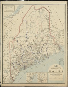
Post route map of the State of Maine showing post offices with the intermediate distances and mail routes in operation on the...
62.
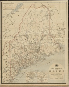
Post route map of the State of Maine showing post offices with the intermediate distances and mail routes in operation on the...
63.
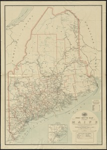
Post route map of the state of Maine showing post offices with the intermediate distances on mail routes in operation on the...
64.
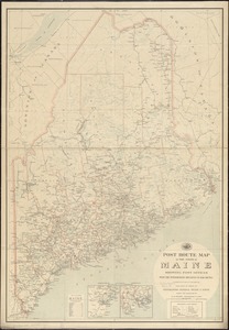
Post route map of the state of Maine showing post offices with the intermediate distances on mail routes in operation on the...
65.
Province of Maine
66.
The province of Maine, from the best authorities
67.
Route and pictorial map of Maine
68.
State of Maine
69.
State of Maine
70.
ABC pathfinder railway guide map : eastern division
71.
Automobile map of New England showing the ideal tour
72.
Boston Clinton Fitchburg and Mansfield Framingham Lowell Railroads, and connections
73.
The Boston Globe ski map of northern New England and Canada
74.
A canoeist's guide to New England's rivers
75.
C.H. Guild & Co.'s newspaper map of New England
76.
The city of New York as laid out by the Commissioners with the surrounding country
77.
Commercial map of New England
78.
Ensign, Bridgman & Fanning's rail road map of the United States, showing the depots & stations
79.
E.P. Dutton & Co.'s railroad, steam boat & stage route map of New England, New-York and Canada
80.
Fishing grounds out of Boston : NLSECO marine diesel oil engines ; built by New London Ship & Engine Co., Groton, Conn
‹ Prev
Next ›
1
2
3
4
5
6
7
8
…
437
438