Toggle navigation
LMEC Home
Exhibitions
Georeferencing
Tools for Teachers
Collections
My Favorites
Sign Up / Log In
Search
Search the map portal
Map Collection
Map Collection
Map Sets
Search
Search
Search for
Search In
All Fields
Creator
Title
Subject
Place
Search All Digital Collections
Advanced Search
8723 Results
My Search
Start Over
More Like
commonwealth:cj82kp59b
Remove constraint More Like: commonwealth:cj82kp59b
Filter your Search
Place
North and Central America
5,954
United States
4,870
Massachusetts
2,083
Europe
1,396
Suffolk (county)
1,048
Boston
1,021
Canada
458
Asia
438
more
Place
»
Topic
Boston (Mass.)--Maps
588
United States--Maps
282
Real property--Massachusetts--Boston--Maps
175
Massachusetts--Maps
164
Landowners--Massachusetts--Boston--Maps
133
New England--Maps
127
North America--Maps--Early works to 1800
103
Europe--Maps
79
more
Topic
»
Date
Date range begin
–
Date range end
Current results range from
1482
to
2023
View distribution
Creator
United States. Hydrographic Office
595
O.H. Bailey & Co
148
Des Barres, Joseph F. W. (Joseph Frederick Wallet), 1722-1824
123
United States. Post Office Dept
120
Ptolemy, 2nd cent
100
Walling, Henry Francis, 1825-1888
94
Geological Survey (U.S.)
86
Jefferys, Thomas, -1771
86
more
Creator
»
Format
Maps/Atlases
8,663
Manuscripts
216
Prints
56
Books
36
Objects/Artifacts
10
Drawings/Illustrations
8
Posters
5
Georeferenced
Yes
871
No
7,852
Collection
Norman B. Leventhal Map & Education Center Collection
8,698
Boston and New England Maps
2,238
Urban Maps
2,023
Maritime Charts and Atlases
1,083
American Revolutionary War-Era Maps
636
Boston Redevelopment Authority Collection
87
American Antiquarian Society Collection
12
David Judkins Weaver Papers
4
more
Collection
»
Available to use
No known restrictions
8,556
Creative Commons license
50
Search Constraints
Sort by relevance
relevance
title
date (asc)
date (desc)
Number of results to display per page
20 per page
10
per page
20
per page
50
per page
100
per page
View results as:
grid view
map view
Search Results
741.
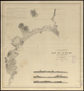
Bay of Avatcha and approaches
742.
Bay of Chaleurs
743.
Bay of Massefao, island of Tutuila ; Bay of Fagaitui, island of Tutuila ; Sketch of Aluau Bay, 1839 ; Sketch of Anuu Island, 1839
744.
Bay of Massefao, island of Tutuila ; Bay of Fagaitui, island of Tutuila ; Sketch of Aluau Bay, 1839 ; Tutuila Isld., approaches...
745.
[Bay of Seven Islands]
746.
Bay State Street Ry. Co's lines and connections
747.
The Bear Garden, the Globe Theatre
748.
La Beauce
749.
Beaufort Harbor and coast line between Charleston S.C. and Savanna Ga : with 5 mile distance lines in circles round Beaufort...
750.
Becket
751.
Becket, Mass
752.
Beddington, Surrey : plan of Croydon sewage farm
753.
Bedford Co., Pa
754.
Bedford irrigation farm
755.
Begin with sense, of ev'ry art the soul, parts answ'ring parts shall slide into a whole
756.
The beginnings of ancient China, 1900-1300 B.C.
757.
Behring's Sea and Arctic Ocean : from surveys of the U.S. North Pacific Surveying Expedition in 1855, Commander John Rodgers,...
758.
Being a cartograph of Ohio : the oldest state west of the thirteen original colonies; now the fourth state in the Union in...
759.
Being a map of the United States in the year 1831 when the Country Gentleman first made its appearance as the Genesee Farmer
760.
Belgii veteris typus
‹ Prev
Next ›
1
2
…
34
35
36
37
38
39
40
41
42
…
436
437


![[Bay of Seven Islands]](https://bpldcassets.blob.core.windows.net/derivatives/images/commonwealth:7h149v48t/image_thumbnail_300.jpg)


