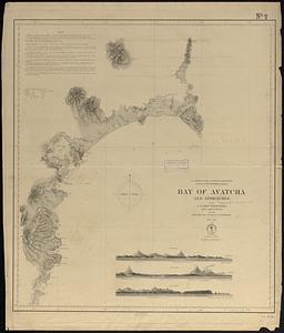
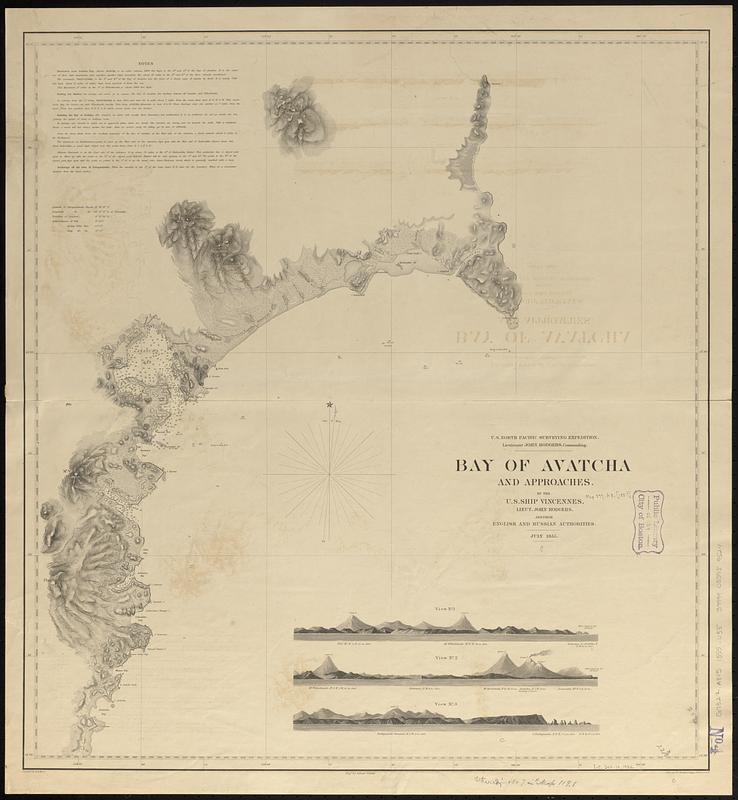
Bay of Avatcha and approaches
Item Information
- Title:
- Bay of Avatcha and approaches
- Draftsman:
- Knorr, E. R. (Ernest Rudolph)
- Artist:
- Boggs, William Brenton, 1809-1875
- Engraver:
- Siebert, Selmar
- Issuing body:
- United States North Pacific Exploring Expedition (1853-1856)
- Name on Item:
-
by the U.S. Ship Vincennes, Lieut. John Rodgers, and from English and Russian Authorities, July 1855 ; projected by E.R. Knorr ; engr. by Selmar Siebert ; views by Wm. Brenton Boggs, purser, U.S.N.
- Date:
-
1855
- Format:
-
Maps/Atlases
- Genre:
-
Nautical charts
- Location:
-
Boston Public Library
Norman B. Leventhal Map & Education Center - Collection (local):
-
Norman B. Leventhal Map & Education Center Collection
- Subjects:
-
Avacha Bay (Russia)--Maps
Nautical charts--Russia (Federation)--Avacha Bay
- Places:
-
RussiaPoluostrov Kamchatka (area)
Avachinskaya Guba
- Extent:
- 1 map ; 65 x 60 cm
- Terms of Use:
-
No known copyright restrictions.
No known restrictions on use.
- Publisher:
-
[Washington, D.C.] :
U.S. North Pacific Surveying Expedition
- Scale:
-
Scale approximately 1:310,000
- Language:
-
English
- Notes:
-
Relief shown by hachures and spot heights. Depths shown by soundings.
Includes notes on land topography and three coastal views.
- Identifier:
-
06_01_017477
- Call #:
-
G7322.A8P5 1855 .U55
- Barcode:
-
39999085959524