Toggle navigation
LMEC Home
Exhibitions
Georeferencing
Tools for Teachers
Collections
My Favorites
Sign Up / Log In
Search
Search the map portal
Map Collection
Map Collection
Map Sets
Search
Search
Search for
Search In
All Fields
Creator
Title
Subject
Place
Search All Digital Collections
Advanced Search
8600 Results
My Search
Start Over
More Like
commonwealth:cj82kn42z
Remove constraint More Like: commonwealth:cj82kn42z
Filter your Search
Place
North and Central America
5,895
United States
4,815
Massachusetts
2,058
Europe
1,359
Suffolk (county)
1,036
Boston
1,009
Canada
458
Asia
422
more
Place
»
Topic
Boston (Mass.)--Maps
579
United States--Maps
273
Real property--Massachusetts--Boston--Maps
174
Massachusetts--Maps
163
Landowners--Massachusetts--Boston--Maps
132
New England--Maps
120
North America--Maps--Early works to 1800
103
New York (State)--Maps
81
more
Topic
»
Date
Date range begin
–
Date range end
Current results range from
1482
to
2023
View distribution
Creator
United States. Hydrographic Office
594
O.H. Bailey & Co
148
Des Barres, Joseph F. W. (Joseph Frederick Wallet), 1722-1824
123
United States. Post Office Dept
120
Ptolemy, 2nd cent
100
Walling, Henry Francis, 1825-1888
94
Geological Survey (U.S.)
86
Jefferys, Thomas, -1771
85
more
Creator
»
Format
Maps/Atlases
8,541
Manuscripts
217
Prints
56
Books
36
Objects/Artifacts
10
Drawings/Illustrations
8
Posters
4
Georeferenced
Yes
872
No
7,728
Collection
Norman B. Leventhal Map & Education Center Collection
8,552
Boston and New England Maps
2,208
Urban Maps
1,936
Maritime Charts and Atlases
1,081
American Revolutionary War-Era Maps
659
Boston Redevelopment Authority Collection
87
William L. Clements Library Collection
26
American Antiquarian Society Collection
14
more
Collection
»
Available to use
No known restrictions
8,412
Creative Commons license
49
Search Constraints
Sort by relevance
relevance
title
date (asc)
date (desc)
Number of results to display per page
20 per page
10
per page
20
per page
50
per page
100
per page
View results as:
grid view
map view
Search Results
1681.
China
1682.
China
1683.
China, divided into it's great provinces according to the best authorities
1684.
China east coast population density
1685.
China, east coast, the River Min from the entrance to the Pagoda Anchorage
1686.
China, Korean Archipelago, Nan How Group, Port Hamilton : from the most recent British survey
1687.
China, military regions
1688.
China, north east coast, Shantung Promontory, Kyau-Chau Bay to Miau-Tau Strait : from Brit. surveys in 1857-66, corrected to...
1689.
China Sea
1690.
China Sea, channel between Lamtia Island and House Hill
1691.
China Sea, Gaspar Strait with its three channels
1692.
China Sea, Hongkong, Man of War Anchorage : from a British survey in 1877
1693.
China, south coast, principal ethnic groups and dialects
1694.
China's situation in the world
1695.
[Chippewa] National Forest, Minnesota
1696.
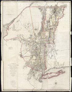
A chorographical map of the Province of New-York in North America, divided into counties, manors, patents and townships :...
1697.
A chorographical map of the Province of New-York in North America, divided into counties, manors, patents and townships :...
1698.
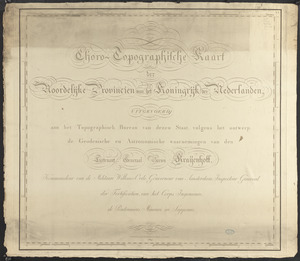
Choro-topographische kaart der Noordelijke provincien van het Koningrijk der Nederlanden
1699.
Chūseki keishi chizu
1700.
A cidade de Angra na ilha de Iesu xpō da Tercera que esta em 39. graos
‹ Prev
Next ›
1
2
…
81
82
83
84
85
86
87
88
89
…
429
430


![[Chippewa] National Forest, Minnesota](https://bpldcassets.blob.core.windows.net/derivatives/images/commonwealth:th83pg40d/image_thumbnail_300.jpg)