Toggle navigation
LMEC Home
Exhibitions
Georeferencing
Tools for Teachers
Collections
My Favorites
Sign Up / Log In
Search
Search the map portal
Map Collection
Map Collection
Map Sets
Search
Search
Search for
Search In
All Fields
Creator
Title
Subject
Place
Search All Digital Collections
Advanced Search
8888 Results
My Search
Start Over
More Like
commonwealth:cf95jc989
Remove constraint More Like: commonwealth:cf95jc989
Filter your Search
Place
North and Central America
6,119
United States
5,035
Massachusetts
2,128
Europe
1,396
Suffolk (county)
1,234
Boston
1,207
Canada
449
Asia
438
more
Place
»
Topic
Boston (Mass.)--Maps
752
United States--Maps
282
Real property--Massachusetts--Boston--Maps
198
City planning--Massachusetts--Boston--Maps
178
Massachusetts--Maps
166
Landowners--Massachusetts--Boston--Maps
145
New England--Maps
104
North America--Maps--Early works to 1800
103
more
Topic
»
Date
Date range begin
–
Date range end
Current results range from
1482
to
2023
View distribution
Creator
United States. Hydrographic Office
595
Boston Redevelopment Authority
183
O.H. Bailey & Co
148
Des Barres, Joseph F. W. (Joseph Frederick Wallet), 1722-1824
124
United States. Post Office Dept
120
Ptolemy, 2nd cent
100
Walling, Henry Francis, 1825-1888
94
Geological Survey (U.S.)
87
more
Creator
»
Format
Maps/Atlases
8,828
Manuscripts
215
Prints
56
Books
36
Objects/Artifacts
10
Drawings/Illustrations
8
Posters
5
Georeferenced
Yes
885
No
8,003
Collection
Norman B. Leventhal Map & Education Center Collection
8,724
Boston and New England Maps
2,380
Urban Maps
2,164
Maritime Charts and Atlases
1,083
American Revolutionary War-Era Maps
639
Boston Redevelopment Authority Collection
213
Mapping Boston Collection
20
Massachusetts Real Estate Atlases
15
more
Collection
»
Available to use
No known restrictions
8,687
Creative Commons license
71
Search Constraints
Sort by relevance
relevance
title
date (asc)
date (desc)
Number of results to display per page
20 per page
10
per page
20
per page
50
per page
100
per page
View results as:
grid view
map view
Search Results
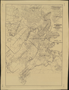
241.
Map of Boston (as it should be) and the country adjacent, with proposed harbor improvements, etc
242.
Map of Boston Common : with surrounding streets & adjacent parts of Beacon Hill
243.
Map of Boston Common and Public Garden
244.
Map of Boston, comprising the whole city, with the new boundaries of the wards
245.
A map of Boston, county of Suffolk and the adjacent towns
246.
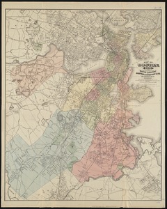
Map of Boston for 1874
247.
Map of Boston, for 1874
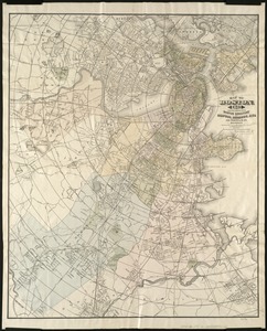
248.
Map of Boston, for 1875
249.
Map of Boston, for 1876
250.
Map of Boston, for 1877
251.
Map of Boston, for 1878
252.
Map of Boston, for 1879
253.
Map of Boston for 1880
254.
Map of Boston, for 1881
255.
Map of Boston, for 1881
256.
Map of Boston, for 1882
257.
Map of Boston, for 1883
258.
Map of Boston, for 1883
259.
Map of Boston, for 1884
260.
Map of Boston, for 1885
‹ Prev
Next ›
1
2
…
9
10
11
12
13
14
15
16
17
…
444
445