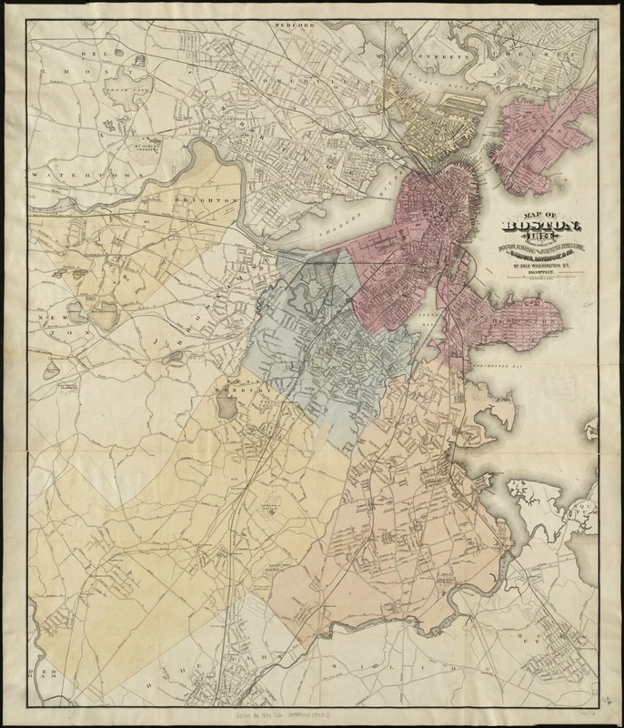
Map of Boston, for 1874
Item Information
- Title:
- Map of Boston, for 1874
- Creator:
- Sampson, Davenport & Co
- Date:
-
[1874]
- Format:
-
Maps/Atlases
- Location:
-
Boston Public Library
Norman B. Leventhal Map & Education Center - Collection (local):
-
Norman B. Leventhal Map & Education Center Collection
- Subjects:
-
Boston (Mass.)--Maps
- Places:
-
MassachusettsSuffolk (county)Boston
- Extent:
- 1 map : col. ; 81 x 68 cm.
- Terms of Use:
-
No known copyright restrictions.
No known restrictions on use.
- Publisher:
-
Boston :
Sampson, Davenport & Co.
- Scale:
-
Scale [1:19,800]. 100 rods to an inch.
- Language:
-
English
- Notes:
-
Published expressly for the Boston Almanac & Boston Directory.
Shows in various colors the lands that have been annexed to Boston since 1865.
- Notes (date):
-
This date is inferred.
- Identifier:
-
06_01_004248
- Call #:
-
G3764.B7 1874 .S3x
- Barcode:
-
39999059005312


