Map of Boston, comprising the whole city, with the new boundaries of the wards
Item Information
- Title:
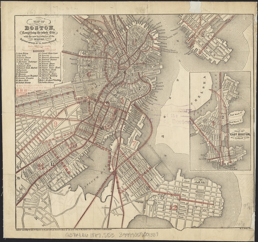
- Map of Boston, comprising the whole city, with the new boundaries of the wards
- Creator:
- Sharp, William Comely, 1822-1897
- Name on Item:
-
engraved expressly for the Boston Almanac ; W.C. Sharp.
- Date:
-
[1867]
- Format:
-
Maps/Atlases
- Location:
-
Boston Public Library
Norman B. Leventhal Map & Education Center - Collection (local):
-
Norman B. Leventhal Map & Education Center Collection
- Subjects:
-
Boston (Mass.)--Maps
- Places:
-
MassachusettsSuffolk (county)Boston
- Extent:
- 1 map : col. ; 25 x 28 cm.
- Terms of Use:
-
No known copyright restrictions.
No known restrictions on use.
- Publisher:
-
Boston, Mass :
s.n.
- Scale:
-
Scale 1:21,120.
- Language:
-
English
- Notes:
-
Includes index to points of interest.
Inset: Plan of East Boston on a reduced scale.
"Entered according to Act of Congress in the year 1861 by Damrell & Moore in the Clerks Office of the District Court for the Distric of Massachusetts."
- Notes (date):
-
This date is inferred.
- Identifier:
-
06_01_003485
- Call #:
-
G3764.B6 1867 .S53
- Barcode:
-
39999059001337


