Toggle navigation
LMEC Home
Exhibitions
Georeferencing
Tools for Teachers
Collections
My Favorites
Sign Up / Log In
Search
Search the map portal
Map Collection
Map Collection
Map Sets
Search
Search
Search for
Search In
All Fields
Creator
Title
Subject
Place
Search All Digital Collections
Advanced Search
9052 Results
My Search
Start Over
More Like
commonwealth:bz60gc13n
Remove constraint More Like: commonwealth:bz60gc13n
Filter your Search
Place
North and Central America
6,283
United States
5,201
Massachusetts
2,150
Suffolk (county)
1,403
Europe
1,396
Boston
1,376
Canada
449
Asia
438
more
Place
»
Topic
Boston (Mass.)--Maps
677
City planning--Massachusetts--Boston--Maps
418
United States--Maps
282
Urban renewal--Massachusetts--Boston--Maps
253
Real property--Massachusetts--Boston--Maps
216
Massachusetts--Maps
162
Landowners--Massachusetts--Boston--Maps
135
North America--Maps--Early works to 1800
103
more
Topic
»
Date
Date range begin
–
Date range end
Current results range from
1482
to
2023
View distribution
Creator
United States. Hydrographic Office
595
Boston Redevelopment Authority
392
O.H. Bailey & Co
148
Des Barres, Joseph F. W. (Joseph Frederick Wallet), 1722-1824
123
United States. Post Office Dept
120
Ptolemy, 2nd cent
100
Walling, Henry Francis, 1825-1888
94
Geological Survey (U.S.)
86
more
Creator
»
Format
Maps/Atlases
8,992
Manuscripts
215
Prints
56
Books
36
Objects/Artifacts
10
Drawings/Illustrations
8
Posters
5
Georeferenced
Yes
869
No
8,183
Collection
Norman B. Leventhal Map & Education Center Collection
8,694
Boston and New England Maps
2,590
Urban Maps
2,378
Maritime Charts and Atlases
1,083
American Revolutionary War-Era Maps
616
Boston Redevelopment Authority Collection
444
Available to use
No known restrictions
8,910
Creative Commons license
47
Search Constraints
Sort by relevance
relevance
title
date (asc)
date (desc)
Number of results to display per page
20 per page
10
per page
20
per page
50
per page
100
per page
View results as:
grid view
map view
Search Results
1321.
Boston's top foreign-born populations : Salvadorans
1322.
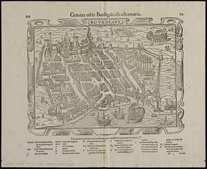
Bovrdeavx
1323.
Bowles's map of the seat of war in New England, comprehending the provinces of Massachusets Bay, and New Hampshire : with the...
1324.
Bowles's new map of the River Thames, from it's spring in Gloucester-shire, to it's influx into the sea : with a table of all...
1325.
Bowles's new one-sheet map of the independent states of Virginia, Maryland, Delaware, Pensylvania, New Jersey, New York,...
1326.
Boyle and Mercer counties
1327.
Bradford, Massachusetts
1328.
Bradshaw's map of Europe shewing the railways opened and in progress
1329.
Bradshaw's map of the railways, in Central Europe
1330.
Bradshaw's map of the Rhine from Rotterdam to Schafhausen
1331.
Bradshaw's new map of the railways in Great Britain for 1872
1332.
Bradshaw's plan of Paris, and map of the environs
1333.
Brasilia
1334.
Brattleboro, Vt : 1876
1335.
Brattleboro, Vt : 1886
1336.
Brazil : from official and other sources
1337.
Brazil, Bolivia, & Peru
1338.
Brésil : carte politique et économique
1339.
Brésil
1340.
Bressia = vulgo Bresse
‹ Prev
Next ›
1
2
…
63
64
65
66
67
68
69
70
71
…
452
453