Toggle navigation
LMEC Home
Exhibitions
Georeferencing
Tools for Teachers
Collections
My Favorites
Sign Up / Log In
Search
Search the map portal
Map Collection
Map Collection
Map Sets
Search
Search
Search for
Search In
All Fields
Creator
Title
Subject
Place
Search All Digital Collections
Advanced Search
8783 Results
My Search
Start Over
More Like
commonwealth:9s161h55p
Remove constraint More Like: commonwealth:9s161h55p
Filter your Search
Place
North and Central America
6,078
United States
4,986
Massachusetts
2,164
Europe
1,359
Suffolk (county)
1,196
Boston
1,169
Canada
448
Asia
422
more
Place
»
Topic
Boston (Mass.)--Maps
740
United States--Maps
273
Massachusetts--Maps
218
Real property--Massachusetts--Boston--Maps
194
City planning--Massachusetts--Boston--Maps
157
Landowners--Massachusetts--Boston--Maps
141
North America--Maps--Early works to 1800
103
New England--Maps
102
more
Topic
»
Date
Date range begin
–
Date range end
Current results range from
1482
to
2023
View distribution
Creator
United States. Hydrographic Office
594
Boston Redevelopment Authority
162
O.H. Bailey & Co
148
Des Barres, Joseph F. W. (Joseph Frederick Wallet), 1722-1824
124
United States. Post Office Dept
120
Ptolemy, 2nd cent
100
Walling, Henry Francis, 1825-1888
95
Geological Survey (U.S.)
92
more
Creator
»
Format
Maps/Atlases
8,723
Manuscripts
217
Prints
56
Books
36
Objects/Artifacts
10
Drawings/Illustrations
8
Posters
5
Ephemera
1
Georeferenced
Yes
894
No
7,889
Collection
Norman B. Leventhal Map & Education Center Collection
8,611
Boston and New England Maps
2,366
Urban Maps
2,056
Maritime Charts and Atlases
1,085
American Revolutionary War-Era Maps
661
Boston Redevelopment Authority Collection
195
Mapping Boston Collection
29
William L. Clements Library Collection
23
more
Collection
»
Available to use
No known restrictions
8,548
Creative Commons license
79
Search Constraints
Sort by relevance
relevance
title
date (asc)
date (desc)
Number of results to display per page
20 per page
10
per page
20
per page
50
per page
100
per page
View results as:
grid view
map view
Search Results
7461.
Sexta Europae tabula
7462.
Shah Bay, Loo Choo I.
7463.
Shaker Village
7464.
Shall Union Square overshadow the United States? : America's other 60 families : the real rulers of America
7465.
Shamokin : Pennsylvania, 1884
7466.
A shared problem, an unequal burden : causes & consequences of climate change
7467.
Sheboygan County, Wis.
7468.
Shepherd's map of the seat of war
7469.
Sherman & Smith's rail road, steam boat & stage route map of New England, New-York, and Canada
7470.
Shewey's new map of the city of St. Louis
7471.
Shíjú tú
7472.
Shipyard Park phase 3 : Boston Naval Shipyard at Charlestown : schematic design
7473.
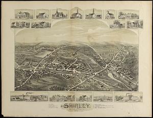
Shirley, Massachusetts, 1892
7474.
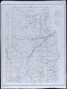
Shoshone National Forest, Wyoming
7475.
Showing rental values in greater Tokyo - 1926
7476.
Siberia
7477.
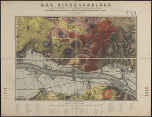
Das Siebengebirge
7478.
The siege of Colberg, from 3d. to 31st. October, 1758
7479.
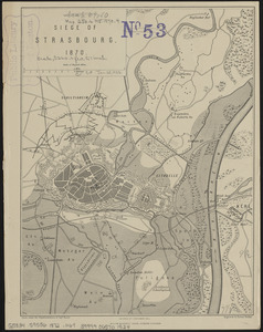
Siege of Strasbourg, 1870
7480.
Siege of Strasbourg, 1870 : enlarged sketch of works
‹ Prev
Next ›
1
2
…
370
371
372
373
374
375
376
377
378
…
439
440