Shewey's new map of the city of St. Louis
Item Information
- Title:
- Shewey's new map of the city of St. Louis
- Title (alt.):
-
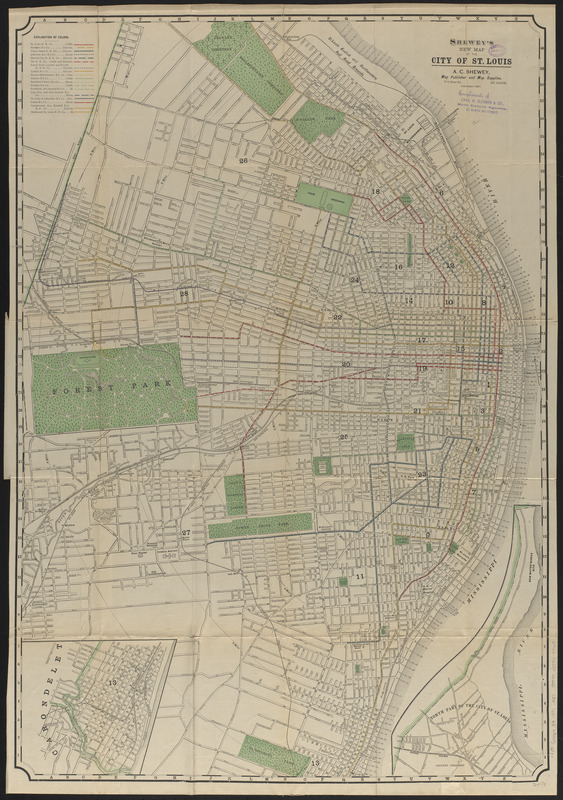
Shewey's new official map of the city of St. Louis : showing street railway systems in separate colors
- Publisher:
- A. C. Shewey (Firm)
- Distributor:
- Charles H. Gleason & Co.
- Date:
-
(c) 1891
- Format:
-
Maps/Atlases
- Location:
-
Boston Public Library
Norman B. Leventhal Map & Education Center - Collection (local):
-
Norman B. Leventhal Map & Education Center Collection
- Subjects:
-
Railroads--Missouri--Saint Louis--Maps
Saint Louis (Mo.)--Maps
- Places:
-
MissouriSaint Louis
- Extent:
- 1 map : color ; 92 x 63 cm, folded in cover 18 x 12 cm + index (6, 10 unnumbered pages ; 18 cm)
- Terms of Use:
-
No known copyright restrictions.
No known restrictions on use.
- Publisher:
-
St. Louis :
A.C. Shewey
- Scale:
-
Scale approximately 1:11,000
- Language:
-
English
- Notes:
-
Insets: Carondelet -- North part of the city of St. Louis.
Stamped compliments of Chas. H. Gleason & Co.
Index includes advertisements for Chas. H. Gleason Co.
- Identifier:
-
06_01_016660
- Call #:
-
G4164.S4 1891 .A27
- Barcode:
-
39999085949947