Toggle navigation
LMEC Home
Exhibitions
Georeferencing
Tools for Teachers
Collections
My Favorites
Sign Up / Log In
Search
Search the map portal
Map Collection
Map Collection
Map Sets
Search
Search
Search for
Search In
All Fields
Creator
Title
Subject
Place
Search All Digital Collections
Advanced Search
8780 Results
My Search
Start Over
More Like
commonwealth:9s161f71n
Remove constraint More Like: commonwealth:9s161f71n
Filter your Search
Place
North and Central America
6,011
United States
4,929
Massachusetts
2,090
Europe
1,396
Suffolk (county)
1,131
Boston
1,104
Canada
449
Asia
438
more
Place
»
Topic
Boston (Mass.)--Maps
606
United States--Maps
282
Real property--Massachusetts--Boston--Maps
253
Landowners--Massachusetts--Boston--Maps
170
Massachusetts--Maps
162
City planning--Massachusetts--Boston--Maps
113
North America--Maps--Early works to 1800
103
New England--Maps
102
more
Topic
»
Date
Date range begin
–
Date range end
Current results range from
1482
to
2023
View distribution
Creator
United States. Hydrographic Office
595
O.H. Bailey & Co
148
Des Barres, Joseph F. W. (Joseph Frederick Wallet), 1722-1824
123
United States. Post Office Dept
120
Boston Redevelopment Authority
113
Ptolemy, 2nd cent
100
Walling, Henry Francis, 1825-1888
94
Geological Survey (U.S.)
86
more
Creator
»
Format
Maps/Atlases
8,720
Manuscripts
215
Prints
56
Books
36
Objects/Artifacts
10
Drawings/Illustrations
8
Posters
5
Georeferenced
Yes
869
No
7,911
Collection
Norman B. Leventhal Map & Education Center Collection
8,696
Boston and New England Maps
2,283
Urban Maps
2,072
Maritime Charts and Atlases
1,083
American Revolutionary War-Era Maps
616
Boston Redevelopment Authority Collection
136
Massachusetts Real Estate Atlases
35
Applied Geographics, Inc. Records
2
Available to use
No known restrictions
8,603
Creative Commons license
47
Search Constraints
Sort by relevance
relevance
title
date (asc)
date (desc)
Number of results to display per page
20 per page
10
per page
20
per page
50
per page
100
per page
View results as:
grid view
map view
Search Results
4361.
A map of the New England states : Maine, New Hampshire, Vermont, Massachusetts, Rhode Island & Connecticut, with the adjacent...
4362.
A map of the New England states : Maine, New Hampshire, Vermont, Massachusetts, Rhode Island & Connecticut, with the adjacent...
4363.
Map of the New York & Boston Railway, with its connections with other railways
4364.
Map of the New York Central & Hudson River and Boston & Albany Railroads : sea shore and summer resorts of New York and New...
4365.
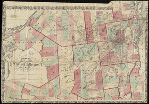
Map of the New York wilderness
4366.
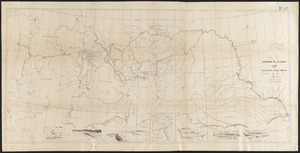
Map of the Nez Perce Indian campaign Brig. Gen. O. O. Howard commanding
4367.
A map of the North Pole with all the territories that lye near it, known to us &c. According to the latest discoveries, and...
4368.
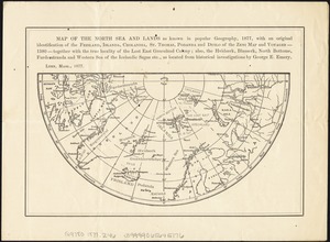
Map of the North Sea and lands as known in popular geography, 1877, with an original identification of the Frisland, Islanda,...
4369.
Map of the northern & eastern section of the United States
4370.
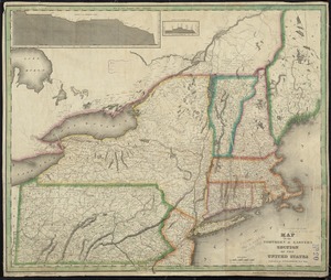
A map of the northern and middle states : comprehending the western territory & the British dominions in North America : from...
4371.
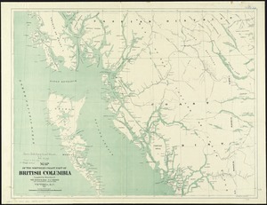
Map of the northern coast part of British Columbia
4372.
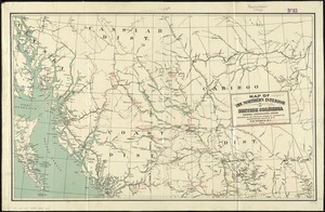
Map of the northern interior of British Columbia shewing undeveloped areas
4373.
Map of the northern, or, New England states of America, comprehending Vermont, New Hampshire, District of Main, Massachusetts,...
4374.
Map of the Northern Pacific R.R. its connections and tributary country
4375.
Map of the northern part of the state of Maine and of the adjacent British provinces : shewing the portion of that state to...
4376.
Map of the northern part of the state of New York
4377.
Map of the oil district of West Virginia
4378.
[Map of the operations at the seige of Savannah in 1779, by the French and American forces]
4379.
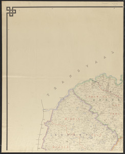
Map of the Orange River Colony
4380.
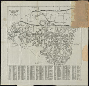
Map of the Oranges, and Irvington, New Jersey
‹ Prev
Next ›
1
2
…
215
216
217
218
219
220
221
222
223
…
438
439


![[Map of the operations at the seige of Savannah in 1779, by the French and American forces]](https://bpldcassets.blob.core.windows.net/derivatives/images/commonwealth:9s161g724/image_thumbnail_300.jpg)