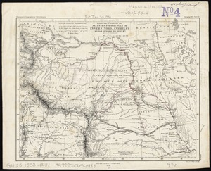
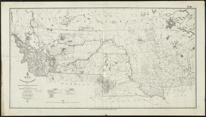
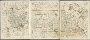
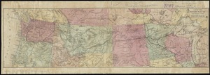
Map of the Nez Perce Indian campaign Brig. Gen. O. O. Howard commanding
Item Information
- Title:
- Map of the Nez Perce Indian campaign Brig. Gen. O. O. Howard commanding
- Description:
-
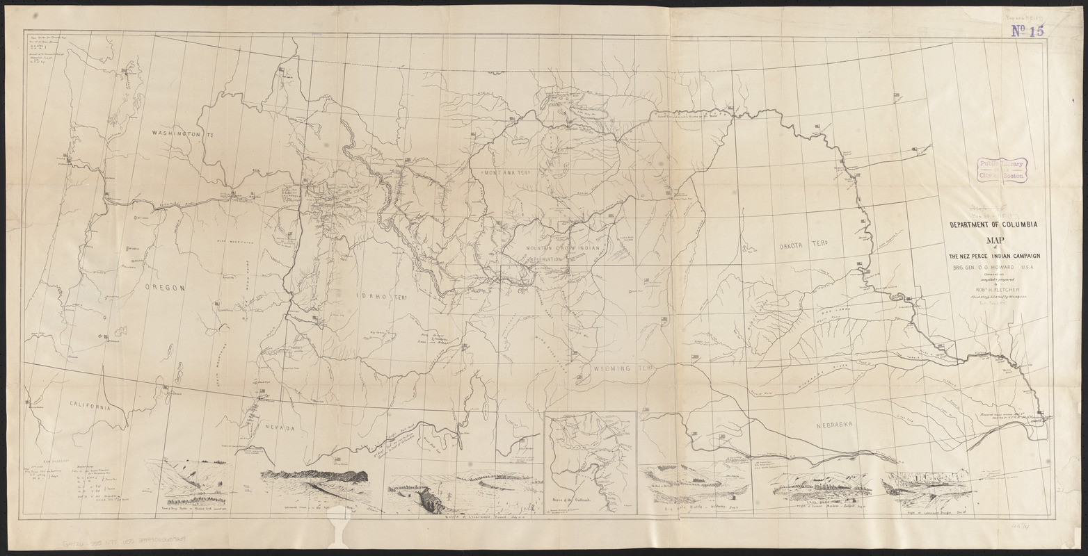
America Transformed: This military map records the Nez Perce War in 1877, one of the final campaigns of the U.S. Army against the tribal nations of the Pacific Northwest. Gen. Oliver Otis Howard, a Union Civil War leader, Commissioner of the Freedmen’s Bureau, and a founder of Howard University, led U.S. troops. They pursued several bands of Nimiipuu (Nez Perce) who refused to surrender their ancestral lands and move to a smaller reservation in Idaho. Threatened with forced removal, they embarked on a northward trek to find sanctuary in Canada. After a fighting retreat of 1,170 miles and 18 skirmishes and battles, they surrendered just south of the Canadian border.
- Creator:
- United States. Army. Dept. of the Columbia
- Contributor:
- Fletcher, Robert H.
- Contributor:
- Howard, O. O.
- Contributor:
- United States. War Dept
- Name on Item:
-
compiled & prepared by Robt. H. Fletcher 1st Lieut. 21st Infy.
- Date:
-
[1877]
- Format:
-
Maps/Atlases
- Location:
-
Boston Public Library
Norman B. Leventhal Map & Education Center - Collection (local):
-
Norman B. Leventhal Map & Education Center Collection
- Subjects:
-
Indians of North America--Wars--1866-1895--Maps
Nez Percé Indians--History--Maps
Nez Percé Indians--Wars, 1877--Maps
Northwestern States--Maps
- Places:
-
Northwestern United States (area)
- Extent:
- 1 map ; 54 x 116 cm.
- Terms of Use:
-
No known copyright restrictions.
No known restrictions on use.
- Publisher:
-
[Washington] :
Dept. of Columbia
- Scale:
-
Scale [ca. 1:2,000,000]
- Language:
-
English
- Notes:
-
Conservation of this piece was funded by Ron Grim in honor of Gayl B. and Paul D. McDermott.
Relief shown by hachures.
Key events of campaign illustrated on perimeter.
Removed from U.S. War Dept. Report, 1877, v.1.
Inset: Scene of the outbreak.
- Notes (date):
-
This date is inferred.
- Notes (exhibitions):
-
Exhibited: "America transformed. Part 1: the United States expands westward," organized by the Norman B. Leventhal Map & Education Center at the Boston Public Library, 2019.
- Identifier:
-
06_01_014287
- Call #:
-
G4126.S55 1877 .U55
- Barcode:
-
39999065657239