Toggle navigation
LMEC Home
Exhibitions
Georeferencing
Tools for Teachers
Collections
My Favorites
Sign Up / Log In
Search
Search the map portal
Map Collection
Map Collection
Map Sets
Search
Search
Search for
Search In
All Fields
Creator
Title
Subject
Place
Search All Digital Collections
Advanced Search
8594 Results
My Search
Start Over
More Like
commonwealth:9s161f25j
Remove constraint More Like: commonwealth:9s161f25j
Date facet yearly ssim
1482
to
1499
Remove constraint Date facet yearly ssim: <span class='from'>1482</span> to <span class='to'>1499</span>
Filter your Search
Place
North and Central America
5,889
United States
4,813
Massachusetts
2,052
Europe
1,359
Suffolk (county)
1,078
Boston
1,051
Canada
448
Asia
422
more
Place
»
Topic
Boston (Mass.)--Maps
579
United States--Maps
273
Real property--Massachusetts--Boston--Maps
185
Massachusetts--Maps
160
Landowners--Massachusetts--Boston--Maps
136
City planning--Massachusetts--Boston--Maps
104
North America--Maps--Early works to 1800
103
New England--Maps
99
more
Topic
»
Date
Date range begin
–
Date range end
Current results range from
1482
to
2023
View distribution
Creator
United States. Hydrographic Office
594
O.H. Bailey & Co
148
Des Barres, Joseph F. W. (Joseph Frederick Wallet), 1722-1824
123
United States. Post Office Dept
120
Boston Redevelopment Authority
107
Ptolemy, 2nd cent
100
Walling, Henry Francis, 1825-1888
94
Geological Survey (U.S.)
86
more
Creator
»
Format
Maps/Atlases
8,535
Manuscripts
215
Prints
56
Books
36
Objects/Artifacts
10
Drawings/Illustrations
8
Posters
4
Georeferenced
Yes
869
No
7,725
Collection
Norman B. Leventhal Map & Education Center Collection
8,550
Boston and New England Maps
2,244
Urban Maps
1,976
Maritime Charts and Atlases
1,081
American Revolutionary War-Era Maps
616
Boston Redevelopment Authority Collection
127
Massachusetts Real Estate Atlases
4
Mapping Boston Collection
1
Available to use
No known restrictions
8,448
Creative Commons license
47
Search Constraints
Sort by date (asc)
relevance
title
date (asc)
date (desc)
Number of results to display per page
20 per page
10
per page
20
per page
50
per page
100
per page
View results as:
grid view
map view
Search Results
8201.
Climate zones for Eastern Asia
8202.
Germany, western border regions, agricultural areas (north of the Main and west of the Rhine Rivers)
8203.
Germany western border regions rail traffic volume (excluding inter-Ruhr traffic) summer 1939
8204.
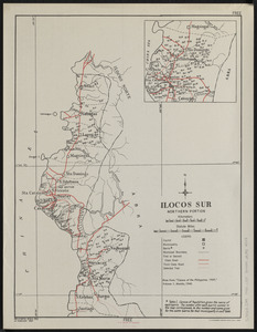
Ilocos Sur : northern portion
8205.
Java and Madoera : Indonesian ethnic groups, elementary education, and Christian missions
8206.
Java and Madoera principal estate regions showing major products
8207.
Lesser Sunda Islands, distribution of population
8208.
Lesser Sunda Islands Indonesian Ethnic groups and Christian missions
8209.
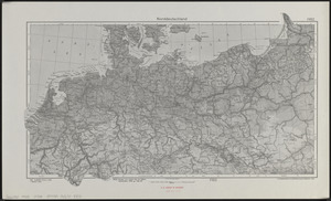
Norddeutschland
8210.
Pampanga
8211.
Philippine Islands : [outline map]
8212.
A pictorial map of North America
8213.
Pictorial map of the American continent : featuring the Pan American Highway and showing some of the natural resources, scenic...
8214.
Süddeutschland, Österreich, Schweiz und östliches Frankreich
8215.
Sumatra wegenkaart
8216.
Tayabas (northern part)
8217.
Tayabas (southern part)
8218.
Uprooted people of the U.S.A.
8219.
Ward lines and voting precincts circa 1945
8220.
Zambales
‹ Prev
Next ›
1
2
…
407
408
409
410
411
412
413
414
415
…
429
430