Toggle navigation
LMEC Home
Exhibitions
Georeferencing
Tools for Teachers
Collections
My Favorites
Sign Up / Log In
Search
Search the map portal
Map Collection
Map Collection
Map Sets
Search
Search
Search for
Search In
All Fields
Creator
Title
Subject
Place
Search All Digital Collections
Advanced Search
8771 Results
My Search
Start Over
More Like
commonwealth:9s161d47c
Remove constraint More Like: commonwealth:9s161d47c
Filter your Search
Place
North and Central America
6,002
United States
4,906
Massachusetts
2,154
Europe
1,396
Suffolk (county)
1,047
Boston
1,020
Canada
450
Asia
438
more
Place
»
Topic
Boston (Mass.)--Maps
590
United States--Maps
282
Massachusetts--Maps
235
Real property--Massachusetts--Boston--Maps
175
Landowners--Massachusetts--Boston--Maps
133
New England--Maps
104
North America--Maps--Early works to 1800
103
Europe--Maps
79
more
Topic
»
Date
Date range begin
–
Date range end
Current results range from
1482
to
2023
View distribution
Creator
United States. Hydrographic Office
595
O.H. Bailey & Co
148
Des Barres, Joseph F. W. (Joseph Frederick Wallet), 1722-1824
123
United States. Post Office Dept
120
Ptolemy, 2nd cent
100
Walling, Henry Francis, 1825-1888
95
Geological Survey (U.S.)
92
Jefferys, Thomas, -1771
85
more
Creator
»
Format
Maps/Atlases
8,710
Manuscripts
217
Prints
56
Books
36
Objects/Artifacts
10
Drawings/Illustrations
8
Posters
5
Ephemera
1
Georeferenced
Yes
879
No
7,892
Collection
Norman B. Leventhal Map & Education Center Collection
8,740
Boston and New England Maps
2,280
Urban Maps
2,024
Maritime Charts and Atlases
1,083
American Revolutionary War-Era Maps
635
Boston Redevelopment Authority Collection
90
Applied Geographics, Inc. Records
20
David Judkins Weaver Papers
18
more
Collection
»
Available to use
No known restrictions
8,598
Creative Commons license
51
Search Constraints
Sort by relevance
relevance
title
date (asc)
date (desc)
Number of results to display per page
20 per page
10
per page
20
per page
50
per page
100
per page
View results as:
grid view
map view
Search Results
1701.
A chart of the South Sea
1702.
A chart of the Streights of Bell Isle
1703.
Chart of the Streights of Belle Isle
1704.
Chart of the streights of Belle Isle
1705.
Chart of the streights of Belle Isle
1706.
Chart of the track of the Dolphin, Tamar, Swallow & Endeavour through the South Seas ; & of the track of M. Bougainville round...
1707.
Chart of the Vineyard Sound and Nantucket Shoals
1708.
Chart of the Viti Group or Feejee Islands
1709.
Chart of the west coast of Sumatra between Rigas and Diah from actual survey
1710.
Chart of the West Indies and Spanish Dominions in North America
1711.
A chart of the West Indies from Cape Cod to the River Oronoque
1712.
A chart of the West Indies, from the latest marine journals and surveys
1713.
A chart of the western coast of Africa, from the Straits of Gibraltar to eleven degrees of north latitude : including the...
1714.
A chart of the world, according to Mercators projection, shewing the latest discoveries of Capt. Cook
1715.
Chart of the world according to Mercators projection, shewing the tracks & discoveries of Captn. Cook
1716.
Chart of the world, on Mercator's projection : illustrative of the impolicy of slavery
1717.
Chart of the world showing area in the Pacific Ocean having Hawaii as the only base of supplies in transpacific voyages and...
1718.
A chart of the world upon Mercator's projection : describing the tracks of Capt. Cook in the year 1768, 69, 70, 71, and in...
1719.
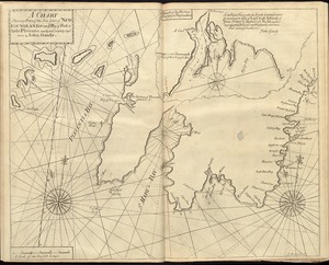
[Chart of Tierra del Fuego and the Strait of Magellan]
1720.
A chart shewing part of the sea coast of Newfoundland from ye Bay of Bulls to little Plecentia
‹ Prev
Next ›
1
2
…
82
83
84
85
86
87
88
89
90
…
438
439


![[Chart of Tierra del Fuego and the Strait of Magellan]](https://bpldcassets.blob.core.windows.net/derivatives/images/commonwealth:w9505s59b/image_thumbnail_300.jpg)