Toggle navigation
LMEC Home
Exhibitions
Georeferencing
Tools for Teachers
Collections
My Favorites
Sign Up / Log In
Search
Search the map portal
Map Collection
Map Collection
Map Sets
Search
Search
Search for
Search In
All Fields
Creator
Title
Subject
Place
Search All Digital Collections
Advanced Search
8920 Results
My Search
Start Over
More Like
commonwealth:9s161c963
Remove constraint More Like: commonwealth:9s161c963
Filter your Search
Place
North and Central America
6,151
United States
5,067
Massachusetts
2,137
Europe
1,396
Suffolk (county)
1,266
Boston
1,239
Canada
449
Asia
438
more
Place
»
Topic
Boston (Mass.)--Maps
752
United States--Maps
282
Real property--Massachusetts--Boston--Maps
253
City planning--Massachusetts--Boston--Maps
187
Landowners--Massachusetts--Boston--Maps
170
Massachusetts--Maps
166
New England--Maps
104
North America--Maps--Early works to 1800
103
more
Topic
»
Date
Date range begin
–
Date range end
Current results range from
1482
to
2023
View distribution
Creator
United States. Hydrographic Office
595
Boston Redevelopment Authority
192
O.H. Bailey & Co
148
Des Barres, Joseph F. W. (Joseph Frederick Wallet), 1722-1824
124
United States. Post Office Dept
120
Ptolemy, 2nd cent
100
Walling, Henry Francis, 1825-1888
94
Geological Survey (U.S.)
87
more
Creator
»
Format
Maps/Atlases
8,860
Manuscripts
215
Prints
56
Books
36
Objects/Artifacts
10
Drawings/Illustrations
8
Posters
5
Georeferenced
Yes
885
No
8,035
Collection
Norman B. Leventhal Map & Education Center Collection
8,724
Boston and New England Maps
2,390
Urban Maps
2,174
Maritime Charts and Atlases
1,083
American Revolutionary War-Era Maps
638
Boston Redevelopment Authority Collection
223
Massachusetts Real Estate Atlases
38
Mapping Boston Collection
20
more
Collection
»
Available to use
No known restrictions
8,697
Creative Commons license
70
Search Constraints
Sort by relevance
relevance
title
date (asc)
date (desc)
Number of results to display per page
20 per page
10
per page
20
per page
50
per page
100
per page
View results as:
grid view
map view
Search Results
5101.
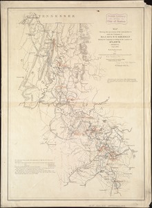
Map showing route of marches of the army of Genl. W.T. Sherman, from Atlanta, Ga. to Goldsboro, N.C : to accompany the report...
5102.
Map showing siege operations against Forts Sumter and Wagner between July 13th & Sept. 7th, 1863
5103.
Map showing the advance of the Union army under the command of Lieut.-Gen. Grant, also, battle-fields, fortifications, etc. in...
5104.
Map showing the Atchison, Topeka and Santa Fe railroad system : with its connections
5105.
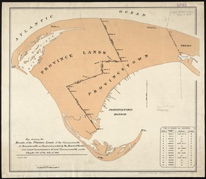
Map showing the bounds of the Province lands of the Commonwealth of Massachusetts, as fixed and marked by the Board of Harbor...
5106.
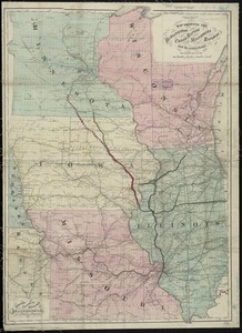
Map showing the Burlington, Cedar Rapids and Minnesota Railway and its connections
5107.
Map showing the comparative merits, and benefits to Massachusetts, of the proposed extension of the New York and Massachusetts...
5108.
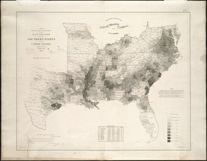
Map showing the distribution of the slave population of the southern states of the United States
5109.
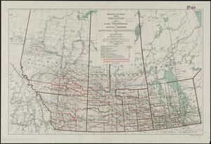
Map showing the land registration and judicial districts of Manitoba, Saskatchewan & Alberta : compiled from information...
5110.
Map showing the lands & waterway of the Florida Coast Line Canal & Transportation Co
5111.
Map showing the lines of canals & rail roads owned, leased & operated by the Delaware and Hudson Canal and Rail Road Co. with...
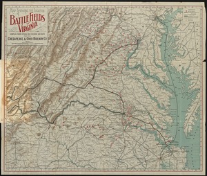
5112.
Map showing the location of battle fields of Virginia
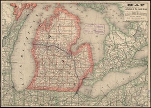
5113.
Map showing the location of the land grant of the Flint & Pere Marquette Railway Company, in Michigan
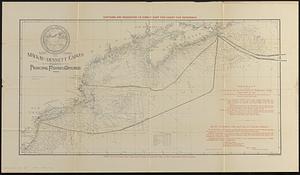
5114.
Map showing the Mackay-Bennett cables in the vicinity of the principal fishing grounds
5115.
Map showing the number of chartered banks in New Brunswick, Nova Scotia, and Prince Edward Island
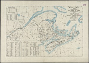
5116.
Map showing the operations of the national forces under the command of Maj. Gen. W.T. Sherman during the campaign resulting in...
5117.
Map showing the overland and overseas flights of Charles A. Lindbergh
5118.
A map showing the proposed branch railroads with the Old Colony Railroad : 1846
5119.
Map showing the proposed line of the Manchester Rail Road as petitioned for by S.D. Bell & others
5120.
Map showing the proposed rail roads from Boston to Burlington, from Hale's map of New England
‹ Prev
Next ›
1
2
…
252
253
254
255
256
257
258
259
260
…
445
446