Toggle navigation
LMEC Home
Exhibitions
Georeferencing
Tools for Teachers
Collections
My Favorites
Sign Up / Log In
Search
Search the map portal
Map Collection
Map Collection
Map Sets
Search
Search
Search for
Search In
All Fields
Creator
Title
Subject
Place
Search All Digital Collections
Advanced Search
8975 Results
My Search
Start Over
More Like
commonwealth:9s161b729
Remove constraint More Like: commonwealth:9s161b729
Filter your Search
Place
North and Central America
6,206
United States
5,122
Massachusetts
2,175
Europe
1,396
Suffolk (county)
1,321
Boston
1,294
Canada
449
Asia
438
more
Place
»
Topic
Boston (Mass.)--Maps
752
United States--Maps
282
Real property--Massachusetts--Boston--Maps
253
City planning--Massachusetts--Boston--Maps
239
Landowners--Massachusetts--Boston--Maps
170
Massachusetts--Maps
166
Urban renewal--Massachusetts--Boston--Maps
125
New England--Maps
104
more
Topic
»
Date
Date range begin
–
Date range end
Current results range from
1482
to
2023
View distribution
Creator
United States. Hydrographic Office
595
Boston Redevelopment Authority
246
O.H. Bailey & Co
148
Des Barres, Joseph F. W. (Joseph Frederick Wallet), 1722-1824
124
United States. Post Office Dept
120
Ptolemy, 2nd cent
100
Walling, Henry Francis, 1825-1888
94
Geological Survey (U.S.)
87
more
Creator
»
Format
Maps/Atlases
8,915
Manuscripts
215
Prints
56
Books
36
Objects/Artifacts
10
Drawings/Illustrations
8
Posters
5
Georeferenced
Yes
885
No
8,090
Collection
Norman B. Leventhal Map & Education Center Collection
8,724
Boston and New England Maps
2,445
Urban Maps
2,229
Maritime Charts and Atlases
1,083
American Revolutionary War-Era Maps
638
Boston Redevelopment Authority Collection
278
Massachusetts Real Estate Atlases
38
Mapping Boston Collection
20
more
Collection
»
Available to use
No known restrictions
8,752
Creative Commons license
70
Search Constraints
Sort by relevance
relevance
title
date (asc)
date (desc)
Number of results to display per page
20 per page
10
per page
20
per page
50
per page
100
per page
View results as:
grid view
map view
Search Results
7721.
South America : corrected from the observation communicated to the Royal Societys of London & Paris
7722.
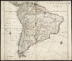
South America
7723.
South America : reduced from the sheet map
7724.
South America
7725.
South America : performed under the patronage of Louis Duke of Orleans, First Prince of the Blood
7726.
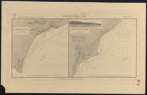
South America, anchorages in Magellan Strait : from the most recent British surveys
7727.
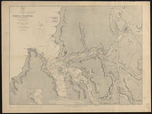
South America, Chile, Port of Valdivia and approaches : from a Chilean government survey in 1868-70 corrected to 1882
7728.
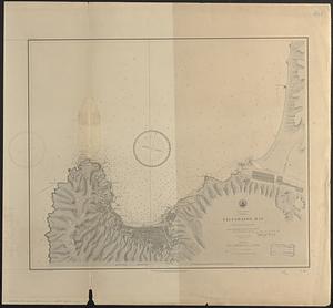
South America, Chili, Valparaiso Bay : from a Chilian survey in 1877
7729.
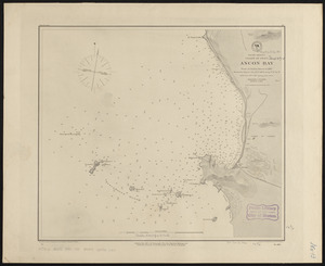
South America, coast of Peru, Ancon Bay : from an Italian survey in 1883
7730.
South America, coast of Peru, Callao Bay and vicinity : from a British survey in 1840, and a French survey in 1876
7731.
South America, coast of Peru, Pisco Bay : from the latest French and English charts, 1885
7732.
South America divided into its IIII principall parts : I Spanish part: vizt. Firmland, Guiana, Peru, Chili, pt of the country...
7733.
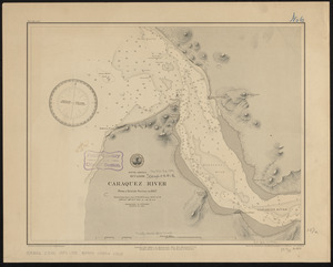
South America, Ecuador, Caraquez River : from a British survey in 1847
7734.
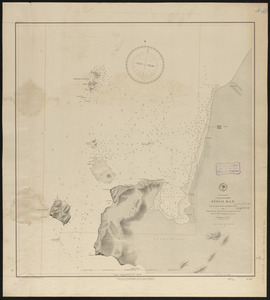
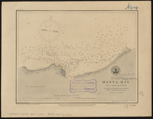
South America, Ecuador, Manta Bay : from a British survey in 1876
7735.
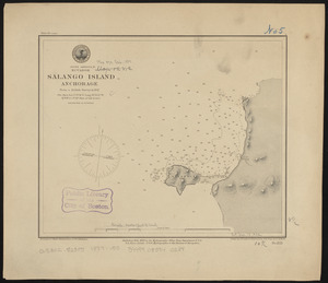
South America, Ecuador, Salango Island anchorage : from a British survey in 1847
7736.
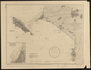
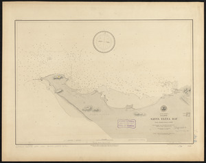
South America, Ecuador, Santa Eléna Bay : from a British survey in 1847
7737.
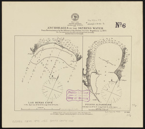
South America, Magellan Strait, anchorages in the Skyring Water : from a reconnaissance by the officers of the Chilean corvette...
7738.
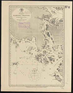
South America, Magellan Strait, Barbara Channel : from British surveys corrected to 1878
7739.
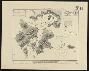
South America-- Magellan Strait, Desolation I., Week Islands : from a British survey in 1830
7740.
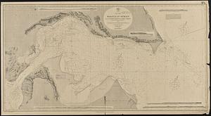
South America, Magellan Strait from the eastern entrance to the First Narrows : compiled from the most recent surveys to 1883
‹ Prev
Next ›
1
2
…
383
384
385
386
387
388
389
390
391
…
448
449