Toggle navigation
LMEC Home
Exhibitions
Georeferencing
Tools for Teachers
Collections
My Favorites
Sign Up / Log In
Search
Search the map portal
Map Collection
Map Collection
Map Sets
Search
Search
Search for
Search In
All Fields
Creator
Title
Subject
Place
Search All Digital Collections
Advanced Search
8975 Results
My Search
Start Over
More Like
commonwealth:9s161b729
Remove constraint More Like: commonwealth:9s161b729
Filter your Search
Place
North and Central America
6,206
United States
5,122
Massachusetts
2,175
Europe
1,396
Suffolk (county)
1,321
Boston
1,294
Canada
449
Asia
438
more
Place
»
Topic
Boston (Mass.)--Maps
752
United States--Maps
282
Real property--Massachusetts--Boston--Maps
253
City planning--Massachusetts--Boston--Maps
239
Landowners--Massachusetts--Boston--Maps
170
Massachusetts--Maps
166
Urban renewal--Massachusetts--Boston--Maps
125
New England--Maps
104
more
Topic
»
Date
Date range begin
–
Date range end
Current results range from
1482
to
2023
View distribution
Creator
United States. Hydrographic Office
595
Boston Redevelopment Authority
246
O.H. Bailey & Co
148
Des Barres, Joseph F. W. (Joseph Frederick Wallet), 1722-1824
124
United States. Post Office Dept
120
Ptolemy, 2nd cent
100
Walling, Henry Francis, 1825-1888
94
Geological Survey (U.S.)
87
more
Creator
»
Format
Maps/Atlases
8,915
Manuscripts
215
Prints
56
Books
36
Objects/Artifacts
10
Drawings/Illustrations
8
Posters
5
Georeferenced
Yes
885
No
8,090
Collection
Norman B. Leventhal Map & Education Center Collection
8,724
Boston and New England Maps
2,445
Urban Maps
2,229
Maritime Charts and Atlases
1,083
American Revolutionary War-Era Maps
638
Boston Redevelopment Authority Collection
278
Massachusetts Real Estate Atlases
38
Mapping Boston Collection
20
more
Collection
»
Available to use
No known restrictions
8,752
Creative Commons license
70
Search Constraints
Sort by relevance
relevance
title
date (asc)
date (desc)
Number of results to display per page
20 per page
10
per page
20
per page
50
per page
100
per page
View results as:
grid view
map view
Search Results
7241.
Progress chart of the Survey of the Northern & North Western Lakes, July 1st, 1873 : primary triangulation, telegraphic...
7242.
Progress map of Signal Corps telegraph lines & cables in the military division of the Philippines : based on map of Montero y...
7243.
Progress map of Signal Corps telegraph lines & cables in the military division of the Philippines : based on map of Montero y...
7244.
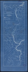
Progress of construction, government railroad, Alaska
7245.
Property atlas of city of Lowell, northern district, Middlesex County, Massachusetts, showing the entire city complete in one...
7246.
Property qualifications for suffrage, 1775
7247.
Property qualifications for suffrage, 1800
7248.
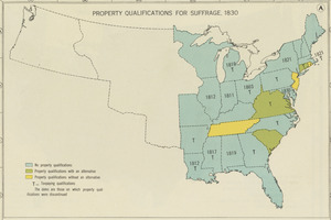
Property qualifications for suffrage, 1830
7249.
Property qualifications for suffrage, 1860
7250.
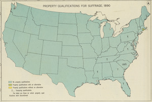
Property qualifications for suffrage, 1890
7251.
Property qualifications for suffrage, 1920
7252.
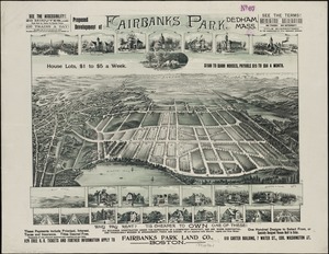
Proposed development of Fairbanks Park, Dedham, Mass
7253.
Proposed improvement of Back Bay
7254.
Proposed plan of the estate of the Cary Improvement Compy : in Chelsea opposite Boston, and in the same county
7255.
Proposed public park and routes leading thereto
7256.
Proposed route of the Boston and Mystic Valley railroad
7257.
Proposed site for navy yard, Port Orchard, Puget Sound, Washington Ter.
7258.
Proposition as to a public ground to include the Harvard Arboretum
7259.
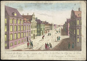
Prospect der König Strasse gegen das land thor zu Boston = Vuë de la Rue du Roi vers la porte de la campagne a Boston
7260.
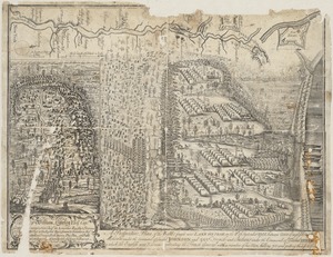
A prospective plan of the battle fought near Lake George on the 8th of September, 1755 between 2000 English with 250 Mohawks...
‹ Prev
Next ›
1
2
…
359
360
361
362
363
364
365
366
367
…
448
449